Country:

 City:


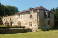
Park in the Écluse de Beauséjour car park at the end of Impasse de l’Écluse, below the bridge over the Isle, opposite the Château de Beauséjour. Information boards about the walks are located here, as well as a fitness trail.
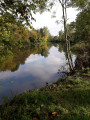
(S/E) Facing the château on the opposite bank, set off to the left along a tarmac path that runs alongside the canal. Then follow the River Isle.
(1) When you reach the power line, ignore the path opposite that runs alongside the river and turn left onto a limestone track.
(2) At the junction with Rue du Petit Pont, turn right, then take the first right again. At the T-junction just after that, turn left towards the town hall.
(3) Carry on straight ahead along Avenue de la République towards Grignols and the chemist’s. Pass the stadium, then the cemetery.
(4) When you’re almost at the chemist’s, take the path branching off to the left, between the last house and a bus shelter. At the junction with a road, turn left to join the old RN89 straight away. At the ‘Give Way’ sign, cross the road and then go under the motorway. Caution: crossing the road is dangerous. Take great care!
(5) Shortly after the motorway, leave the main path and turn right onto a smaller path, the start of which is blocked by rubbish. Stay on the path that runs alongside the motorway fence. A little further on, you can see the bell tower of Neuvic and its castle. Continue along the main path which, after a left-hand bend, climbs into the woods. When you’re almost at the top, ignore a path on the left.
(6) At the crossroads marked by a bench, turn left. At the next crossroads, carry on straight ahead, leaving the path on your left that leads down to the Fontaine de la Demoiselle. Then continue along the tarmac road, passing two successive paths on your right. At the Stop sign, turn left towards Saint-Léon-sur-l’Isle, leaving the Route des Plateaux straight ahead.
(7) Before the descent, take the Chemin des Truffières on the right. The tarmac turns into limestone. When you reach a gate marked No. 189, continue along the path to the right.
(8) At the T-junction, turn right.
(9) At the junction with a limestone track, turn left. Near a house, the limestone track ends. Pass under some power lines and continue along the track as it descends.
(10) At the junction with a road, turn right towards the hamlet of Angunand and pass through it.
(11) After the narrower section with a 30 km/h speed limit, leave the junction leading to Grignols straight ahead and turn left towards Saint-Léon-sur-l’Isle. The track goes straight down and then curves to the right. Shortly afterwards, let the main track continue downhill; carry on along the slightly smaller track which continues on level ground and joins a road.
(12) Turn left and follow this road to La Valade.
(13) In the hamlet, leave the road before a left-hand bend and turn right to walk alongside a corrugated-iron building. Then turn left at the end of the pond and continue along the same path until you reach an uninhabited farm. The path continues to the right, below a meadow, and leads out onto a road.
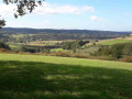
(14) Continue to the left. You can make a round trip to a viewpoint by turning right. At the junction with another road, continue to the right. Pass under the motorway then cross the old RN89. Take care when crossing again.
(15) Turn right onto the Route de la Guéridonn, pass under a power line and rejoin the road further on after walking alongside it.
(16) Leave the road as it bends to the left and take the path leading straight ahead. Follow the River Isle, then pass under the road bridge to reach the Écluse car park (S/E).
 Visorando Member
 Difficult

 Easy
 Tourist office