The Landes Circular Walk in Gennes

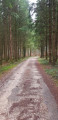
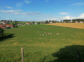
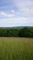
A hillside walk through the forest between Gennes and Nancray. Explore the old village of Gennes, then take in the scents of the fir forest, and finally the field of wild blackberries, which are a delight to pick from September to October.

Details

n°2879730
Creation:
Last update:
Last review:
  • Walking
    Activity: Walking
  • ↔
    Distance: 5.20 mi
  • ◔
    Average duration: 2h 50 
  • ▲
    Difficulty: Easy

  • ⚐
    Back to start: Yes
  • ↗
    Ascent: + 525 ft
  • ↘
    Descent: - 502 ft

  • ▲
    Highest point: 1,713 ft
  • ▼
    Lowest point: 1,286 ft
  • ⚐ Country: France
  • ⚐ City: Gennes (25660)
  • ⚑
    Start/End: N 47.241375° / E 6.123515°
  • ❏
    IGN map(s): Ref. 3323ET
  • Hour-by-hour weather

Photos

Description of the walk

Park in the car park at the Gennes multi-purpose hall.
The walk is signposted in yellow and blue.

(S/E) As you leave the car park, head uphill towards the village of Gennes.

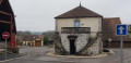
(1) Walk round the old village fountain to take a closer look at this historic building, which also houses the town hall. Stay on the road on the right, then at the next junction just after that, turn left.

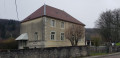
(2) At the next junction, you can admire the old village school, which is still in use, and the village’s old water reservoir.
Turn right towards the entrance to the Bois de la Côte. Then follow the road running alongside the Champs du Four and carry on straight ahead.

(3) At the Y-junction of the forest tracks, stay on the one that continues to climb to the right (for your information, the track on the left leads to the Gennes hunting lodge). Cross an open area, then back into the forest.

(4) When you reach the gate (often open) that may block the forest track, take the path leading downhill to the right. Turn left at thethird junction, before reaching the meadow. Follow the yellow and blue signposts carefully to reach the end of the forest track coming from Nancray, where there is a roundabout allowing vehicles to turn round. Continue for about 200 metres.

(5) Turn right onto the track that leads straight down the hillside. Then turn left and then right to reach the T-junction with the Route des Landes.

(6) Turn right.

(7) Take the tree-lined path on the left, where you’ll enter the vicinity of the Gennes SPSE pumping station (no inconvenience).

(8) At the junction, there is a signpost directing you to turn right and follow this forest track to Gennes.

(9) Once you reach the village, continue left onto Rue des Landes. Then turn left onto Rue de la Maltière, then right onto Rue du Vieux Tilleul. At the end of this street, turn left to return to the car park at the community hall (S/E).

Waypoints

  1. S/E : mi 0 - alt. 1,286 ft - Car park at the Gennes multi-purpose hall
  2. 1 : mi 0.23 - alt. 1,319 ft - Gennes Washhouse and Town Hall
  3. 2 : mi 0.43 - alt. 1,375 ft - Junction, on the right
  4. 3 : mi 1.1 - alt. 1,529 ft - Y-junction, turn right
  5. 4 : mi 1.73 - alt. 1,693 ft - Forest barrier
  6. 5 : mi 2.31 - alt. 1,608 ft - Path on the right
  7. 6 : mi 2.83 - alt. 1,322 ft - Route des Landes junction
  8. 7 : mi 3.2 - alt. 1,335 ft - Start of danger zone, on the left
  9. 8 : mi 3.49 - alt. 1,414 ft - Signpost, on the right
  10. 9 : mi 4.7 - alt. 1,362 ft - Rue des Landes
  11. S/E : mi 5.2 - alt. 1,286 ft - Car park at the Gennes multi-purpose hall

Notes

(7) The Southern European Underground Oil Pipeline (also known by the acronym S.P.S.E) is an oil pipeline linking the Mediterranean to the Upper Rhine region via France, supplying refineries in France, Switzerland and Germany.
Gennes is the junction point for the pipeline heading towards Switzerland.

The walk passes through an area posing a technological risk due to its proximity to a pumping station on the S.P.S.E underground oil pipeline at Gennes.
You will come across warning signs as you enter and leave this area.
If you hear the siren whilst in this area, you must evacuate it:
- Warning signal: 5 seconds, then 5 seconds.
- End of alert: 30 seconds.
You can listen to the signal by calling 0 800 507 305

Worth a visit

From the first turning point (5) and for a distance of 800 metres, the upper slope is covered with wild mulberry bushes which produce delicious berries in autumn.
Gourmets of the woodland should not get lost whilst searching for blackberries, as you must then turn right up the slope (see route description).

Reviews and comments

4.2 / 5
Based on 2 reviews

Reliability of the description
4 / 5
Ease of following the route
4 / 5
Route interest
4.5 / 5
Backpack
Backpack

Overall rating : 4.3 / 5

Date of your route : Feb 10, 2025
Reliability of the description : ★★★★☆ Good
Ease of following the route : ★★★★☆ Good
Route interest : ★★★★★ Very good
Very busy route : No

A route that runs partly through woodland and partly in open country, passing through a beautiful forest. One advantage of this route is that it can be easily extended or shortened thanks to the numerous paths criss-crossing the area – provided, of course, that you have a map or a smartphone.

Machine-translated

46497477
46497477

Overall rating : 4 / 5

Date of your route : Jan 20, 2020
Reliability of the description : Not used / Not applicable
Ease of following the route : Not used / Not applicable
Route interest : ★★★★☆ Good

Not yet used, but nevertheless very interesting and well described
I’m saving it for the next few sunny days

Machine-translated

Other walks in the area

For more walks, use our search engine .

The GPS track and description are the property of this route's author. Please do not copy them without permission.