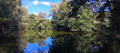
The Arcier Springs via the Grand Bois, starting from Gennes

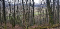
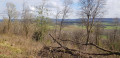
Follow the water’s path as it disappears into the underground channels (see ‘During’ section below) at Saône, Gennes and Nancray, only to reappear near Arcier. The footpath and small roads through the woodland will take you from one hillside to the other, offering alternating views of the plateau and the Doubs valley, before you reach the water again at the Arcier springs.

Details

3049681
Creation:
Last update:
Last review:
  • Walking
    Activity: Walking
  • ↔
    Distance: 5.16 mi
  • ◔
    Average duration: 3h 30 
  • ▲
    Difficulty: Moderate

  • ⚐
    Back to start: Yes
  • ↗
    Ascent: + 1,283 ft
  • ↘
    Descent: - 1,270 ft

  • ▲
    Highest point: 1,804 ft
  • ▼
    Lowest point: 840 ft
  • ⚐ Country: France
  • ⚐ City: Gennes (25660)
  • ⚑
    Start/End: N 47.24583° / E 6.12215°
  • ❏
    IGN map(s): Ref. 3323ET
  • Hour-by-hour weather

Photos

Description of the walk

Park in the car park at Gennes church.

(S/E) Head up to the right towards the school, make your way towards the Bois de la Côte, and reach a crossroads at the edge of the woodland.

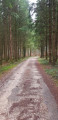
(1) Leave the road and head up into the forest opposite. Continue until you reach the hunting lodge.

(2) To the left of the hunting lodge, continue straight ahead uphill until you reach the highest point. Continue straight ahead downhill and join the junction of a forest track.

(3) Cross this track and continue down the ridge. Keep to the left and join the shortcut at Source Bergeret.

(4) Here you have two options:
- continue to the right along the path – this is the route shown on the map background;
- take the very steep shortcut to the left, which is not recommended in wet weather. Be careful here: you must keep to the left to avoid the rocky outcrop overlooking the Source Bergeret.
In either case, head back to the car park at the entrance to Arcier, where you’ll find theGR®59.

(5) Turn left onto it and you’ll reach a place called Le Caprice, where you’ll find a signpost: Route des Trois Portes.

(6) Climb a steep slope via a flight of steps fitted with wooden risers. Continue along the main path without taking the other tracks branching off to your left. You’ll reach the signpost for the Route des Epesses and the Route des Trois Portes.

(7) Turn left onto the path leading up towards the Grand Bois ridge; this is the Circuit des Epesses, marked in blue and yellow, but you’ll be walking in the opposite direction. Reach the ridge.

(8) Follow it to the right towards Montfaucon. You’ll come to another signpost.

(9) Continue down the path to the left towards Gennes.
Note: there are several paths leading to Gennes, but the GPS route mentioned takes you through a fir forest. At the hairpin bend, carry on straight ahead to reach the crossroads at the edge of the woodland you passed on the way out.

(1) Turn right and follow the road to the car park at Gennes church (S/E).

Waypoints

  1. S/E : mi 0 - alt. 1,358 ft - Starting point
  2. 1 : mi 0.23 - alt. 1,407 ft - Back in the Forest
  3. 2 : mi 0.69 - alt. 1,581 ft - Hunting lodge
  4. 3 : mi 1.44 - alt. 1,529 ft - Forest track
  5. 4 : mi 1.96 - alt. 1,083 ft - A very steep shortcut
  6. 5 : mi 2.16 - alt. 863 ft - Arcier car park
  7. 6 : mi 2.51 - alt. 869 ft - The springs
  8. 7 : mi 3 - alt. 1,486 ft - Final climb to the ridge
  9. 8 : mi 3.51 - alt. 1,709 ft - On the right, the ridge path
  10. 9 : mi 3.96 - alt. 1,798 ft - Descent through the fir trees
  11. S/E : mi 5.16 - alt. 1,358 ft - Arrival

Notes

Sturdy footwear is essential to keep your feet secure on the descent and prevent slipping on the ascent.

Worth a visit

The sinkholes: these are 11 deep, natural holes at Saône, Nancray, Gennes, Mamirolle and Naisey, through which water collected on the plateau seeps into the ground. It then flows through the fissured limestone subsoil known as ‘kartz’, before re-emerging at the Arcier springs.
An interesting challenge whilst hiking: it’s up to you to find them as you walk across the plateau.
This route has been identified using a dye called fluorescein.

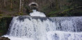
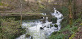
(Between 4 and 5) Once you reach the flat path above Arcier, take the opportunity to admire the Bergeret, Arcier and, above all, Martinet springs, which flow via several waterfalls towards the Doubs. These springs originate, via the Mamirolle faults, from the natural drainage of the Saône-Nancray plateau’s catchment area.
The sinkholes and springs are protected and serve as the route for the town of Besançon’s drinking water.
The Arcier springs are among the listed sites in the Doubs department.

Always be cautious and plan ahead when you're outdoors. Visorando and the author of this route cannot be held responsible for any accidents occurring on this route.

The GR® and PR® markings are the intellectual property of the Fédération Française de Randonnée Pédestre.

Reviews and comments

4.2 / 5
Based on 4 reviews

Reliability of the description
4 / 5
Ease of following the route
4 / 5
Route interest
4.5 / 5
GISORANDO
GISORANDO

Overall rating : 4.3 / 5

Date of your route : Apr 30, 2025
Reliability of the description : ★★★★☆ Good
Ease of following the route : ★★★★☆ Good
Route interest : ★★★★★ Very good
Very busy route : No

A lovely hike with the beautiful Arcier springs, with a good climb to reach the plateau...
We got a bit lost at point 4, but with the GPS we were able to find the route again.
Worth doing.

Machine-translated

Serge2566
Serge2566

Overall rating : 4 / 5

Date of your route : Jul 14, 2024
Reliability of the description : ★★★★☆ Good
Ease of following the route : ★★★★☆ Good
Route interest : ★★★★☆ Good
Very busy route : No

A lovely walk on an overcast day. However, the route is very shaded as it runs almost entirely through the forest. The springs are a fascinating sight. There’s a steep climb between points 6 and 7.
Using the GPS for navigation proved very useful, given the numerous paths that criss-cross the forest.
At point 9, we couldn’t find the path through the undergrowth, so we took a detour via the Fort des Epesses (ruins) and returned via a direct path to GENNES;

Machine-translated

Yoko25
Yoko25

Overall rating : 4 / 5

Date of your route : Jun 03, 2024
Reliability of the description : ★★★★☆ Good
Ease of following the route : ★★★★☆ Good
Route interest : ★★★★☆ Good
Very busy route : No

A very lovely walk through the woods, though there were a few difficulties finding your way due to logging operations and numerous paths leading off in all directions. No problems with the GPS. Having done the route twice, I’d advise you, at point 4, to take the first option – especially if you’re with children – namely ‘carry on to the right along the path’.

Machine-translated

Ptilapin
Ptilapin

Overall rating : 4.3 / 5

Date of your route : Feb 22, 2021
Reliability of the description : ★★★★☆ Good
Ease of following the route : ★★★★☆ Good
Route interest : ★★★★★ Very good
Very busy route : No

A lovely walk through varied landscapes, taking us to a beautiful spring.

Machine-translated

Other walks in the area

For more walks, use our search engine .

The GPS track and description are the property of this route's author. Please do not copy them without permission.