Balcon du Parc trail

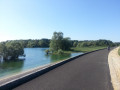
As soon as you set off along the path, your gaze takes in the chalky hillsides and meadows of the Champagne region. The path winds its way through the landscape, passing through fields, meadows, woods and springs, and takes you past the Saint-Gengoult Fountain.

Details

n°2211737
Creation:
Last update:
Last review:
  • Walking
    Activity: Walking
  • ↔
    Distance: 3.57 mi
  • ◔
    Average duration: 1h 45 
  • ▲
    Difficulty: Easy

  • ⚐
    Back to start: Yes
  • ↗
    Ascent: + 115 ft
  • ↘
    Descent: - 115 ft

  • ▲
    Highest point: 525 ft
  • ▼
    Lowest point: 397 ft

Photos

Description of the walk

Yellow markings on the Sacey circular route passing through points 1, 2, 3 and 4

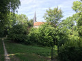
Starting point: Saint-Gengoult Church in Sacey.

(S/E) With your back to the church, head right onto the D86 then carry on straight ahead when you reach the Chemin du Chardonneret.

(1) At the Croix Saint-Martin wayside cross, take the path opposite that leads into the countryside. At the bottom, turn right to continue downhill through woodland and open fields.

(2) At the bend, keep to the right and cross the small woodland managed by the ONF. As you emerge from the woodland, the landscape changes, with its hedgerows, beautiful oak trees in meadows and springs. Walk past a fishing pond.

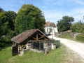
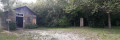
(3) At the end of the path, take the small road on the right which passes the Fontaine Saint-Gengoult, its wayside cross and its wash house. Turn left onto the sunken track which leads back up to the main road. You can turn right towards the church to return to the starting point.

(4) Turn left, then after 100 metres, turn left onto the Chemin du Moulin. At the end of the path, turn right and continue straight on to Saint-Martin Church.

(5) Turn right onto Rue de l’Ecole, then 200 m further on, turn right onto Rue de Surgale.

(6) At the junction by the war memorial, carry on straight ahead and turn onto Route du Balcon du Parc. 200 m past the junction is the Easter Cross. Carry on straight ahead to Saint-Gengoult Church (S/E)

Waypoints

  1. S/E : mi 0 - alt. 512 ft - Église Saint-Gengoult (Sacey)
  2. 1 : mi 0.29 - alt. 525 ft - Saint-Martin Cross
  3. 2 : mi 1.01 - alt. 407 ft - Bend in the path before the forest
  4. 3 : mi 1.68 - alt. 423 ft - Fontaine de Saint-Gengoult
  5. 4 : mi 2.05 - alt. 505 ft - Exit from the Chardonneret path
  6. 5 : mi 2.84 - alt. 479 ft - Église Saint-Martin (Rouilly)
  7. 6 : mi 3.03 - alt. 492 ft - War memorial
  8. S/E : mi 3.57 - alt. 512 ft - Église Saint-Gengoult (Sacey)

Notes

Unpaved paths: 78 per cent.

Bench behind the church, at the Croix Saint-Martin and at the Saint-Gengoult Fountain

Worth a visit

- 16th-century Saint-Gengoult Church at the start: occasionally open
- Restored washhouse, wrought-iron wayside cross and Saint-Gengoult Fountain
- panoramic view at the Croix Saint-Martin

Reviews and comments

4.7 / 5
Based on 1 review

Reliability of the description
5 / 5
Ease of following the route
5 / 5
Route interest
4 / 5
User 10715686

Overall rating : 4.7 / 5

Date of your route : Mar 22, 2026
Reliability of the description : ★★★★★ Very good
Ease of following the route : ★★★★★ Very good
Route interest : ★★★★☆ Good
Very busy route : No

A pleasant, easy walk

Machine-translated

Other walks in the area

For more walks, use our search engine .

The GPS track and description are the property of this route's author. Please do not copy them without permission.