The Lajo Peat Bogs Trail

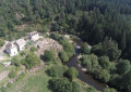
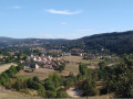
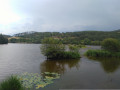
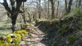
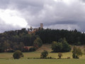
A lovely, family-friendly and educational walk along well-marked, easy paths. Over a short distance, you can enjoy a wide variety of landscapes: deciduous and coniferous woodland, peat bogs, rocky outcrops, heathland and views out across the plain. Boardwalks allow you to venture deep into the peat bog. Information boards explain the history and biology of the peat bogs and forests, etc. Beautiful trees: the scents of broom, the forest and the heathland… A lovely walk for everyone.

Details

22379655
Creation:
Last update:
Last review:
  • Walking
    Activity: Walking
  • ↔
    Distance: 3.00 mi
  • ◔
    Average duration: 1h 50 
  • ▲
    Difficulty: Easy

  • ⚐
    Back to start: Yes
  • ↗
    Ascent: + 551 ft
  • ↘
    Descent: - 551 ft

  • ▲
    Highest point: 4,600 ft
  • ▼
    Lowest point: 4,049 ft

Photos

Description of the walk

Park near Lajo Town Hall.

Red signposting

(S/E) Set off opposite the town hall and follow the red signposting away from the centre, on a gentle climb (south-east). Follow a tarmac road which becomes a wide track.

(1) At the fork in the road, turn left. At the next track junction, continue to the right.

(2) Take a short return trip along a boardwalk to the left. 100 m further on, turn right for a return trip to the Lajo peat bog, via a boardwalk. On your return, continue along the track to the right until you reach a fork.

(3) Between plot numbers 7 and 8, the circular loop (marked in red) branches off to the left. Continue straight on, following the yellow markings, until you reach another fork 100 metres further on.

Yellow signposts

(4) At a rock, follow the signposting towards a track on the right at a right angle, until you reach a large rock.

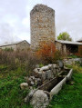
(5) Leave the track and take a path on the right. The path turns left towards a pile of rocks in the distance. These are the summit rocks, a pile of granite boulders. In front of them, turn left to rejoin the track. Pass in front of a large heath. After this, follow the track to the left down a fairly steep slope.
Return to the junction of the circular route and the rock you passed on the way out.

(4). Continue straight on, downhill. You’ll come to the junction of plots 7 and 8, which you’ve already passed on the way out.

Red signposting

(3). Follow the red markings again, turning right onto a path that leads into the forest.
After 600 m along the forest path, you’ll reach a track. First turn right then left. After a descent, at the sign for “Foyer” on the right, turn left to return to the start (S/E).

Waypoints

  1. S/E : mi 0 - alt. 4,049 ft - Lajo Town Hall - Eglise Romane de Lajo
  2. 1 : mi 0.37 - alt. 4,203 ft - Fork in the road near the - Limagnole (rivière) - Affluent de la Truyère
  3. 2 : mi 0.71 - alt. 4,288 ft - Jetty to the left, return route
  4. 3 : mi 1.1 - alt. 4,390 ft - Plots 7 and 8
  5. 4 : mi 1.2 - alt. 4,423 ft - Junction of the circular loop
  6. 5 : mi 1.41 - alt. 4,547 ft - Large rock: path on the right
  7. S/E : mi 3 - alt. 4,049 ft - Lajo Town Hall

Notes

The first circular route (marked in red) is approximately 3.5 km long and runs through woods and peat bogs. We will follow this route as well as the additional 2 km circular route (marked in yellow), which takes in the ridge, some beautiful rock formations, heathland and more.

Signposting: wooden posts and arrows, coloured red or yellow, decorated with a drawing of a dwarf birch leaf.

Worth a visit

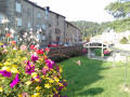
Saint-Roch Church in Lajo.

Shops: in Malzieu-Ville.

Reviews and comments

5 / 5
Based on 4 reviews

Reliability of the description
5 / 5
Ease of following the route
5 / 5
Route interest
5 / 5
User 14154747

Overall rating : 5 / 5

Date of your route : Jul 24, 2026
Reliability of the description : ★★★★★ Very good
Ease of following the route : ★★★★★ Very good
Route interest : ★★★★★ Very good
Very busy route : No

A lovely, cool walk with informative signs. I’d recommend it.

Machine-translated

danielinu
danielinu

Overall rating : 5 / 5

Date of your route : Jul 16, 2026
Reliability of the description : ★★★★★ Very good
Ease of following the route : ★★★★★ Very good
Route interest : ★★★★★ Very good
Very busy route : No

A lovely walk, packed with information on nature conservation, and not at all difficult. One of the most beautiful in the region. Very well signposted, and with a choice of routes, you can make it shorter or longer depending on how fit you are.

Machine-translated

sergio0342
sergio0342

Overall rating : 5 / 5

Date of your route : Jul 08, 2024
Reliability of the description : ★★★★★ Very good
Ease of following the route : ★★★★★ Very good
Route interest : ★★★★★ Very good
Very busy route : Yes

A lovely, informative walk, even in the rain

Machine-translated

coquelicots
coquelicots

Overall rating : 5 / 5

Date of your route : Jul 18, 2022
Reliability of the description : ★★★★★ Very good
Ease of following the route : ★★★★★ Very good
Route interest : ★★★★★ Very good
Very busy route : No

A lovely, short and easy walk. The boardwalks leading to the peat bogs allow you to get close whilst respecting these fragile habitats. In the summer of 2022, the drought is very noticeable, but you can still spot a few sundews, those famous little carnivorous plants. Do take the time to climb up to the ridge – the rocky scree there is impressive. A peaceful and relaxing walk. The village is well worth a stop, with its fountain, church, and more...

Machine-translated

Other walks in the area

For more walks, use our search engine .

The GPS track and description are the property of this route's author. Please do not copy them without permission.