Country:

 City:


Start from the Domaine du Sauvage.
(S) From the car park, head south-west along the famous GR®65 trail. Follow the red and white markings.
(1) Cross the Virlange (river). Ignore the successive paths on your left and join the D587; walk carefully along the left-hand side of the road for about 500 m to reach the village of Saint-Roch.
(2) Once past the chapel and the refuge, follow the wide track on the right, signposted ‘Lajo, off the GR®’, up a steep incline. Ignore the first track on the right, pass by the Ronc del Chapel and continue to the next junction. Then turn right towards Lajo and cross the small stream.
(3) At the next junction, continue to the left then to the right, still following the signs for Lajo.
(4) Cross another small stream.
(5) At the next junction, turn right towards the Lajo peat bogs. Go through the metal barrier blocking the way and continue along this track, ignoring the paths on either side, until you reach the next junction.
(6) Then follow the track to the left, before leaving it further on, halfway up the hill, to take a wide path on the left-hand side instead. This will take you to an open junction, where you should turn right.
(7) At the 1352 mark, keep to the left and continue to a hairpin bend. Ignore this and take a grassy path on the right-hand side which leads to a junction of several paths.
(8) Take the path that veers slightly to the left, then turn left again at the Fork in the road. Continue downhill in this direction until you reach the next junction.
(9) Then turn right onto the path leading downhill (a small yellow sign marked ‘6 Mialanes’ attached to a tree trunk on your right will serve as a landmark) and, after a few metres, turn left straight away onto a narrow path (look for the rock at the start of the track) which winds through the coniferous woodland and leads downhill to the village of Mialanes.
(10) Follow the road opposite, which leads to the centre of the village and the church. You can stop off at the village’s small café-restaurant and fill your water bottle at the fountain near the communal oven.
(11) Opposite the church, take the path that runs alongside the building on the right. Pass by the cemetery, keeping to the right onto a grassy path that joins the road. Cross the road and continue straight ahead, cross the Ruisseau des Ducs and carry on to the junction, ignoring the track on the right.
(12) Turn right at the uphill bend, then left, and join the GR® on the right. Follow the red and white markings through the woodland to the next track.
(13) Then turn right and head for a large crossroads of tracks at an elevation of 1184. Follow the GR® signposted ‘Le Malzieu-Paladines’ to the left. Pass the hunters’ hut on your right and continue along this wide track, ignoring the track on the right which leads to the village of Montchabrier. Join the tarmac road.
(14) Cross carefully and take the grassy path opposite, which leads downhill to the first houses of the hamlet of Le Villard.
(15) Cross the road again and follow the track slightly to your left, which leads downhill through the housing estate. You are still on the GR®. This will take you back to the road, which you should follow to the left until you reach the village boundary.
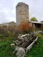
(16) At the last house, on the bend, leave the road and take the wide track instead, which crosses the pastures and leads to the medieval village of Malzieu-Ville. Walk past the water tower to catch a glimpse, in the meadow, of the Croix de la Serre, which once served as a landmark for pilgrims. Walk past the cemetery on your left, then the Lodges du Pigeonnier on your right, and join the road.
(17) Turn right onto Avenue Jacques de Féligonde and head towards the centre of the village. You will then find yourself facing the Tour de Bodon, set within the village ramparts, which houses the tourist office (E).
 Visorando Member
 Easy