Country:
 City:
City:


Car park near the Waldhölzbach fire station, Kurstrabe.
Signposting: white ‘SH’ on a purple background
(S/E) Head towards the church; the starting point is at the rear of the church, on Kurstrabe. Take the path uphill and walk past the Grotte de Marie. The path winds its way uphill. Ignore the path on the right and continue to the left. Cross the road and carry on. The path runs alongside the road. At the end of the path, turn left. At the road, turn right. Head towards the house and take the path to the right of it. Then turn right.
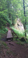
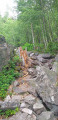
(1) Take thefirst path on the left. Climb up to the Teufelsfels rocks. Go round to the right of the rocks. At the top, turn right. The path leads downhill. Cross the forest track, go over the footbridge, then wade across the stream and turn left. Follow the path uphill, with the stream on your left, until you reach the Kneipp pool. Turn left and then right. Further on, ignore the path on the right and carry on.
(2) At the T-junction, take the path to the left.
(3) A little further on, turn left onto the path after the two benches.
(4) At the junction, take the path straight ahead on the right.
(5) At the junction with a forest track, go straight on. Ford the stream. Further on, go down the steps and continue to the left until you reach the crossroads. Turn right, walk past the hut (Hütte) and then turn left.
(6) A little further on, turn left onto the path that runs closest to the stream. Ford the stream and continue to the right. Atthe first path on the left, you’ll reach Barenfels – head uphill. At the scree slope on the right, follow the rock face and head downhill. Head right and, at the junction with the forest track, carry on straight ahead. Cross the footbridge and then fords. Turn left and then right. At the pond, go round it on the left. Walk past thesecond Kneipp pool. At the end, turn right. At the road, carry on straight ahead, walk through open country and then enter the forest.
(7) Turn right atthe first path. At the forest track, turn right and then take the path on the left. At the viewpoint with a bench, turn right and head downhill. At the bottom, look back – you have just descended Adelfelsen. The path winds its way down and turns right. Unobstructed view of the countryside. The path then turns sharply to the left after entering the forest. Atthe first path, turn left and head uphill towards the ruins of the medieval castle. Continue to the right past the remains ofthe second castle and descend via a series of hairpin bends. The path winds through the undergrowth.
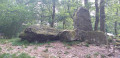
(8) At the Fork in the road, turn left and walk past the Celtic shrine. Continue down the path and, at the wide track, turn right. Walk alongside a private pond.
(9) After the chalet, turn left to take the path closest to the stream. Once back on the track, ignore the path to the left and carry on straight ahead. Then take thefirst path on the left. Cross a bridge, climb up with a view of the Schangenfelsen rocks, cross asecond bridge and finally athird. At the top, go round the meadow on the right. Pass through a first gate and then a second. On the road, keep to the left. After the bend, carry on straight ahead. At the end of the road, turn left and enjoy the unobstructed view of the countryside. Walk down the road and, at the bend, carry on straight ahead onto the dirt track.
(10) Enter the forest and take the path on your left straight away. Walk uphill to the forest track, turn right and, at the Fork in the road, turn left. When you’re back on a forest track, turn right.
(11) At the junction, take the path on the left. Head downhill, following the stream. Cross the bridge, then the gate; carry on straight ahead and pass thesecond gate. Turn right. Further on, turn left onto the path before the road and head uphill. The path turns right. Continue through the open countryside until you reach the road, then cross it.
(12) Ignore the forest track branching off to the left and take the gap in the fence on your right. Cross the meadow; at the far end, the path continues to the left and then turns right before the forest track. Walk past an observation platform. Back on the forest track, head straight up. At the fork in the road, turn left (not shown on the map).
(13) Join a path and follow it to the left. At the junction, turn right. Ignore the path branching off to the right and carry on straight ahead. At the cross, turn left and, when you reach the road, turn right, cross it and take thefirst path on the left. Walk through open country until you enter the forest. Cross a pontoon and go round the pond on the left. At thesecond pond, go round it on the right. Then turn left onto the barefoot path.
(14) At the junction, carry on to the right. Ignore the footbridge on the left and carry on. Cross the pontoon and, at the wide path, carry on to the left. At the road, turn left. At the crossroads, cross the road and carry on straight ahead, going up the road to return to the starting archway near the car park (S/E).

 Visorando Member
 Easy
Easy 
 Tourism professional