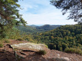
Route from the Imsthal rocks to Loosthal

A walk to explore the Petite Pierre forest.

Details

39708255
Creation:
Last update:
Last review:
  • Walking
    Activity: Walking
  • ↔
    Distance: 5.70 mi
  • ◔
    Average duration: 3h 15 
  • ▲
    Difficulty: Easy

  • ⚐
    Back to start: Yes
  • ↗
    Ascent: + 722 ft
  • ↘
    Descent: - 725 ft

  • ▲
    Highest point: 1,283 ft
  • ▼
    Lowest point: 764 ft

Description of the walk

Start and finish at the car park of the Imsthal Inn, accessible by car or bus.

(S/E) With your back to the inn, turn right onto the path, then turn right again after 150 metres, continuing straight on past the two tracks you come across, until you reach a path coming from the left.

(1) Follow this path. Take the first path on the left, ignoring a path on the right and then another on the left.

(2) When you reach the T-junction, turn left then right to join the road (elevation 370).

(3) Cross the road and continue straight ahead for 30 m. Turn left for 100 m until you reach the junction, then keep to the right and continue until you come out onto a forest track not far from the Rocher de Hirshfels. Cut across the track towards the rock. At the crossroads, go straight ahead to reach the rock.

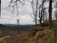
(4) Enjoy the view from an altitude of 383 m. Return to the crossroads and turn right. Carry on straight ahead until you reach the panoramic viewpoint at the Rocher du Loosthal.

(5) Enjoy the view and resume the route. Keep to the right when you reach the road, then turn left to follow a path leading onto another road; turn right here to rejoin the departmental road.

(6) Cross the road and continue along the path furthest to the left. You’ll come to a large parking area; take the path on the right. Keep to the right all the way to the departmental road. Cross the road and you’ll arrive at the Rocher de la Grenouille.

(7) Turn left until you reach the next road, Chemin du Kirchberg. Follow this road to the right, keep right at the junction and stay on this road, which bends 90° further on. Pass the Kirchberg retirement home by 100 metres, and you’ll reach a fork in the road (elevation 384).

(8) Turn left onto Rue du Rebberg. At the end of the street, turn left (Le Kirchberg) then follow a path on the left leading back to the D7. Turn right onto it for 40 metres until you reach the Petote-Pierre post office.

(9) Just before this, turn left onto a footpath, then continue straight ahead onto a track. Keep going straight on until you reach a pond on your left. Pass it and turn left. Then keep to the right at the next three junctions, heading south-west. You’ll come to a tarmac road; follow it to the left until you reach the Auberge d’Imsthal and its pond. Return to the car park (S/E).

Waypoints

  1. S/E : mi 0 - alt. 850 ft - Car park - Etang d'Imsthal
  2. 1 : mi 0.15 - alt. 942 ft - Path on the left
  3. 2 : mi 0.36 - alt. 1,099 ft - Junction
  4. 3 : mi 0.95 - alt. 1,217 ft - Road
  5. 4 : mi 1.53 - alt. 1,188 ft - Rocher du Hirschfels
  6. 5 : mi 2.34 - alt. 1,257 ft - Rocher du Loosthal
  7. 6 : mi 2.73 - alt. 1,175 ft - D34
  8. 7 : mi 3.38 - alt. 1,175 ft - Froschkopf
  9. 8 : mi 4.08 - alt. 1,260 ft - Rebberg Street
  10. 9 : mi 4.43 - alt. 1,119 ft - La Petite-Pierre, checkpoint
  11. S/E : mi 5.7 - alt. 850 ft - Car park - Etang d'Imsthal

Worth a visit

(4) Hirschfels Rock.
(5) Loosthal Rock.
(7) Frog Rock.

Reviews and comments

3.3 / 5
Based on 5 reviews

Reliability of the description
2.8 / 5
Ease of following the route
3 / 5
Route interest
4.2 / 5
Noëlle Noëlle
Noëlle Noëlle
• Edited:

Overall rating : 5 / 5

Date of your route : Sep 16, 2024
Reliability of the description : ★★★★★ Very good
Ease of following the route : ★★★★★ Very good
Route interest : ★★★★★ Very good
Very busy route : No

A lovely, well-signposted walk that you can follow right down to the last detail.
Everything fits together perfectly.

Machine-translated

lemarcheur65
lemarcheur65 ★

Hello SYWI
Thank you
Description updated.

Machine-translated

SYWI
SYWI

Overall rating : 2.3 / 5

Date of your route : Jun 29, 2024
Reliability of the description : ★★☆☆☆ Disappointing
Ease of following the route : ★★☆☆☆ Disappointing
Route interest : ★★★☆☆ Average
Very busy route : No

The directions were very confusing right from the start. We only completed half the route, having to do a circular loop because we got the route wrong (the Red Cross symbol marks several paths! and we took the longest one through the forest with no views) and we had to cut across via another path to get back to the hostel, so we ended up walking 10 km!
We didn’t see any signs for Hirschfelsen, but a hiker recommended the “Saut du Chien”, which was a lovely viewpoint. We had to take a shortcut via the path back to Imsthal (red–white–red Red Rectangle) from Loosthal as it would otherwise have been too long. A bit of a shame, perhaps, but the rest of the walk was satisfactory?

Machine-translated

bey2.geo
bey2.geo

Overall rating : 3 / 5

Date of your route : May 27, 2024
Reliability of the description : ★★☆☆☆ Disappointing
Ease of following the route : ★★☆☆☆ Disappointing
Route interest : ★★★★★ Very good
Very busy route : No

A lovely walk, but the route is quite tricky at points 1 and 2, and then after point 8.

The route description and the route itself should be reviewed at these points.

Machine-translated

Papilou1
Papilou1

Overall rating : 4 / 5

Date of your route : Jan 27, 2024
Reliability of the description : ★★★★☆ Good
Ease of following the route : ★★★★☆ Good
Route interest : ★★★★☆ Good
Very busy route : No

We took a detour via the ‘Frog’s Head’; it’s only an extra 200 metres if you can find the little path. It’s an interesting rock formation to see. On the way back, we took a diversion leading towards La Petite Pierre. We set off from the castle, which makes for a slightly longer route of around one kilometre.

Machine-translated

Rhum57
Rhum57

Overall rating : 2.3 / 5

Date of your route : Oct 27, 2023
Reliability of the description : ★☆☆☆☆ Very disappointing
Ease of following the route : ★★☆☆☆ Disappointing
Route interest : ★★★★☆ Good
Very busy route : No

Hello infoarunner
Why ignore the Club Vosgien’s signposts?
As described, you’re constantly with your nose in the map, counting the paths to the right and left that you mustn’t take... : You could have said: Follow the horizontal Yellow Diamond to the right, then the Red Cross to the left, then the yellow circle to the right, and there you are at the Rocher du Hirschfels… instead of: With your back to the inn, turn right onto the path, then veer right.
Carry on straight ahead past the first two tracks. (1) You’ll come across a path coming from the left. Follow this one. Take the first path on the left, ignoring a track on the right and then another on the left. When you reach the T-junction, turn left and then right to reach the road. (2) Cross the road and continue straight on for a few dozen metres. Turn left, keep to the right at the next junction and carry on until you come out onto a forest track not far from the Rocher du Hirschfels. If you want to get lost, follow it.

Machine-translated

Other walks in the area

For more walks, use our search engine .

The GPS track and description are the property of this route's author. Please do not copy them without permission.