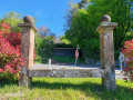
From the Auberge d’Imsthal to Hunebourg Castle

A lovely circular walk with a variety of views.

Details

n°50008993
Creation:
Last update:
Last review:
  • Walking
    Activity: Walking
  • ↔
    Distance: 9.68 mi
  • ◔
    Average duration: 5h 45 
  • ▲
    Difficulty: Moderate

  • ⚐
    Back to start: Yes
  • ↗
    Ascent: + 1,512 ft
  • ↘
    Descent: - 1,512 ft

  • ▲
    Highest point: 1,325 ft
  • ▼
    Lowest point: 679 ft

Photos

Description of the walk

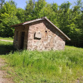
Park in the car park at the Auberge d’Imsthal, Route d’Imsthal, off the D178 (towards La Petite Pierre).

(S/E) Leave the inn on your right and the house on its own little island on your left, and continue to the first junction. Turn right and follow the Yellow Diamond sign. You will reach the Heidekoepfel crossroads.

(1) Carry on straight ahead to reach a four-way junction.

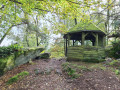
(2) Turn left onto the path marked with a Yellow Disc, walk alongside the Hundsprung (Dog’s Leap) and then turn right. You’ll reach the junction at the Breitschloss Hut.

(3) Keep left to reach the Rocher du Bélier, following a gentle descent.

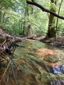
(4) Continue to the left, still following the Yellow Disc, down a path with tight hairpin bends. Walk alongside a small reservoir on the River Fischbaechel before reaching a five-way junction.

(5) Carry on to the right, following the river, until you reach another crossroads at the bottom of the descent.

(6) Turn left onto the path marked with a Yellow Disc and Blue Cross. Begin a long, fairly steep climb to reach the Hunebourg Forest House.

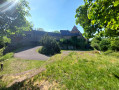
(7) Carry on until you reach the Château du Hunebourg at the top of the climb.

(8) Turn left onto the path marked ‘Red Cross’ and walk past the Grotte d’Amour.

(9) Continue downhill; after a sharp bend to the right, you’ll reach the Johannisthal Forest Road.

(10) Turn left onto this road and head for the hamlet of Johannisthal.

(11) Here, turn right uphill onto the path marked with a Blue Rectangle. At the top, you’ll reach the centre of Loosthal and its car park.

(12) Turn left and now follow the Red Cross markings along the ridge. You will then reach the original junction at Heidekoepfel.

(1) Turn right and follow the route you took on the way there, but in the opposite direction, to return to the car park at the Auberge d’Imbsthal (S/E).


Waypoints

  1. S/E : mi 0 - alt. 843 ft - Auberge d’Imsthal car park - Etang d'Imsthal
  2. 1 : mi 0.59 - alt. 1,165 ft - Junction of the circular loop
  3. 2 : mi 1.05 - alt. 1,243 ft - Four-way junction
  4. 3 : mi 1.59 - alt. 1,247 ft - Breitschloss Hut
  5. 4 : mi 2.13 - alt. 1,158 ft - Rocher du Bélier (Eschbourg)
  6. 5 : mi 2.74 - alt. 725 ft - Crossroads with 5 directions
  7. 6 : mi 3.53 - alt. 682 ft - Crossroads towards Hunebourg
  8. 7 : mi 5.05 - alt. 1,184 ft - Hunebourg Forest House
  9. 8 : mi 5.4 - alt. 1,325 ft - Château du Hunebourg
  10. 9 : mi 5.55 - alt. 1,316 ft - Cave of Love
  11. 10 : mi 6.4 - alt. 971 ft - Johannisthal Forest Road
  12. 11 : mi 6.83 - alt. 807 ft - Johannisthal
  13. 12 : mi 7.86 - alt. 1,161 ft - Loosthal
  14. S/E : mi 9.68 - alt. 843 ft - Auberge d’Imsthal car park

Worth a visit

(7) Hunebourg Castle is, unfortunately, no longer open to the public, but a conveniently situated bench in front of the entrance provides a spot to take a break and admire the view.
(12) Loosthal and its wildlife rescue centre.

Reviews and comments

4.2 / 5
Based on 2 reviews

Reliability of the description
4.5 / 5
Ease of following the route
3.5 / 5
Route interest
4.5 / 5
User 28647690

Overall rating : 4.3 / 5

Date of your route : Apr 22, 2026
Reliability of the description : ★★★★★ Very good
Ease of following the route : ★★★☆☆ Average
Route interest : ★★★★★ Very good
Very busy route : No

A lovely walk, though not always easy. The area is really pleasant. That said, I found it wasn’t always easy to find the right path, but it’s possible that I just wasn’t paying enough attention.
In any case, I’d recommend it.

Machine-translated

Vic&Nath
Vic&Nath

Overall rating : 4 / 5

Date of your route : Dec 29, 2024
Reliability of the description : ★★★★☆ Good
Ease of following the route : ★★★★☆ Good
Route interest : ★★★★☆ Good
Very busy route : No

A walk taken on the morning of 29 December in a beautiful forest setting covered in hoarfrost.
The route remains pleasant, although the section along forest tracks can be a bit monotonous at times.

Machine-translated

Other walks in the area

For more walks, use our search engine .

The GPS track and description are the property of this route's author. Please do not copy them without permission.