La Petite-Pierre – Saverne

The fifth stage of the journey across the Vosges, from north to south, with *Passion Vosges*, between La Petite-Pierre and Saverne, following in the footsteps of Louise Weiss, René Char and Felsekaeth. A hike recounted by Christian Bach, which you can read about in the *Passion Vosges* magazine published by the DNA and *L’Alsace*.

Details

n°70097330
Creation:
Last update:
Last review:
  • Walking
    Activity: Walking
  • ↔
    Distance: 12.95 mi
  • ◔
    Average duration: 7h 10 
  • ▲
    Difficulty: Difficult

  • ⚐
    Back to start: No
  • ↗
    Ascent: + 1,381 ft
  • ↘
    Descent: - 1,896 ft

  • ▲
    Highest point: 1,378 ft
  • ▼
    Lowest point: 607 ft
  • ⚐ Country: France
  • ⚐
  • ⚐ City: La Petite-Pierre (67290)
  • ⚑
    Start: N 48.856513° / E 7.319131°
  • ⚑
    End: N 48.741877° / E 7.362443°
  • Accessible from the train station Gare de Saverne.
  • ❏
    IGN map(s): Ref. 3614ET, 3714ET, 3715OT
  • Hour-by-hour weather

Photos

Description of the walk

The route starts at the Petite-Pierre Tourist Office, on Rue du Château.

Follow the Red Rectangle throughout the route, unless otherwise stated.

(S) From the Tourist Office in La Petite-Pierre, head up the Chemin de l’Altenbourg, directly opposite. Continuing straight ahead, you’ll soon reach the Rocher du Corbeau, which overlooks the Imsthal.

(1) Then descend for about a hundred metres along a winding path, taking the path downhill at each junction. You’ll arrive near the Auberge de l’Imsthal, where you can stop for a break, and follow the road to the right.

(2) Pass the Kohlerthalhof and the pond, then reach the Moulin de la Petite-Pierre and walk round it.

(3) Then, immediately take a path that climbs to the left; the ascent is a good hundred metres. Make a wide left-hand bend, then leave the path to turn right and cross the forest road. Continue along the path that runs alongside the road, towards Graufthal. You’ll end up not far from the Eschbourg stadium.

(4) From there, begin a pleasant descent which, if you keep going straight ahead, leads to a road.

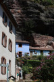
(5) Keep heading along this road towards Graufthal. Turn into the second street on the right, then turn left towards the church. Graufthal is a troglodytic site.

(6) At the T-junction, turn left, then take the right-hand bend. On leaving Graufthal, turn right, past the cemetery, then join a footpath at the bend in the road.

(7) Turn left. Stay along the Zinsel. “From here, the walk follows a path – which quickly becomes muddy in wet weather – all the way to Oberhof. Keep to the left, along the stream, then continue to Oberhof.

(8) Head straight ahead, then keep to the left on the road. After the left-hand bend, continue to the right. Take a second left-hand bend, then head uphill to the right. Keep heading south until you reach the district road.

(9) Head straight ahead, then follow the railway line to the right for about 200 m.

(10) Cross over the high-speed rail line and the A4. Leave the road to the left, then, at the end of the path, turn right. Take a right-right-left to rejoin the path. The route follows the edge of the road, or runs close to the D1004. Cut across the forest warden’s house road, and continue straight on until you reach the second one.

(11) Carry on straight ahead, then head left to reach the Fossé des Pandours.

(12) Carry on straight ahead until you pass a mast on your left. First turn left then right, then carry on straight ahead to reach the Saut du Prince Charles.

(13) From the Saut du Prince Charles, take two hairpin bends; at the second, head down along the riverbank. You’ll reach the hospital on your left. Continue along Rue Edmond About, towards Saverne town centre, to reach the Kuth Site.

(14) Carry on along the street. At the end, turn right onto the departmental road, until you reach the railway bridge. Shortly afterwards, turn left to reach the Grand Rue, Vieux Saverne and the town centre.

(15) Turn right onto Grand Rue and continue to Saverne Castle (E).

Waypoints

  1. S : mi 0 - alt. 1,155 ft - Petite-Pierre Tourist Office
  2. 1 : mi 0.81 - alt. 1,165 ft - Rocher du Corbeau (Altenburg)
  3. 2 : mi 1.41 - alt. 722 ft - Imsthal
  4. 3 : mi 1.71 - alt. 722 ft - Fourche - Moulin
  5. 4 : mi 3.3 - alt. 1,079 ft - Eschbourg Stadium
  6. 5 : mi 4.11 - alt. 676 ft - Route
  7. 6 : mi 4.52 - alt. 663 ft - Troglodytic site - Église de la Bienheureuse Vierge-Marie (Graufthal)
  8. 7 : mi 4.91 - alt. 669 ft - Start of the trail - Zinsel du Sud (rivière)
  9. 8 : mi 6.62 - alt. 640 ft - Intersection
  10. 9 : mi 8.72 - alt. 1,083 ft - D122 road
  11. 10 : mi 9.06 - alt. 1,125 ft - Railway bridge
  12. 11 : mi 10.21 - alt. 1,296 ft - Route
  13. 12 : mi 10.59 - alt. 1,316 ft - Fossé des Pandours
  14. 13 : mi 11.47 - alt. 1,030 ft - Saut du Prince Charles
  15. 14 : mi 12.38 - alt. 646 ft - Kuhn website
  16. 15 : mi 12.73 - alt. 610 ft - Grand Rue - Zorn (rivière)
  17. E : mi 12.95 - alt. 640 ft - Château des Rohan (Saverne)

Notes

(2) Auberge de l’Imsthal, a great place to stop off, (petite-pierre.com),

Pays de Saverne Tourist and Trade Office, 4 rue Poincaré, www.tourisme-saverne.fr, 03 88 91 80 47.

To purchase the magazine featuring this walk, visit the L’ALSACE-DNA Shop. 

Passion Vosges invites you to explore the Vosges mountains, whether on your own, with family or with friends, as you discover its majestic peaks, lush foothills and picturesque valleys. With hiking routes, practical advice, local anecdotes and captivating articles from the editorial team, let us guide you into the heart of a region rich in nature and history.

With *Passion Vosges*, the Vosges mountains will hold no more secrets for you!

Find the full collection of magazines atthe L’ALSACE-DNA Shop.

Worth a visit

Reviews and comments

4 / 5
Based on 2 reviews

Reliability of the description
4.5 / 5
Ease of following the route
4 / 5
Route interest
3.5 / 5
Leo l'embrouille
Leo l'embrouille

Overall rating : 4.7 / 5

Date of your route : Aug 24, 2026
Reliability of the description : ★★★★☆ Good
Ease of following the route : ★★★★★ Very good
Route interest : ★★★★★ Very good
Very busy route : No

A lovely walk, not particularly difficult, with some very interesting sights to see along the route (cave dwellings and the Saut du Prince)

Machine-translated

BretzelRando
BretzelRando

Overall rating : 3.3 / 5

Date of your route : Jun 05, 2026
Reliability of the description : ★★★★★ Very good
Ease of following the route : ★★★☆☆ Average
Route interest : ★★☆☆☆ Disappointing
Very busy route : Yes

After lunch, for the second stage of the day, I must admit I was disappointed with the route.
The ride from Petite-Pierre is very pleasant as far as Graufthal, but the rest is of little interest.
The stretch along the roadside, with the TGV bridge and the motorway bridge in quick succession, followed by secondary roads and a change in route, is the weak point of this magnificent five-day ride through the Vosges.
Even the descent towards Saverne, which follows a lovely path, is accompanied by a constant background noise of traffic – a shame.
However, the finish near Saverne makes you forget this uninteresting stretch. The town is very pleasant and its surroundings enchanting.
End of the journey for me, with a total of 115 km (including a few detours), 4,000 metres of elevation gain and three days’ walking to cover the five stages.
Very good TER train connections to Wissembourg on the way there and Saverne on the way back.

Machine-translated

Other walks in the area

For more walks, use our search engine .

The GPS track and description are the property of this route's author. Please do not copy them without permission.