The Saint-Pierre to Chanay trail

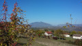
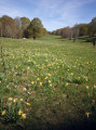
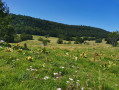
The paths you’ll be following are in the southern part of the Jura, known as La Michaille. Perhaps, if you’re quiet enough and with a bit of luck, you might spot some of the many animals that inhabit our mountains.

Details

n°3161506
Creation:
Last update:
Last review:
  • Walking
    Activity: Walking
  • ↔
    Distance: 2.19 mi
  • ◔
    Average duration: 1h 35 
  • ▲
    Difficulty: Easy

  • ⚐
    Back to start: Yes
  • ↗
    Ascent: + 656 ft
  • ↘
    Descent: - 656 ft

  • ▲
    Highest point: 2,280 ft
  • ▼
    Lowest point: 1,611 ft

Description of the walk

In the village of Chanay, from the D991, take the Route de Bocconod and park at the City-Stade.

(S/E) From the City-Stade, follow the Route de Bocconod towards the top of the village. Pass the Chemin de la Croix Ancian on your right and follow the Chemin Louis Hottlet to the top of the village.

(1) At the signpost marking the hamlet of Bocconod, take the path leading uphill to the left into the woods and follow this path until you reach the tarmac road, the Chemin du Réservoir.

(2) When you reach the road, turn left and follow the winding road.

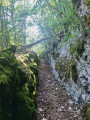
(3) After the second hairpin bend and before the third, in the slight right-hand bend, take a well-marked path on the left which descends into the woods. (Please note: this path can be slippery when wet). Continue along this path through the woods until you reach the village.

(4) Near the village, turn left onto a path that winds its way under a beautiful avenue of conifers and leads to the City-Stade (S/E).

Waypoints

  1. S/E : mi 0 - alt. 1,624 ft - City-Stade
  2. 1 : mi 0.29 - alt. 1,768 ft - Signpost for the hamlet of Bocconod
  3. 2 : mi 0.58 - alt. 2,067 ft - Chemin du Réservoir
  4. 3 : mi 1.04 - alt. 2,260 ft - Path through the woods. Passage close to the - Dorches (rivière) - Affluent du Rhône
  5. 4 : mi 1.91 - alt. 1,611 ft - Village of Chanay
  6. S/E : mi 2.19 - alt. 1,624 ft - City-Stade

Notes

The City-Stade car park has a motorhome service area.
A welcome sign on site indicates the walk and its starting point.

Worth a visit

The village of Chanay has a grocery shop.
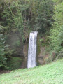
Also worth a visit, 3 km away in Surjoux, is the Pain de Sucre Waterfall.
Further information is available from the Terre Valserine Tourist Office.

Reviews and comments

5 / 5
Based on 1 review

Reliability of the description
5 / 5
Ease of following the route
5 / 5
Route interest
5 / 5
jacpat
jacpat

Overall rating : 5 / 5

Date of your route : Jan 24, 2021
Reliability of the description : ★★★★★ Very good
Ease of following the route : ★★★★★ Very good
Route interest : ★★★★★ Very good
Very busy route : Yes

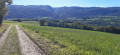
A walk through the woodland with a magnificent view of the mountains and Mont Blanc.

Machine-translated

Other walks in the area

For more walks, use our search engine .

The GPS track and description are the property of this route's author. Please do not copy them without permission.