Country:

 City:
City:


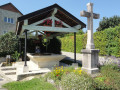
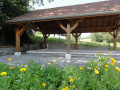
Start from the car park in the centre of the village of Bassy.
(S/E) Follow the Route du Château, passing the restaurant “La Grange”, and turn right onto the Chemin de Lévaud (the first road branching off to the right). “Note: after about 200 m, there is a drinking trough in a field to the left of the road.” Continue along the Chemin de Lévaud, even beyond the tarmac section.
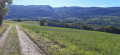
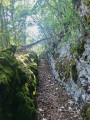
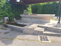
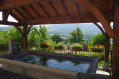
(1) After passing the wash house on the Chemin de Lévaud – the first wash house on our route – continue along the dirt track that leads into the forest. About 400 m after the wash house, do not head down towards the Rhône but take the fork to the right. After a somewhat steep climb, there is a magnificent view of the Rhône and the Corbonod vineyards. Continue along the main path, which climbs north-north-east. Ignore all the turnings on the left and pass at the foot of the Crêt hill. Carry on towards the D14, cross it with care (it’s a busy road) and continue opposite along the Route des Folies, then turn left onto the Route de Chez les Métral.
(2) This is where the Chez les Métral wash house is located, the second stop on the walk. Carry on straight ahead, taking care to admire the magnificent dry-stone wall running alongside the road on your left, and at the junction turn right onto the Route du Pèse-Lait.
(3) The Pèse-Lait washhouse is on the left just after the crossroads. Continue down the route towards Veytrens, taking care to note, some 100 metres after the washhouse, on the left, a small spring emerging from the ground. At the crossroads with the Route de Veytrens-d’en-Bas, turn right.
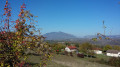
(4) In front of one of the first houses on the left, note the presence of a drinking trough bearing the date 1858. Continue along the Route de Veytrens-d’en-Bas, admiring the landscape and the views of the Colombier Massif (on the right) and the Mont des Princes (on the left). Cross the D14 again, taking the utmost care, and carry on straight ahead to the junction with the Route de Crie.
(5) At the junction, note the new drinking trough on the right, at the foot of the water reservoir. Continue to the left towards the village, pass the school and carry on straight ahead along the Route de la Sainte, which then curves slightly to the right and continues as the Chemin du Curtil du Bois (with a sign for ‘Ferme du Vieux Lavoir’). At the junction with the Chemin de Charmy, keep right. After passing the house on the left, a few dozen metres further on, a small path branches off to the right, towards the statue of the Virgin of Charmy. Continue along the Chemin du Curtil du Bois, enjoying the views of the village, then, at the Ferme du Vieux Lavoir, head down to the left onto the Chemin du Vieux Lavoir.
(6) From the Vieux Lavoir, turn back and rejoin the Chemin du Curtil du Bois. Head left and you’ll reach the junction with the Route des Ires. Turn left to reach the junction with the Route du Fond du village, where the washhouse of the same name is situated.
(7) Turn right onto the Route du Fond du village, the final section of which is somewhat steep. At the junction with the Route des Ires, turn left and head uphill towards the war memorial. On your right: the landscaped ‘dry river’ feature, which also includes a drinking trough. On your left: a magnificent view of Seyssel, its dam, the Colombier massif, the Chautagne and the Savoyard mountain ranges.
(8) Head off to the right (Route du Château) to return to the car park where you started (S/E).

 Tourist office

 Visorando Member
 Moderate