Seebergsee

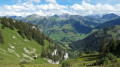
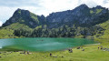
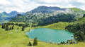
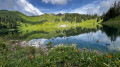
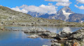
A typical Bernese Oberland alpine hike featuring one of the region’s most beautiful lakes, starting from the valley and following a small stream and, in places, the road. You climb up through the mountain pastures to reach the Seebergsee; take a short detour to gain some height and enjoy a better view of the lake before heading back down and taking a dip in summer. Then descend via a different path which offers a better panorama but is more challenging towards the end.

Details

3678059
Creation:
Last update:
Last review:
  • Walking
    Activity: Walking
  • ↔
    Distance: 13.63 mi
  • ◔
    Duration according to the author: 7 hrs 
  • ▲
    Difficulty: Very difficult

  • ⚐
    Back to start: Yes
  • ↗
    Ascent: + 3,839 ft
  • ↘
    Descent: - 3,809 ft

  • ▲
    Highest point: 6,309 ft
  • ▼
    Lowest point: 3,553 ft

Photos

Description of the walk

Park at the Anger car park in Tiermatten.

(S/E) Take the tarmac path towards Seebergsee, following the Yellow Diamond markings.

(1) Leave the road and turn left to stay on the hiking trail.

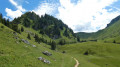
(2) Ignore the path on the right, then join a lovely little mountain road and follow it for several kilometres.

(3) Continue to the right on the hiking trail, which often follows the road but sometimes veers away from it to a greater or lesser extent. After a long stretch, you’ll reach the Seeberg crossroads.

(4) Turn right to quickly reach Seebergsee.

(5) Walk along the left-hand side of the lake, continuing on to reach a Fork in the road at Stiereberg.

(6) Turn right, keeping to the right at all junctions to return to the lake junction.

(5) Follow the route you took on the way there to the right to return to the Seeberg junction you passed on the way there.

(4) Turn right to follow theGR® path, marked in red and white and named Vordermenige. Reach the Vordermenige farm.

:7:: Ignore the path leading down to the right, then take the path on the left. Continue along the path linking the farm to the valley, though it descends quite steeply and can be slippery in places. Pass close to the Sennhutte farm, then the path continues towards Schwand. You’ll reach the crossroads you passed on the way out.

(3) Turn right and follow the path taken on the way there to the Anger car park (S/E).

Waypoints

  1. S/E : mi 0 - alt. 3,553 ft - Anger car park
  2. 1 : mi 0.38 - alt. 3,802 ft - Trail junction
  3. 2 : mi 0.74 - alt. 3,878 ft - Crossroads
  4. 3 : mi 1.37 - alt. 4,154 ft - Junction of the circular loop
  5. 4 : mi 5.08 - alt. 5,906 ft - Seeberg
  6. 5 : mi 5.27 - alt. 6,017 ft - Seebergsee
  7. 6 : mi 6.25 - alt. 6,138 ft - Stiereberg crossroads
  8. 7 : mi 9.93 - alt. 6,053 ft - Vordermenige Farm
  9. S/E : mi 13.63 - alt. 3,553 ft - Anger car park

Notes

As we’re in Switzerland, everything is well signposted, with signs at every junction. However, as I’m hiking using the app, I don’t always pay attention to all the information on the signs, so I apologise for any resulting inaccuracies and recommend the app, which is really handy.
This walk doesn’t include any exposed or dangerous sections, but you’ll come across plenty of herds in summer, so don’t forget to close the gates to the pastures.
Take care, as most of the route is exposed to the sun. Do not attempt this if the weather is uncertain, as you’re in the mountains.
Note: the Suisse Mobile app, which automatically tracks the trails, shows an extra 0.5 km and 130 m of elevation gain compared to Visorando, as well as a walking time of 7 hours 30 minutes excluding breaks; please bear this in mind.
Hiking boots and walking poles are essential; there are several restaurants, farm-to-table eateries and water points along the route.

Worth a visit

At the end of the car park – which is free, a rarity in Switzerland – there’s a shop selling local produce. In fact, as is often the case in Switzerland, it’s a self-service fridge stocked with cheese, jams, syrups and drinks, and you simply put the money in a cash box right next to it.
There are plenty of other walks to choose from in the area, such as the Wiriehore circuit or the Stockhorn.

Always be cautious and plan ahead when you're outdoors. Visorando and the author of this route cannot be held responsible for any accidents occurring on this route.

The GR® and PR® markings are the intellectual property of the Fédération Française de Randonnée Pédestre.

Reviews and comments

4.3 / 5
Based on 2 reviews

Reliability of the description
4.5 / 5
Ease of following the route
4.5 / 5
Route interest
4 / 5
David025
David025

Overall rating : 5 / 5

Date of your route : Jul 20, 2024
Reliability of the description : ★★★★★ Very good
Ease of following the route : ★★★★★ Very good
Route interest : ★★★★★ Very good
Very busy route : Yes

We shortened the walk by parking at point 3, leaving around 20km and 1000m of ascent, so the route becomes more accessible and only "difficult" instead of "very difficult"!
At the start, we follow the road that leads to the car park near the lake, and a lot of cars pass by. The area around the lake is very busy, but there are far fewer people on the rest of the route, and the scenery is beautiful all the way!

Machine-translated

Brunsperger
Brunsperger

Blimey! Yes, there's been a mistake!
It was the Circuit de Neuenweg at Belchen in the Black Forest !!!
Sorry again

Machine-translated

David025
David025

Brunsperger, are you sure you're talking about the Seebergsee hike?
There's no summit or cable car, but a car park near the lake is accessible by car. The point of this hike, however, is to enjoy the different landscapes typical of this region, and yes, you do have to walk part of the way along a small road to do this...

Machine-translated

Brunsperger
Brunsperger

Overall rating : 3.7 / 5

Date of your route : Jul 29, 2024
Reliability of the description : ★★★★☆ Good
Ease of following the route : ★★★★☆ Good
Route interest : ★★★☆☆ Average
Very busy route : Yes

Unfortunately, this hike takes in a lot of forest tracks, some of them tarmac, and this makes up a large part of the route.
The summit is very popular, as it is accessible by cable car.

Machine-translated

Other walks in the area

For more walks, use our search engine .

The GPS track and description are the property of this route's author. Please do not copy them without permission.