


Seacroft 1
Details
Creation:
Last update:
–
–
-
 Activity: Walking
 -
 Distance: 5.48 mi
 -
 Average duration: 2h 50
 -
 Difficulty: Not specified
 -
-
 Back to start: Yes
 -
 Ascent: + 390 ft
 -
 Descent: - 397 ft
 -
-
 Highest point: 361 ft
 -
 Lowest point: 23 ft
-
 Country:
United Kingdom
Country:
United Kingdom
-
 City:
St. Bees
City:
St. Bees -
 Start/End: N 54.489903° / W 3.603385°
 -


 Hour-by-hour weather


Waypoints
- S/E : mi 0 - alt. 43 ft
- 1 : mi 0.02 - alt. 39 ft - Walk north towards Beach Rd
- 2 : mi 0.07 - alt. 36 ft - Turn right onto Beach Rd
- 3 : mi 0.31 - alt. 39 ft - Turn right onto Station Rd
- 4 : mi 0.63 - alt. 26 ft - Turn right onto Main St/B5345
- 5 : mi 0.9 - alt. 92 ft - Turn left onto Outrigg
- 6 : mi 1.92 - alt. 295 ft - Turn right
- 7 : mi 1.92 - alt. 295 ft - Walk north
- 8 : mi 1.93 - alt. 295 ft - Turn right
- 9 : mi 2.32 - alt. 338 ft - Walk south-west towards B5345
- 10 : mi 2.95 - alt. 187 ft - Walk south towards B5345
- 11 : mi 2.97 - alt. 180 ft - Sharp right onto B5345
- 12 : mi 4.57 - alt. 92 ft - Walk north on Main St/B5345 towards Outrigg
- 13 : mi 4.85 - alt. 30 ft - Walk north-west on Main St/B5345 towards Station Rd
- 14 : mi 4.87 - alt. 26 ft - Turn left onto Station Rd
- 15 : mi 5.19 - alt. 39 ft - Station Rd turns slightly left and becomes Beach Rd
- 16 : mi 5.43 - alt. 36 ft - Turn left
- S/E : mi 5.48 - alt. 39 ft
Other walks in the area
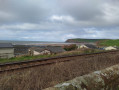
St Bees Village And Beach
 Visorando Member
 3.01 mi
+95 ft
-95 ft
1h 30
3.01 mi
+95 ft
-95 ft
1h 30
 Easy
Easy
 Departure from St. Bees (Cumberland)
Lovely dog friendly walk to discover St Bees beach, the England Coast path and St bees village.
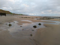
Along St Bees beach
 1.82 mi
+39 ft
-33 ft
0h 50
Easy
Departure from St. Bees (Cumberland)
1.82 mi
+39 ft
-33 ft
0h 50
Easy
Departure from St. Bees (Cumberland)
St bees beach is one of the most beautiful beach in West Cumbria. The beach is dog-friendly all year round. Great view on Black Combe mountain.
⚠️This walk can only be done at low tide.
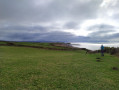
St bees to Coulderton
 4.17 mi
+243 ft
-217 ft
2h 10
Easy
Departure from St. Bees (Cumberland)
4.17 mi
+243 ft
-217 ft
2h 10
Easy
Departure from St. Bees (Cumberland)
Dog-friendly circular walk from St Bees to Coulderton along the England Coast Path. Great view on the Isle of Man and also the west summits of the Lake District.
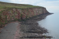
St Bees Head - Fleswick bay, St Bees lighthouse and Birkham's Quarry
 5.16 mi
+755 ft
-755 ft
3h 00
5.16 mi
+755 ft
-755 ft
3h 00
 Moderate
Departure from Whitehaven (Cumberland)
Moderate
Departure from Whitehaven (Cumberland)
Dog-friendly circular walk starting from Sandwith village and passing by Fleswick Bay, St Bees Lighthouse and Birkham's Quarry.
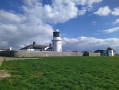
St Bees Head - St Bees lighthouse and Birkham's Quarry
 3.72 mi
+643 ft
-630 ft
2h 15
Easy
Departure from Whitehaven (Cumberland)
3.72 mi
+643 ft
-630 ft
2h 15
Easy
Departure from Whitehaven (Cumberland)
Dog-friendly circular walk starting from Sandwith village and passing by Birkham's Quarry and St Bees Lighthouse.
Dent by Nannycatch
8.19 mi
+1,352 ft
-1,345 ft
4h 55
Moderate
Departure from Egremont (Cumberland)
Circular walk to Dent summit by Nannycath and starting from Longlands Lake. Dog friendly
Whitehaven to St Bees
 6.81 mi
+1,207 ft
-1,217 ft
4h 10
Moderate
Departure from Whitehaven (Cumberland)
6.81 mi
+1,207 ft
-1,217 ft
4h 10
Moderate
Departure from Whitehaven (Cumberland)
Linear walk from Whitehaven to St Bees following the England Coast Path. Great views of the South of Scotland and the Isle of Man.
Uldale Plantation and Nannycatch gate
 2.57 mi
+476 ft
-486 ft
1h 35
Moderate
Departure from Cleator Moor (Cumberland)
2.57 mi
+476 ft
-486 ft
1h 35
Moderate
Departure from Cleator Moor (Cumberland)
A lovely moderate walk passing by the bottom of Udale plantation, nannycatch gate and the side of Flat Fell summit.
The descend from Udale Plantation to nannycatch path is steep and can be difficult for some walkers.
For more walks, use our search engine .
The GPS track and description are the property of this route's author. Please do not copy them without permission.

