Country:

 City:
City:


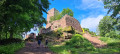
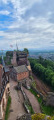
The entire route follows the Red Rectangle, unless otherwise stated.
The walk begins in front of Saverne Town Hall, on Place du Général-de-Gaulle.
(S) From the town hall, turn left towards the Marne–Rhine Canal, then follow it to the left along Quai de l’École. You will then reach the steps.
(1) Go up the steps, first turn right then left and join Rue Dell, then turn left again, then right, onto Rue des Dragons until you reach Rue Leclerc.
(2) Turn right onto the street and follow it until you reach Rue du Parc Celtique on the left.
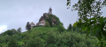
(3) Take the street on the right to begin the climb up to Haut-Barr; the path runs through the forest until you reach a Fork in the road. Before the Route du Haut-Barr, take the path on the left which runs alongside it, then keep to the right at the next three-way junction and stay south of the road, heading towards Haut-Barr. Take the path on the left which climbs up to Haut-Barr.
(4) Continue along the path, at the end of the Haut-Barr car park, towards the Grand Geroldseck. Carry on along the road, then turn left off it until you reach a Fork in the road. Leave the GR®53 to reach the Grand Geroldseck by following the Red Saltire signposting straight ahead.
(5) Continue along the path and, keeping to the left, rejoin the GR®53 on the right, then leave it again straight ahead for the Petit Geroldseck, following the Red Saltire signposts.
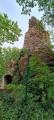
(6) It is a complete ruin emerging from a dense wood. Carry on to rejoin the GR®53. Keep going straight ahead until you reach a road.
(7) You’ll come out onto the forest road from Saverne to Billebaum and rejoin the GR®53. Take another forest road straight ahead, leave it on the left and follow the path on the right which climbs towards the Tour du Brotsch.
(8) After the shelter, follow the path that heads off to the left towards the Schaeferplatz forest house. Reach the Grotte du Brotsch.
(9) Turn left, then follow the path to the right, then quickly turn left onto the track leading downwards before turning right onto the path that runs alongside the Markwald forest road towards Schaeferplatz.
(10) Carry on straight ahead along the road, leave it to the right, then keep to the left, staying higher up alongside the road. Cross a track, then follow the road, still keeping higher up, to the Billebaum crossroads.
(11) Carry on straight ahead along a path that runs alongside the road on the left towards the Haberacker forest lodge. Ignore the road leading there and take the one on the left. Round the bend and turn left onto the path leading up to the Geissfelswasen gazebo. Carry on straight ahead, then skirt a track before following it straight ahead to reach the Geissfelswasen gazebo.
(12) Head up to the right and carry on straight ahead, first uphill, then on level ground, towards La Hardt.
(13) At the T-junction, carry on straight ahead towards La Hoube. Always make sure to head down towards the stream, then cross it on the right and climb up towards La Hoube.
(14) Once you reach Rue Bellevue, head down to the right and turn left at Les Aliziers. Continue towards Dabo, cutting across a road. Once past La Hoube, stay on the path that descends towards the valley, cross the Barbelsahntal and then the Dabo stream. After crossing it, take the path that climbs up the opposite bank towards Dabo. Climb straight ahead until you reach the road. Follow it, keeping to the left, until you reach the departmental road (beautiful view of the rock).
(15) Take a small road between the campsite and the stadium, then follow a track to the right and take the path to the left. You’ll rejoin the road further on.
(16) Head left towards the Col de la Schleif. At the junction of the forest tracks, carry on to the right along the path that climbs towards the Col de la Schleif. Keep heading straight ahead, climbing towards the Rutschfelsen.
(17) When you reach the Rutschfelsen and return to the road, don’t be misled: this is indeed the road you need to take. It climbs up to the Col de la Schleif. Almost at the pass, continue to the left towards it.
(18) The Col de la Schleif marks the start of the descent towards Engenthal-le-Bas and Wangenbourg. Continue straight ahead, heading downhill towards the forest lodge. When you reach a small stream, leave the forest track and turn left onto the path that descends into the valley towards the Helschberg forest lodge.
(19) Cross the D224 with care, pass to the left of a house, cross the Mossig and head towards Wangenbourg straight ahead, skirting Engenthal-le-Bas. Take two first turns left then right until you reach the road. Turn right, then right again at the end of the road to reach the Impasse de l’Escalier.
(20) Head down to the left to reach the D218, then turn right to reach the church or left to reach the town hall (E).
 Visorando Member
 Moderate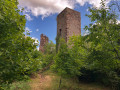
 Difficult