From Saverne to the Cave of the 10th BCP

The10th Battalion of Foot Chasseurs, the Saverne Battalion, was garrisoned at the Château des Rohan between the two world wars, from 1922 to 1939. This short walk follows a historic route taken by the soldiers of that era. At the cave itself, a rustic feature has been created by the Amicale des Diables Bleus de Saverne. Please respect it!

Details

28848009
Creation:
Last update:
Last review:
  • Walking
    Activity: Walking
  • ↔
    Distance: 3.86 mi
  • ◔
    Average duration: 2h 20 
  • ▲
    Difficulty: Moderate

  • ⚐
    Back to start: Yes
  • ↗
    Ascent: + 686 ft
  • ↘
    Descent: - 705 ft

  • ▲
    Highest point: 1,260 ft
  • ▼
    Lowest point: 607 ft
  • ⚐ Country: France
  • ⚐
  • ⚐ City: Saverne (67700)
  • ⚑
    Start/End: N 48.741829° / E 7.362897°
  • Accessible from the train station Gare de Saverne.
  • ❏
    IGN map(s): Ref. 3715OT
  • Hour-by-hour weather

Photos

Description of the walk

The walk starts in front of the Château des Rohan. There is a large, free car park at the rear of the château, which is easily accessible and signposted. Saverne railway station is very close by, barely a 5-minute walk away.

(S/E) Cross the Place du Château and turn right onto Grand Rue. Cross the Marne–Rhine Canal. Walk down Grand Rue, then cross the River Zorn, following Rue du Vieil Hôpital for a short while. Take a path on the left that takes you under the railway lines and up Rue de la Côte. Walk alongside the N4 road for just under 100 metres.

(1) Cross it and take Rue Edmont About, following it for about 500 m. On the right, note the last buildings of the Saverne hospital complex, and on the left, the historic site of the KUHN agricultural machinery factories. Turn left onto Chemin du Koepfel, following the Yellow Cross markings. Walk past the last houses in the valley.

(2) Take the path on the left which climbs into the forest. The winding ascent crosses a logging track; take this to the right for 150 m, then turn left again, following the Yellow Ring markings, towards the Koepfel gazebo. The climb is almost over. Continue following the Yellow Disc markings for 300 m, until you reach a crossroads of tracks.

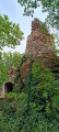
(3) Turn left and follow the distinctive ‘Daffodil Blue’ markings so dear to hunters, whether on foot or mountaineers. Thanks to the Saverne Club Vosgien for this thoughtful touch! You’ll arrive at the10th BCP Cave.

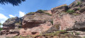
(4) It’s more of a rocky overhang than a cave in the strict sense of the word. Head back down towards Saverne along the path marked with a Yellow Disc. This path descends steeply. It can be tricky in autumn, in wet weather, when the leaves pile up. A pair of walking poles may come in handy. Further on, take care not to miss the fork in the path.

(5) Follow the path, which is still marked with a Yellow Disc. Pass through the fitness trail, then a playground next to the pumping station.

(6) Walk alongside the railway line, go through the tunnel and cross the River Zorn. When you reach Route de Lutzelbourg, turn left for 200 m, then cross the road and go up a flight of steps.

(7) Turn left and walk alongside the Marne–Rhine Canal to reach the centre of Saverne, at the main lock and a few metres from the Place du Château (S/E).

Waypoints

  1. S/E : mi 0 - alt. 640 ft - Château des Rohan (Saverne)
  2. 1 : mi 0.47 - alt. 646 ft - Cross the D1004 at the Rue About junction
  3. 2 : mi 1.03 - alt. 689 ft - Climb up to the - Kaestenberg
  4. 3 : mi 1.84 - alt. 1,260 ft - T-junction
  5. 4 : mi 1.94 - alt. 1,237 ft - Cave of the 10th BCP
  6. 5 : mi 2.41 - alt. 1,037 ft - T-junction
  7. 6 : mi 3.05 - alt. 614 ft - Railway line - Zorn (rivière)
  8. 7 : mi 3.43 - alt. 630 ft - Canal de la Marne au Rhin
  9. S/E : mi 3.86 - alt. 640 ft - Château des Rohan (Saverne)

Worth a visit

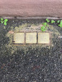
  1. As you walk up Rue de la Côte, on the pavement, be sure to note the Stolpersteine laid in memory of the Jewish families arrested, deported and exterminated by Nazi Germany during theSecond World War: opposite No. 17, Rue de la Côte – Anselme Bloch; and 9 Rue de la Côte – the Meyer-Kahn family.
  2. The10th Battalion of Chasseurs à Pied was garrisoned at the Château des Rohan between the two world wars, from 1922 to 1939. The units (sections, companies, etc.) of chasseurs would march on foot to their firing ranges in the Moselle. On the way, they would stop to take shelter in this cave. This spot, still known to the older generation, has been catalogued and signposted by the Club Vosgien.
  3. Do not hesitate to visit Saverne and its castle.

Reviews and comments

3.4 / 5
Based on 5 reviews

Reliability of the description
3.2 / 5
Ease of following the route
3.2 / 5
Route interest
3.8 / 5
RosineR
RosineR
• Edited:

Overall rating : 3 / 5

Date of your route : Oct 25, 2025
Reliability of the description : ★★★☆☆ Average
Ease of following the route : ★★★☆☆ Average
Route interest : ★★★☆☆ Average
Very busy route : No

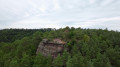
A pleasant forest trail with a rare viewpoint at the gazebo. Few markings, especially on the uphill sections. The app is very useful. Otherwise, no difficulty. This trail is suitable for families.

Machine-translated

PAT133
PAT133

Overall rating : 3.3 / 5

Date of your route : Jan 27, 2025
Reliability of the description : ★★★☆☆ Average
Ease of following the route : ★★★☆☆ Average
Route interest : ★★★★☆ Good
Very busy route : Yes

A nice route.
Moderately well signposted, with a few inaccuracies in the route description

Machine-translated

SFrando
SFrando

Overall rating : 4.3 / 5

Date of your route : Aug 12, 2024
Reliability of the description : ★★★★☆ Good
Ease of following the route : ★★★★★ Very good
Route interest : ★★★★☆ Good
Very busy route : No

A lovely walk through the woods

Machine-translated

catsweet
catsweet

Overall rating : 3.3 / 5

Date of your route : Dec 17, 2023
Reliability of the description : ★★★☆☆ Average
Ease of following the route : ★★★☆☆ Average
Route interest : ★★★★☆ Good
Very busy route : No

The term ‘daffodil blue’ refers to a combination of blue and yellow: it would have been clearer to put it that way when talking about the Alpine Hunters’ logo.
The signposting isn’t very good, so the smartphone app is essential here to avoid getting lost;
The descent isn’t difficult at all.
A lovely walk, mainly through the woods (not much of the town, actually); the cave was a bit of a let-down, but the rest was very nice; we didn’t come across anyone (December).

Machine-translated

Saverti
Saverti
• Edited:

Overall rating : 3 / 5

Date of your route : Sep 26, 2023
Reliability of the description : ★★★☆☆ Average
Ease of following the route : ★★☆☆☆ Disappointing
Route interest : ★★★★☆ Good
Very busy route : No

The first part of the route is well described, up to point 2; after that, without a map or any knowledge of the area, it becomes much trickier – there isn’t enough description, and the blue and yellow markings are only visible on the section heading downhill towards Saverne.

Machine-translated

Other walks in the area

For more walks, use our search engine .

The GPS track and description are the property of this route's author. Please do not copy them without permission.