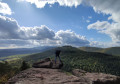
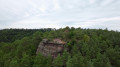
Circular walk around Saverne

A 14 km circular loop with the following highlights:
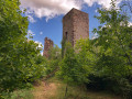
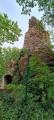
- Greifenstein Castle,
- the Mélanie Fountain,
- the Source des Bavarois,
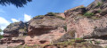
- the Saint-Vit Cave.

Details

40227387
Creation:
Last update:
Last review:
  • Walking
    Activity: Walking
  • ↔
    Distance: 9.26 mi
  • ◔
    Average duration: 5h 30 
  • ▲
    Difficulty: Moderate

  • ⚐
    Back to start: Yes
  • ↗
    Ascent: + 1,437 ft
  • ↘
    Descent: - 1,417 ft

  • ▲
    Highest point: 1,476 ft
  • ▼
    Lowest point: 604 ft
  • ⚐ Country: France
  • ⚐
  • ⚐ City: Saverne (67700)
  • ⚑
    Start/End: N 48.743454° / E 7.366564°
  • Accessible from the train station Gare de Saverne.
  • ❏
    IGN map(s): Ref. 3715OT
  • Hour-by-hour weather

Description of the walk

Park in the Champ de Foire car park in Saverne, Rue de l’Orangerie.

(S/E) Turn right, then walk alongside the SNCF station until you reach the main road at the very end – this is the Route de Paris.

(1) Cross it carefully, then turn right onto it to reach the junction with Rue Edmond About.

(2) Turn left onto it, follow it, then continue along the Promenade de la Schlitte. You’ll reach a three-way junction opposite a crucifix.

(3) Leave the return path on your left, turn right onto Chemin du Koepeel, walk along the banks of the Schlettenbach stream and cross it to reach the Edmond About memorial.

(4) Continue to the right along the path marked with a Red Rectangle – this is theGR®53. You’ll soon reach the Saut du Prince Charles.

(5) Continue uphill on theGR® until you reach a junction of several paths and a track at the top of the hill.

(6) Keep theGR® straight ahead, head downhill and reach the junction at the Fossé des Pandours.

(7) Leave theGR® here and turn left onto the path marked with a Yellow Triangle. Cross the Route Forestière des Pandours. Continue down the slope alongside the Ruisseau de la Fontaine to reach the Fontaine Mélanie.

(8) Turn right, then turn left at the next junction onto the path marked with a Yellow Saltire to reach the Source des Bavarois.

(9) Continue following the shared Yellow Triangle and Yellow Saltire markings until you reach the junction near the Schweizerhof Forest House.

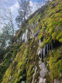
(10) Turn left onto the tarmac path for a few metres, then take the forest track signposted with a Red Ring and continue down an easy descent to reach the Grotte Saint-Vit.

(11) Join theGR®531(marked with a Red Ring) opposite and head for Greifenstein Castle.

(12) As you leave the castle, take the path to the left and walk downhill to the Étang du Ramsthal, crossing several roads.

(13) Continue along the path marked with a Green Disc until you reach the three-way junction you passed on the way there.

(3) Turn right and retrace your steps along the route you took on the way there to return to the Champ de Foire car park in Saverne (S/E).
Waypoints

  1. S/E : mi 0 - alt. 604 ft - Saverne Fairground car park.
  2. 1 : mi 0.53 - alt. 630 ft - Route de Paris
  3. 2 : mi 0.67 - alt. 646 ft - Rue Edmond About
  4. 3 : mi 1.05 - alt. 640 ft - Junction on the circular loop
  5. 4 : mi 1.44 - alt. 748 ft - Edmond About memorial stone
  6. 5 : mi 1.84 - alt. 1,030 ft - Prince Charles’s Leap
  7. 6 : mi 2.23 - alt. 1,250 ft - Top of the hill
  8. 7 : mi 2.68 - alt. 1,329 ft - Fossé des Pandours junction
  9. 8 : mi 3.78 - alt. 797 ft - Fontaine Mélanie
  10. 9 : mi 4.35 - alt. 1,230 ft - Source des Bavarois
  11. 10 : mi 4.93 - alt. 1,453 ft - Crossroads near the - Maison forestière du Schweizerhof
  12. 11 : mi 5.83 - alt. 1,293 ft - Grotte Saint-Vit
  13. 12 : mi 6.69 - alt. 1,165 ft - Château de Greifenstein
  14. 13 : mi 7.7 - alt. 659 ft - Ramsthal Pond
  15. S/E : mi 9.26 - alt. 607 ft - Saverne Fairground car park.

Notes

Worth a visit

(4) Edmont About memorial
(11) Saint-Vit Cave.
(12) Visit the ruins of Greifenstein with caution. Risk of collapse in some fenced-off sections.
(13) Ramsthal Pond.

Always be cautious and plan ahead when you're outdoors. Visorando and the author of this route cannot be held responsible for any accidents occurring on this route.

The GR® and PR® markings are the intellectual property of the Fédération Française de Randonnée Pédestre.

Reviews and comments

4 / 5
Based on 3 reviews

Reliability of the description
4.3 / 5
Ease of following the route
4 / 5
Route interest
3.7 / 5
youl
youl

Overall rating : 4.7 / 5

Date of your route : Mar 23, 2026
Reliability of the description : ★★★★★ Very good
Ease of following the route : ★★★★★ Very good
Route interest : ★★★★☆ Good
Very busy route : No

Detailed description. You can avoid starting and finishing in town by parking behind the hospital.
A lovely walk without any great difficulty.

Machine-translated

thom67500
thom67500

Overall rating : 3.3 / 5

Date of your route : Oct 12, 2024
Reliability of the description : ★★★☆☆ Average
Ease of following the route : ★★★☆☆ Average
Route interest : ★★★★☆ Good
Very busy route : No

A lovely walk, though it was let down a bit by some inaccuracies in the route description at times. Fortunately, the GPX track comes in handy at times like that.

Machine-translated

Jean-Georges COTTIN
Jean-Georges COTTIN

Overall rating : 4 / 5

Date of your route : Oct 08, 2023
Reliability of the description : ★★★★★ Very good
Ease of following the route : ★★★★☆ Good
Route interest : ★★★☆☆ Average
Very busy route : No

The GPX track is a great help in certain places

Machine-translated

Other walks in the area

For more walks, use our search engine .

The GPS track and description are the property of this route's author. Please do not copy them without permission.