From Trassanel to the Roc de l’Aigle

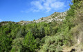
On a clear day, the scenery is magnificent. Although the climb may be tough for some, the reward is at the summit.

Details

1785196
Creation:
Last update:
Last review:
  • Walking
    Activity: Walking
  • ↔
    Distance: 5.61 mi
  • ◔
    Average duration: 3h 25 
  • ▲
    Difficulty: Moderate

  • ⚐
    Back to start: Yes
  • ↗
    Ascent: + 997 ft
  • ↘
    Descent: - 1,004 ft

  • ▲
    Highest point: 2,339 ft
  • ▼
    Lowest point: 1,437 ft

Description of the walk

Coming from Villeneuve-Minervois, park in the large car park on the left before the entrance to the village.

(S/E) Leave the car park and head towards the village.

(1) At the first houses, turn right onto the uphill road. At the first Fork in the road, continue left and at the next junction, turn right. The road climbs continuously for approximately 2.2 km. After the second right-hand bend, you’ll reach a more open area and, in a left-hand bend, you’ll find the start of a path on the right.

(2) Leave the road and take the stony path opposite (you can avoid this by following the road as indicated for the return journey).

(3) Join the forest track on the right. Pass a turn-off on the right and continue to the next junction.

(4) Follow the track to the right. Reach a clearing and leave the forest track to the left to enjoy the view from the clearing.

(5) Continue back along the track to reach the summit of the Roc de l’Aigle.

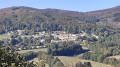
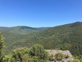
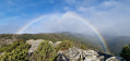
(6) Enjoy the view over Cabrespine, the Pic de Nore, Villeneuve-Minervois, the Monts de l’Alaric and, if the weather is clear, the Pyrenees and the Canigou.
To return, turn round and follow the path back in the opposite direction until you reach the junction with the stony path.

(3) Carry on straight ahead to avoid the descent via the stony path and reach the next junction.

(7) Do not go straight ahead, but head down to the left along the lovely tarmac road. Join the route you took on the way out.

(2) Continue down the same route and return to the car park after Trassanel (S/E).

Waypoints

  1. S/E : mi 0 - alt. 1,447 ft - Car park at the entrance to Trassanel
  2. 1 : mi 0.14 - alt. 1,440 ft - Turn right at the first houses
  3. 2 : mi 1.54 - alt. 2,159 ft - Left-hand bend, stony path on the right
  4. 3 : mi 1.65 - alt. 2,238 ft - Path, on the right
  5. 4 : mi 1.93 - alt. 2,336 ft - Turn right towards the lay-by
  6. 5 : mi 2.29 - alt. 2,326 ft - Clay soil, viewpoint
  7. 6 : mi 2.77 - alt. 2,198 ft - Roc de l'aigle (685m)
  8. 7 : mi 3.92 - alt. 2,208 ft - Road, on the left
  9. S/E : mi 5.61 - alt. 1,447 ft - Car park

Notes

This walk is best undertaken in fine weather and when it is not too windy.

Worth a visit

The memorial dedicated to the resistance fighters killed in the Trassanel maquis.

Reviews and comments

3.8 / 5
Based on 4 reviews

Reliability of the description
3.8 / 5
Ease of following the route
3.8 / 5
Route interest
3.8 / 5
Krugg31
Krugg31

Overall rating : 4.7 / 5

Date of your route : Jan 05, 2026
Reliability of the description : ★★★★★ Very good
Ease of following the route : ★★★★☆ Good
Route interest : ★★★★★ Very good
Very busy route : No

A magnificent circular in a beautiful setting. Beautiful views to the south towards the mountains (best done in good weather). There is a shorter circular that avoids the trail but remains under the Eagle Rock.

Machine-translated

thierry.rossich
thierry.rossich

There’s a lot of tarmac, but the view is lovely; don’t do this in summer when the sun is beating down, as the climb is quite tough.

Machine-translated

Albine
Albine

Overall rating : 2 / 5

Date of your route : Apr 01, 2021
Reliability of the description : ★★☆☆☆ Disappointing
Ease of following the route : ★★☆☆☆ Disappointing
Route interest : ★★☆☆☆ Disappointing
Very busy route : No

Too much walking on tarmac roads and tracks. The interesting path isn’t signposted.
Lovely views over the Carcassonne plain and the Pic de Nore (and the wind turbines that spoil part of the landscape).

Machine-translated

pouchke
pouchke

Overall rating : 3.7 / 5

Date of your route : Sep 28, 2020
Reliability of the description : ★★★☆☆ Average
Ease of following the route : ★★★★☆ Good
Route interest : ★★★★☆ Good
Very busy route : No

The description isn’t very clear; when you’re almost at the top, you’re not sure whether to turn right or left, and the same goes for the rest of the way. A really lovely view. A walk best avoided on hot days, when it’s in full sun.

Machine-translated

jawk
jawk

Overall rating : 4.7 / 5

Date of your route : May 20, 2019
Reliability of the description : ★★★★★ Very good
Ease of following the route : ★★★★★ Very good
Route interest : ★★★★☆ Good

It is possible to complete the full circuit; after the rock, the path leads downhill, after which you can choose to head either along the Laure ravine or towards the Cabrespine chasm. Just to clarify, cars used for the hike must be parked in the car park at Trassanel.

Machine-translated

Other walks in the area

For more walks, use our search engine .

The GPS track and description are the property of this route's author. Please do not copy them without permission.