The ‘Route des Hauteurs’ in Saint-Viaud

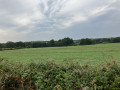
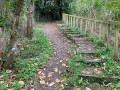
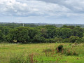
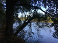
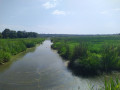
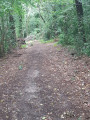
This walk starts at a leisure centre, heads to a memorial commemorating an event from the Second World War, and returns to the starting point. Both on the way there and back, the route follows a succession of wide, shaded paths and stretches of road. Passing through beautiful countryside shaped by large farms and passing through hamlets dotted with lovely houses offers ever-changing, stunning views.

Details

39438822
Creation:
Last update:
Last review:
  • Walking
    Activity: Walking
  • ↔
    Distance: 7.94 mi
  • ◔
    Average duration: 3h 45 
  • ▲
    Difficulty: Moderate

  • ⚐
    Back to start: Yes
  • ↗
    Ascent: + 141 ft
  • ↘
    Descent: - 131 ft

  • ▲
    Highest point: 128 ft
  • ▼
    Lowest point: 10 ft
  • ⚐ Country: France
  • ⚐ City: Saint-Viaud (44320)
  • ⚑
    Start/End: N 47.258581° / W 2.014239°
  • ❏
    IGN map(s): Ref. 1022ET, 1122SB, 1123OT
  • Hour-by-hour weather

Photos

Description of the walk

Car park at the Saint-Viaud Leisure Centre.

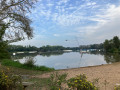
(S/E) With the sports fields on your left, at the far end of the car park you’ll find a path running alongside a road (separated by a wooden railing). Head left to reach the start of the lake. Follow the tarmac path as it veers away from the lake’s edge and ignore an entrance on the left. Follow the yellow signposts. After a few bends, you’ll reach the exit which leads onto a road.

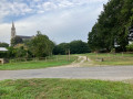
(1) Cross the road carefully, then take the path that opens up in front of you until you reach a gate, which you should go through. Turn right, near the sundial (withan information panel explaining how it works). The path climbs steeply, bends slightly and comes out onto a road, near the church on your left. Head left until you reach Rue des Fleurs on your right.

(2) Turn into this street, follow it straight on, passing the Cultural Centre on your left, then the municipal workshops on your right.

(3) Turn right immediately after the workshops. Pass the Chemin des Bouillons and leave Saint-Viaud. Continue straight ahead. The road climbs slightly and turns left towards Les Bouillons. Leave the road at the bend and take a wide path opening up on the right. The path becomes a road as you reach Le Mesnil du Nord. Carry on until you reach a path entrance on the left, signposted ‘Route des Hauteurs’.

(4) Turn onto this track, which takes two right-angled bends, the first to the right, the second to the left. Carry on, ignoring any turnings to the right or left, until you reach the D86.

(5) Cross this road carefully and carry on straight ahead. Pass Les Petits Brûlés, then Les Quatre Chemins, and you’ll come to a crossroads.

(6) Take the path on the right, which makes a sharp left turn and then crosses a railway line. Carry on until you reach a crossroads.

(7) Take the track straight ahead, which heads off to the left towards La Courandière. The track bends sharply to the right, followed by a long straight stretch. Cross a small road and ignore a track entrance on the right. The track takes a wide bend to the right and crosses a track coming from the left.

(8) Turn left onto this new track, which takes a wide bend to the right and leads you to a junction with a track coming from the left.

(9) Turn right, following the sign for ‘la Brosse’. The path will take you to the La Brosse Memorial.

(10) Once you’ve had a look at the memorial stone and the various information boards, retrace your steps to the fork in the path, where you’ll find an entrance on your right signposted ‘la Roulière’.

(9) Turn right and continue straight ahead until you come to a small road.

(11) Cross this road carefully and continue straight ahead. Pass La Roulière and you’ll soon come to a path entrance on your right.

(12) Turn right and continue until you reach a small road.

(13) Turn left and carry on until you reach a crossroads marked with a cross.

(14) Turn right, towards La Moinerie (the yellow markings end here). At a Fork in the road, take the left-hand branch and carry on until you reach the Route de Frossay.

(15) Cross carefully at the pedestrian crossing to reach Rue des Millauds, a little further on to the left.

(16) Turn left onto this street, which bends sharply to the right, and continue to a roundabout.

(17) Turn left and carry on straight ahead until you reach another roundabout on the D26.

(18) Turn right onto Route de Paimboeuf. Turn left at the first junction, then, at the crossroads, carry on straight ahead. You’ll soon find, on the left – marked by barriers and a large weeping willow – the entrance to a small path.

(19) It runs more or less parallel to the road leading to the leisure centre. This path takes you back to the car park at the Saint-Viaud leisure centre (S/E).

Waypoints

  1. S/E : mi 0 - alt. 10 ft - Car park at the Saint-Viaud leisure centre
  2. 1 : mi 0.32 - alt. 13 ft - Crossing the road
  3. 2 : mi 0.54 - alt. 69 ft - Rue des Fleurs
  4. 3 : mi 0.74 - alt. 36 ft - On the right after the municipal workshops
  5. 4 : mi 1.45 - alt. 36 ft - “Circuits des Hauteurs” junction
  6. 5 : mi 2.57 - alt. 89 ft - D86
  7. 6 : mi 2.85 - alt. 75 ft - Crossroads
  8. 7 : mi 3.65 - alt. 108 ft - Crossroads
  9. 8 : mi 4.38 - alt. 112 ft - Turn left at the fork
  10. 9 : mi 4.69 - alt. 115 ft - Turn-off towards La Brosse
  11. 10 : mi 5 - alt. 118 ft - La Brosse Memorial
  12. 11 : mi 5.72 - alt. 95 ft - Road junction
  13. 12 : mi 6.01 - alt. 79 ft - Turn right at the junction
  14. 13 : mi 6.29 - alt. 125 ft - Road junction
  15. 14 : mi 6.75 - alt. 118 ft - Crossroads (cross)
  16. 15 : mi 7.22 - alt. 43 ft - Route de Frossay
  17. 16 : mi 7.3 - alt. 36 ft - Rue des Millauds
  18. 17 : mi 7.49 - alt. 39 ft - Roundabout
  19. 18 : mi 7.76 - alt. 16 ft - D26 roundabout
  20. 19 : mi 7.88 - alt. 13 ft - Small path, on the left
  21. S/E : mi 7.94 - alt. 10 ft - Car park at the Saint-Viaud leisure centre

Notes

  • Car park at the Saint-Viaud leisure centre

Rue du Parc des Sports
44320 Saint-Viaud

Worth a visit

  • Part of the route is signposted in yellow. You will also find ‘Circuit des Hauteurs’ directional signs here and there. The signposting is clear along most of the route, except at the start leading to the point (1) and at the end from the point (14). Make sure you follow the trail carefully!
  • The Brosse memorial commemorates a tragedy that took place at the end of the Second World War. The memorial stone is accompanied by a series of directional signs bearing the names of towns affected during the war, along with their distance from this site (for example: Saint-Nazaire, Oradour-sur-Glane, Berlin).
  • A panoramic terrace awaits you on the roof of Saint-Viaud Town Hall.

Reviews and comments

3.9 / 5
Based on 4 reviews

Reliability of the description
4.3 / 5
Ease of following the route
4.3 / 5
Route interest
3.3 / 5
Cédric M13
Cédric M13

Overall rating : 3.3 / 5

Date of your route : Aug 17, 2026
Reliability of the description : ★★★★☆ Good
Ease of following the route : ★★★☆☆ Average
Route interest : ★★★☆☆ Average
Very busy route : Yes

A nice little route, but there are a few stretches of road where you need to be careful. Still, there are some lovely views.

Machine-translated

User 26255369

Overall rating : 4.3 / 5

Date of your route : Jul 06, 2025
Reliability of the description : ★★★★★ Very good
Ease of following the route : ★★★★☆ Good
Route interest : ★★★★☆ Good
Very busy route : No

pleasant hike. Keep the app for GPS as it's easy to take a wrong turn.

Machine-translated

User 11793730
• Edited:

Overall rating : 3.7 / 5

Date of your route : May 19, 2025
Reliability of the description : ★★★★☆ Good
Ease of following the route : ★★★★★ Very good
Route interest : ★★☆☆☆ Disappointing
Very busy route : No

Too much driving on main roads. It gets a bit boring over such long distances. Perhaps it would be better to do it by bike?

Machine-translated

Jo Sie
Jo Sie

Overall rating : 4.3 / 5

Date of your route : Mar 25, 2024
Reliability of the description : ★★★★☆ Good
Ease of following the route : ★★★★★ Very good
Route interest : ★★★★☆ Good
Very busy route : No

Hello,
I completed this route on 25 March 2024, in very mild weather,
with calm conditions and little traffic; all the paths were on extremely dry ground,
which I hadn’t seen for several months,
the only downside: we had a bit of trouble finding the starting point, but otherwise it was very well signposted.
Many thanks to the first people to scout the route.

Machine-translated

Other walks in the area

For more walks, use our search engine .

The GPS track and description are the property of this route's author. Please do not copy them without permission.