


 Country:
 City:
City:


The route starts in the town of Saint-Brévin-les-Pins (Bouillons district), at Place de la Potinière, 124 Avenue du 11 Novembre 1918, at the ‘Les Rochelets’ bus stop.
Easy parking and public toilets.
Public transport options: ‘Brévibus’, line 5, ‘Les Rochelets’ stop.
The walk begins on Allée de la Javin, heading north, opposite the Les Rochelets bus shelter (former station).
The vast majority of the route is marked in yellow, under the name “Circuit du Boivre”.
(S/E) Follow the Allée de la Javin, then continue straight on along the Chemin du Pas du Gû. Pass the Camping du Pas du Gû and carry on along the road that runs under the “Route Bleue” (D213) to the Corbinais neighbourhood.
(1) Turn left (yellow markings) just before Rue de la Forge. Follow the street as it curves to the right until you reach No. 38. (If you’re worried about running out of time or energy, you can skip this circular route via La Gamatais by continuing straight ahead along the street to rejoin the route at (7) (heading towards “Pont gaulois” or “Pont Bossu”).)
(2) Turn left onto Chemin de Rollanderie, which leads out of the built-up area. Keep right at the end of the path (follow the signposts and the yellow markings).
(3) Turn right onto Chemin de la Gamatais and carry on until you reach a crossroads.
(4) Turn right and carry on until you reach the first path on the right.
(5) Take this path and walk to the next path on the right (be careful, as it is sometimes not very well maintained).
(6) Turn right towards “Les Étangs” and join the tarmac-surfaced local road.
(7) Opposite, take the tarmac-surfaced village road that branches off to the right, following the sign for “Pont Gaulois” or “Pont Bossu”. This bridge, which local lore says is very old, is visible 40 metres after the junction, on the left (about 20 metres along the path). Continue along the tarmac road until you reach the RD96.
(8) Cross the departmental road with care and, 50 m further on to the left, join the tarmac cycle and footpath which crosses the Marais du Boivre. A few dozen metres further on, cross the footbridge spanning the coastal river, the Boivre. Continue straight on for almost 1 km until you reach the stony path on the left as you emerge from the marsh.
(9) Turn left without passing through the hamlet of La Basse Maillardière. Cross the local road and continue straight on along the Route de la Giclais. Cross the junction with the Chemin de la Rousselerie (signs indicate the Sentier du Boivre). Continue straight on until you reach the stony path opposite.
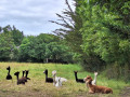
(10) Turn left and follow the stony path as it curves to the right and climbs up the hillside. At the top of the path, turn right. (Please note: if you’re worried about running out of time or energy, you can cut short this circular route through the horse pastures and head straight up the hillside to the stony path, where you’ll rejoin the route by turning west (to the right).)
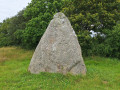
(11) Turn right and follow the stony path along the ridge to the sign for the Menhir du Boivre. Follow the dirt track to discover this megalith, about a hundred metres away. Retrace your steps to rejoin the route heading west. An underpass has been built to cross the “Route Bleue” (RD213).
(12) Follow Rue de la Pierre Levée westwards to the junction with Chemin du Breneau.
(13) Turn right onto Allée de la Cathelinière and continue for 50 metres until you reach the first junction.
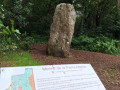
(14) Turn left onto Chemin du Breneau, then enter the forest via thefirst path on the left, signposted “Menhir de la Pierre Attelée”.
(15) Turn left onto the path just behind the menhir. Follow this narrow path as it descends into the holm oak forest and joins the Chemin du Reveau. At Place de la Petite Vague, turn right onto the path leading up the dune (do not go under the bridge). Climb the steep little slope and take the path on the right, marked in yellow and red and white.
(16) Turn right onto theGR®8, which enters the forest and winds up and down the dunes; continue on to the École de la Pierre Attelée and the Avenue des Pierres Couchées.
(17) Turn left towards the small car park and the sea.
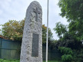
(18) At the far end of the car park, turn right to rejoin theGR®8(marked with red and white, and also yellow, signposts). Follow the path running parallel to the beach. 50 metres after the Allée André, the path veers to the right, leading to a memorial dedicated to those who died on 17 March 1945. Return to the track and follow the path running parallel to the beach for over a kilometre, until you reach the Avenue Alexandre Bernard.
(19) Leave theGR®8. Turn right and walk up Avenue Alexandre Bernard to the roundabout.
(20) Take the second street on the right, Allée Émile Polo. At the end of the street, before the junction with Rue du 11 Novembre, turn left to reach Place de la Potinière (S/E).

 Visorando Member
 Easy
Easy 

 Difficult
