


Refine your search for walks in Saint-Symphorien (Lozère)
Saint-Symphorien (Lozère) walks
 Circular route in the Margeride to Saint-Symphorien
 Visorando Member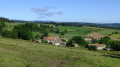
 8.33 mi
 +938 ft
 -912 ft
 4h 40
4h 40
 Moderate
 Departure from Thoras (Haute-Loire)
A walk in the Margeride region starting near Thoras. Beginning in the Haute-Loire, the route crosses into Lozère and climbs up to Saint-Symphorien. A stunning 360° view from the Croix de Saint-Symphorien.
The route passes through typical local hamlets and follows quiet paths offering lovely views of the Margeride.
Circular walk from the Croix de Saugues, starting from Thoras
 7.01 mi
+787 ft
-781 ft
3h 55
Moderate
Departure from Thoras (Haute-Loire)
7.01 mi
+787 ft
-781 ft
3h 55
Moderate
Departure from Thoras (Haute-Loire)
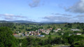
An easy circular walk in the heart of the countryside with lovely views of Thoras and the Lozère.
Margeride and its hamlets
 Association / Club / Walk leader
 5.98 mi
+466 ft
-446 ft
3h 10
Moderate
Departure from Grandrieu (Lozère)
5.98 mi
+466 ft
-446 ft
3h 10
Moderate
Departure from Grandrieu (Lozère)
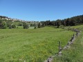
Starting from the village of Grandrieu, this hike allows you to discover the small Margeride massif (formerly Gévaudan) and its typical granite villages. The route described was completed in half a day by young people (aged 7 to 11) from the Sentiers en Margeride hiking club. Difficulty: E2/T2/R1 (according to FFrandonnée classification).
Circular walk of the castles and fortified towns of Alleyras
 12.92 mi
+2,569 ft
-2,543 ft
8h 10
12.92 mi
+2,569 ft
-2,543 ft
8h 10
 Difficult
Departure from Alleyras (Haute-Loire)
Difficult
Departure from Alleyras (Haute-Loire)
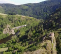
Starting from Pont d’Alleyras station, a crossing point over the Allier for over 2,000 years, the Vabres plain has always been dotted with numerous castles and watchtowers to control the passage of travellers. This route follows one of the two Roman roads designed to link Bordeaux, the capital of Aquitaine, with Lyon, the capital of Gaul, passing through the southern part of the Massif Central towards Rodez and Cahors. In the Middle Ages, the River Allier formed the boundary between the Velay and the Gévaudan regions.
Around Malmont
 5.61 mi
+584 ft
-594 ft
3h 05
5.61 mi
+584 ft
-594 ft
3h 05
 Easy
Departure from Auroux (Lozère)
Easy
Departure from Auroux (Lozère)
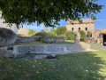
A lovely walk starting from the hamlet of Malmont in the commune of Auroux. This walk will take you through varied landscapes along well-maintained paths.
The hills of Jonchères
 5.33 mi
+745 ft
-725 ft
3h 05
Moderate
Departure from Rauret (Haute-Loire)
5.33 mi
+745 ft
-725 ft
3h 05
Moderate
Departure from Rauret (Haute-Loire)
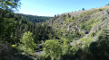
Explore the Allier Gorges and its railway line via a very rural route. The scenery is extremely varied, alternating between meadows, cultivated fields and wild areas, with an elevated walkway over the river and a view of the ruins of Jonchères Castle.
Chapelle Saint-Étienne from Monistrol-d'Allier
6.33 mi
+1,079 ft
-1,089 ft
3h 50
Moderate
Departure from Monistrol-d'Allier (Haute-Loire)
Circular route on the heights of the Allier, around Monistrol, to discover a chapel overlooking the valley. See the variation in the Practical Information section for a round trip to Château de la Beaume.
According to one review, it seems thatthe Visorando app is necessary to follow the route properly.
Ancient Roman road and the Devès Plateau
7.18 mi
+479 ft
-509 ft
3h 45
Moderate
Departure from Ouides (Haute-Loire)
A hike with completely unobstructed views, at an altitude of 1,200 m, offering a beautiful view of the Margeride plateaus, via the old track running alongside the Forêt du Devès. Return via the hamlets and farm tracks of the plateau.
Le Bouchet-Saint-Nicolas - Pradelles
 12.89 mi
+1,001 ft
-1,237 ft
6h 50
Difficult
Departure from Le Bouchet-Saint-Nicolas (Haute-Loire)
12.89 mi
+1,001 ft
-1,237 ft
6h 50
Difficult
Departure from Le Bouchet-Saint-Nicolas (Haute-Loire)
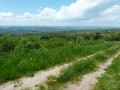
This route is the third stage of a complete journey on the Chemin de Stevenson between Le Puy-en-Velay and Alès. This is undoubtedly the easiest stage of the tour. The route follows the GR®70 (follow the well-known GR® markings). Please note the route may have been slightly modified from what is shown on the map, in particular to avoid a few short stretches of busy road.
Route des orgues de Monistrol-d’Allier
 3.82 mi
+1,053 ft
-1,056 ft
2h 40
Moderate
Departure from Monistrol-d'Allier (Haute-Loire)
3.82 mi
+1,053 ft
-1,056 ft
2h 40
Moderate
Departure from Monistrol-d'Allier (Haute-Loire)
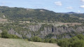
A short walk offering the chance to explore the basalt flows in the Monistrol-d’Allier area. The route follows the River Allier and offers lovely views throughout the walk. Towards the end of the route, you’ll find the Troglodyte Chapel of La Madeleine and the magnificent Rocher du Lion.
A stretch of the pilgrims' route in Monistrol
12.11 mi
+2,211 ft
-2,215 ft
7h 30
Moderate
Departure from Monistrol-d'Allier (Haute-Loire)
This long circular loop offers two very different atmospheres. The first part is spent in the company of pilgrims on the Way of St James, often in groups, some more talkative than others, passing through hamlets marked by this pilgrimage (crosses, statues). In the second part, you will be alone in the world in the vast expanses of the plateau overlooking the Allier valley.The Visorando app is useful on certain sections.
Saugues - Saint-Alban-sur-Limagnole
 21.43 mi
+1,946 ft
-1,962 ft
10 hrs
21.43 mi
+1,946 ft
-1,962 ft
10 hrs
 Very difficult
Departure from Saugues (Haute-Loire)
Very difficult
Departure from Saugues (Haute-Loire)
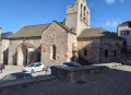
During this 18th stage of the Way of St James, you’ll traverse a wild, poetic and challenging landscape as you cross the Margeride and Gévaudan plateaus. You’ll spot rocky outcrops scattered here and there at the whim of chance and time, promising a surprising journey where it’s lovely to reconnect.
Stroll around Saint-Jean-Lachalm
0.98 mi
+112 ft
-108 ft
0h 35
Easy
Departure from Saint-Jean-Lachalm (Haute-Loire)
A short hike to discover this village in the Devès region, a Cluniac site.
Lac du Bouchet via Cayres
11.88 mi
+1,322 ft
-1,316 ft
6h 35
Moderate
Departure from Saint-Jean-Lachalm (Haute-Loire)
Starting with a short circular route in the Devès, near Cayres, a visit to Lac du Bouchet, well known to volcanology enthusiasts, is a must.
The path around Lac du Bouchet
 1.62 mi
+13 ft
-16 ft
0h 45
Easy
Departure from Cayres (Haute-Loire)
1.62 mi
+13 ft
-16 ft
0h 45
Easy
Departure from Cayres (Haute-Loire)
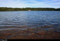
An ideal place for a walk, Lac du Bouchet is reminiscent of a Canadian lake. A real gem in its forest setting, this circular lake of volcanic origin occupies the site of an ancient crater.
The suggested route allows you to walk around it. It is a very easy walk that can be enjoyed by the whole family.
The Patus Forest
 Tourist office
 9.31 mi
+755 ft
-745 ft
4h 55
Moderate
Departure from Saint-Jean-la-Fouillouse (Lozère)
9.31 mi
+755 ft
-745 ft
4h 55
Moderate
Departure from Saint-Jean-la-Fouillouse (Lozère)
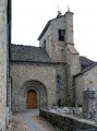
This route takes you through several typical villages of the Margeride region with their rich and varied heritage, as well as the wonderful Patus Forest where you can enjoy unspoilt nature.
Exploring the area around La Fouillouse
 7.22 mi
+781 ft
-761 ft
4h 00
Moderate
Departure from Saint-Jean-la-Fouillouse (Lozère)
7.22 mi
+781 ft
-761 ft
4h 00
Moderate
Departure from Saint-Jean-la-Fouillouse (Lozère)
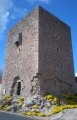
This route will take you on a journey of discovery through the local heritage (the Cellier Tower, the bread oven, the cross) and the wild, unspoilt landscapes around the Ruisseau de la Fouillouse.
 Montchauvet by mountain bike
More walks in Saint-Symphorien (Lozère)
Select a point of interest below: