Circular walk from the Croix de Saugues, starting from Thoras

An easy circular walk in the heart of the countryside with lovely views of Thoras and the Lozère.

Details

4734879
Creation:
Last update:
Last review:
  • Walking
    Activity: Walking
  • ↔
    Distance: 7.01 mi
  • ◔
    Average duration: 3h 55 
  • ▲
    Difficulty: Moderate

  • ⚐
    Back to start: Yes
  • ↗
    Ascent: + 787 ft
  • ↘
    Descent: - 781 ft

  • ▲
    Highest point: 4,131 ft
  • ▼
    Lowest point: 3,517 ft

Photos

Description of the walk

Park near the Salle des Fêtes: a large car park which also serves as the fairground during the fair on 25 August.

(S/E) Take the tarmac road heading south-east towards the hamlets of Savignac, Collanges and La Fagette.

(1) After crossing a small bridge over a stream, turn left. Continue along the tarmac road until you reach the junction with a stony track.

(2) Follow this track to the right. Continue along this track, ignoring all side tracks, until you reach a tarmac road.

(3) Turn right towards the hamlet of La Fagette, which you can see below.

(4) In the middle of the hamlet, after passing very close to a stone house, turn right onto a dirt track.

(5) When you reach this junction, carry on to the right along the track. Cross the junction (elevation 1233) and continue straight on to reach the crossroads where several tracks meet at the Croix de Saugues.

(6) Take the small track on the right and carry on straight ahead, heading due north. Before that, you can get closer to the tarmac road by turning left: there’s a lovely view of the Lozère and the village of Cheyla d’Ance.

(7) Carry on straight ahead; do the same at the junction that appears shortly afterwards, taking the wide track that allows agricultural machinery to pass.

(8) Ignore the path on the left leading to Ventajols, then keep to the right about fifty metres further on. The path climbs initially, then descends towards Thoras, which you’ll reach by returning directly to your starting point (S/E).

Waypoints

  1. S/E : mi 0 - alt. 3,520 ft - Car park, fairground
  2. 1 : mi 0.17 - alt. 3,517 ft - Three-way junction, to the left
  3. 2 : mi 0.83 - alt. 3,780 ft - Gravel path, to the right
  4. 3 : mi 2.66 - alt. 3,960 ft - Tarmac road, on the right
  5. 4 : mi 2.9 - alt. 3,894 ft - The hamlet of La Fagette
  6. 5 : mi 3.27 - alt. 4,009 ft - Junction, turn right
  7. 6 : mi 4.14 - alt. 4,111 ft - The Saugues Cross
  8. 7 : mi 5.53 - alt. 3,750 ft - Crossroads – go straight on
  9. 8 : mi 6.02 - alt. 3,789 ft - Ventajols crossroads
  10. S/E : mi 7.01 - alt. 3,520 ft - Car park, fairground

Notes

An easy walk, but do wear trainers.

Worth a visit

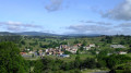
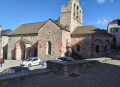
View of Thoras and the surrounding area.
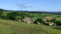
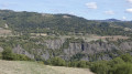
Before La Fagette: view of the Haute-Loire and Lozère (on a clear day, the Mezenc massif).
(6) At the Saugues cross: views of Lozère, the Cheyla d’Ance, the Roc de Fenestre, etc.

Reviews and comments

4.7 / 5
Based on 2 reviews

Reliability of the description
5 / 5
Ease of following the route
4.5 / 5
Route interest
4.5 / 5
MIFA46
MIFA46

Overall rating : 4.3 / 5

Date of your route : May 27, 2026
Reliability of the description : ★★★★★ Very good
Ease of following the route : ★★★★☆ Good
Route interest : ★★★★☆ Good
Very busy route : No

A very pleasant walk with beautiful scenery, and no particular difficulties. Thanks to the author

Machine-translated

MIFA46
MIFA46
• Edited:

A very pleasant walk with beautiful scenery, and no particular difficulties.

Machine-translated

michel1941
michel1941

Overall rating : 5 / 5

Date of your route : Sep 08, 2023
Reliability of the description : ★★★★★ Very good
Ease of following the route : ★★★★★ Very good
Route interest : ★★★★★ Very good
Very busy route : No

A lovely walk in Margeride; a bit of tarmac at the start but nothing to worry about, followed by some lovely paths and beautiful scenery. It’s well worth taking your time to admire the stunning views. Well done to the author – we’d love to do it again. Very easy. Jacqueline and Michel, 38270, on holiday in Saugues.

Machine-translated

Other walks in the area

For more walks, use our search engine .

The GPS track and description are the property of this route's author. Please do not copy them without permission.