Country:

 City:



To reach the Chaos de la Balme car park, which is our starting point, leave the D66 (which you’ll have been following from Castres) about 1 km before Saint-Salvy-de-la-Balme. Turn right. Road signs: Chaos de La Balme – Chapeau de Napoléon. The car park is situated about a hundred metres past a granite quarry. The road is very narrow, so you must drive very carefully.
(S/E) Look out for the start of the path, marked with yellow signposts and a sign reading “La Balade des Légendes”. Follow this path and pass a first rock on your right, known as the “Hamburger”. Shortly afterwards, still on your right, a short detour leads to a former granite quarry (signposted).
You’ll soon reach the Chaos de la Balme. Descend via a series of steps. The Chapeau de Napoléon is on your left.
(1) Once you reach a flat area at the foot of the rock formation, you’ll find two paths marked in yellow. Turn left onto the level path which leads to the hamlet of Tailhades; as you pass through, admire some of the beautifully restored houses. Ignore the small road on the left and continue heading south-east until you reach a three-way junction.
(2) Turn sharply left onto a small road, which you follow to the right for about fifty metres. This then gives way to a path that descends to the bottom of the valley and crosses the stream via a footbridge.
(3) Turn left. Take care at this junction, as it is not very visible on the ground! From here, you must pay close attention and follow the yellow markings carefully, as there are several paths in quick succession.
(4) After a few hairpin bends, leave the wide track and turn left uphill onto a much narrower path (red signpost marked ‘Griffoulas’). Follow this path to the hamlet, where you’ll come out onto a road.
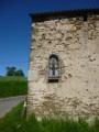
(5) Leave the yellow markings, which head off to the right, and turn left. The house on the corner has a pretty niche decorated with a cross.
Follow the small, flat road to the hamlet of Fontbelle, passing several path junctions and a road on the left.
(6) At the fork in the road on leaving the hamlet, leave the road and take theGR®®36(marked in white and red) on the right, which leads to the D93 at the entrance to the hamlet of Lacombe.
(7) Once on the road, turn left and go past the junction.
(8) Turn right, below the road, towards Cambounès.
(9) Cross the Durenque. Follow theGR®® signposts, keeping to the right at every junction, until you reach a crossroads.
(10) Head straight ahead, pass between two houses and continue to the hairpin bend.
(11) Leave the road and continue straight on along a wide, very well-maintained track. Continue for about two kilometres along this track, which bends to the right below the Lagrange farm and leads to a Fork in the road, about 800 metres further on.
(12) Leave theGR®®36, which takes the left-hand branch, slightly uphill. Continue on the right, on level ground. You’ll come across the yellow markings and the white and red markings ofthe GR®®653, signposted as the Santiago de Compostela Route – Le Rampaillou. This wide forest path leads, with virtually no change in elevation, to a junction shortly after the hamlet of La Peyrarque Basse.
(13) The road is on your left. Do not take it, but turn right and continue along theGR®®. Carry on, sometimes through the forest and sometimes along its edge, ignoring the many paths to the right and left. The view of the Montagne Noire opens up on your left. You’ll reach a crossroads.
(14) On the right, there is a small road and a signpost for “Flourens”. Carry on straight ahead. The path takes a slight detour to avoid the beautiful Fonfage farm, and you will soon come within sight of the village of Boissezon and its hilltop church, which overlooks the area.
Walk past the Saint-Jacques de Compostelle stopover lodge on your left. Pass a small bridge on your right – do not take this – and carry on straight ahead to join the D93 a few dozen metres further on.
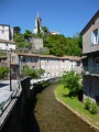
(15) Turn right and cross the bridge over the Durenque, from where you can enjoy a lovely view of the village. Shortly afterwards, on the left, a small road leads uphill, signposted with a yellow and blue sign: ‘Chemin du Chaos de la Balme’. This is more or less the only signposting you’ll find, as the route that follows is very poorly signposted. Walk past a cross on your left and follow the road for about 1 km.
(16) 100 metres after a junction, leave the road and take a path on the left, which slopes gently downwards.
(17) 600 metres further on, at the junction, turn left (a 180° turn) and head towards another Fork in the road.
(18) Take a sharp right-hand bend, following the yellow and blue sign: “Chaos de la Balme”. The path, which is sometimes wide and sometimes narrower, heads north, winding its way through a series of hairpin bends to reach the hamlet of La Borie, with ruined buildings on your left.
(19) At the entrance to the hamlet, turn right at a 90° angle, pass a cross and continue straight on. The path leads to a small road slightly north of the buildings at the heath, which you leave on your right.
(20) Turn left, then immediately right, and follow the road as it heads north, straightening out sharply after a left-hand bend.
(21) Leave the road and take a wide track on the right, which leads to the Chaos de la Balme through areas of cleared woodland.
(1) Once at the Chaos, turn left, taking the steps you used at the start, and reach the car park in a few minutes (S/E).

 Visorando Member

 Moderate

 Tourist office

 Easy