


Refine your search for walks in Saint-Brès
Saint-Brès walks


 The Montagne d'Uzege
 Visorando Member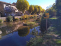
 8.58 mi
 +1,617 ft
 -1,624 ft
 5h 20
5h 20
 Moderate
 Departure from Saint-Brès (Gard)
Starting from the village of Saint-Brès, a lovely walk through the heath between Gard and Ardèche with stunning views from the orientation table at the Chapel of Saint-Privat. The direction indicated is the easiest; this avoids a fairly steep climb to reach the chapel. Do not attempt in very hot weather. You can visit the village of Saint-Sauveur and its church, as well as the village of Saint-Brès, on the way back.
The Gisquet tower and Montalet castle from Saint-Ambroix
 7.16 mi
+1,391 ft
-1,362 ft
4h 30
Moderate
Departure from Saint-Ambroix (Gard) (Gard)
7.16 mi
+1,391 ft
-1,362 ft
4h 30
Moderate
Departure from Saint-Ambroix (Gard) (Gard)
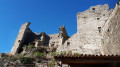
Starting from Saint-Ambroix, a pretty village in the Gard, set off to explore the Gisquet tower and the ruins of the medieval Château de Montalet. A beautiful hike through holm oak woods and chestnut groves.
From the Cèze to the Lerou lake
 8.04 mi
+351 ft
-371 ft
4h 00
Moderate
Departure from Saint-Victor-de-Malcap (Gard)
8.04 mi
+351 ft
-371 ft
4h 00
Moderate
Departure from Saint-Victor-de-Malcap (Gard)
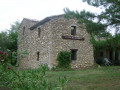
Starting from Saint-Victor-de-Malcap, this hike consists of two circular loops: the first to the Moulin du Roc Tombé on the banks of the Cèze and the second on the shores of the Lerou lake.
Beautiful passages through a forest of fir and pine trees.
Circular loop at Saint-Victor-de-Malcap
 5.72 mi
+249 ft
-240 ft
2h 50
5.72 mi
+249 ft
-240 ft
2h 50
 Easy
Departure from Saint-Victor-de-Malcap (Gard)
Easy
Departure from Saint-Victor-de-Malcap (Gard)
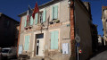
From the Château de Saint-Victor-de-Malcap to the banks of the Cèze, this walk through the fields and small villages of the Gard is an easy one.
The only downside is that there are many tarmac or gravel sections. On the plus side:
- firstly, this walk remains accessible even after rain
- and secondly, these small roads leading to farmhouses have almost no traffic.
The Combe de Blanc in Chadouillet
4.82 mi
+262 ft
-259 ft
2h 25
Moderate
Departure from Saint-André-de-Cruzières (Ardèche)
A short hike with no major difficulties, but best avoided during hot weather. The elevation gain is low, and overall the paths are not too difficult and are often marked in yellow. It is possible to descend to the Cotepatière resurgence and back, preferably after rain, otherwise it is dry.
I am providing the details of the "les résurgences" hike, which you walk along for a while.
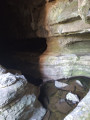
The Cotepatière Cave, starting from Saint-André-de-Cruzières
 5.62 mi
+594 ft
-581 ft
3h 05
Moderate
Departure from Saint-André-de-Cruzières (Ardèche)
5.62 mi
+594 ft
-581 ft
3h 05
Moderate
Departure from Saint-André-de-Cruzières (Ardèche)
An unusual walk and nothing too complicated if you’re not claustrophobic.
Circular walk around the Serre de Banassac
 5.17 mi
+758 ft
-738 ft
3h 00
Moderate
Departure from Les Mages (Gard)
5.17 mi
+758 ft
-738 ft
3h 00
Moderate
Departure from Les Mages (Gard)
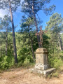
A hike with no particular difficulties, on good unpaved paths. You’ll pass through chestnut and pine forests and be treated to some splendid panoramic views. Here and there, traces of past activities remind the hiker that this mountain, now uninhabited, was once a refuge for many people.
The Crêtes de Cruzières
 6.41 mi
+863 ft
-869 ft
3h 40
Moderate
Departure from Saint-André-de-Cruzières (Ardèche)
6.41 mi
+863 ft
-869 ft
3h 40
Moderate
Departure from Saint-André-de-Cruzières (Ardèche)
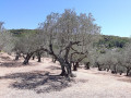
Vineyards and olive groves at the foot of the Montagne de la Serre and Serre de Cruzières. Panoramic view of the Barjac plain and the Cévennes.
Around Saint-Jean-de-Valériscle
 8.40 mi
+1,168 ft
-1,178 ft
4h 55
Moderate
Departure from Saint-Jean-de-Valériscle (Gard)
8.40 mi
+1,168 ft
-1,178 ft
4h 55
Moderate
Departure from Saint-Jean-de-Valériscle (Gard)
A beautiful hike in the Auzonnet valley, with stunning scenery but also the constant presence of the region's industrial past, linked to coal, which is sure to captivate you. The medieval village of Saint-Jean-de-Valériscle is also worth a visit. The route is well marked and does not present any particular difficulties.
Between the Cèze and Auzon rivers from Saint-Jean-de-Valériscle
 14.44 mi
+2,966 ft
-2,969 ft
9h 15
14.44 mi
+2,966 ft
-2,969 ft
9h 15
 Very difficult
Departure from Saint-Jean-de-Valériscle (Gard)
Very difficult
Departure from Saint-Jean-de-Valériscle (Gard)
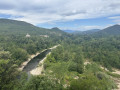
This is a challenging hike that allows you to discover different aspects of the southern Cévennes countryside, passing through forests and superb panoramas, as well as villages and hamlets. The climb from Robiac to the Chapelle Lacham is challenging, with some steep sections, but the scenery is well worth the effort. The descent from the chapel to Saint-Florent-sur-Auzonnet is also challenging, due to the large unstable rocks typical of the Cévennes over much of the descent.
Dolmen Trail in Saint-Paul-le-Jeune
 3.14 mi
+285 ft
-262 ft
1h 40
Easy
Departure from Saint-Paul-le-Jeune (Ardèche)
3.14 mi
+285 ft
-262 ft
1h 40
Easy
Departure from Saint-Paul-le-Jeune (Ardèche)
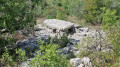
A short walk through the heath dotted with a few dolmens in varying states of repair, but nonetheless interesting for their burial mounds and magnificent limestone slabs, which have unfortunately partially collapsed.
You can also see two shepherds’ drystone shelters, known locally as ‘drystone shelters’, one of which is in good condition.
A circular route through the heath to the Cèze river and then through the fields
 19.58 mi
+1,798 ft
-1,804 ft
10h 35
Very difficult
Departure from Saint-Jean-de-Maruéjols-et-Avéjan (Gard)
19.58 mi
+1,798 ft
-1,804 ft
10h 35
Very difficult
Departure from Saint-Jean-de-Maruéjols-et-Avéjan (Gard)
This circular loop starts in Saint-Jean-de-Maruéjols and heads into the heath via Avéjan, Cabiac, then Serre du Barri and the Ermitage Saint-Ferréol on the banks of the Cèze. It then climbs back up towards Barjac, passing through several charming hamlets. After Barjac, you walk through fields on the plain, along the border of the nearby Ardèche region, through meadows and farmhouses, before returning to the starting point. This circular route is nothing exceptional, but it allows you to discover the heath and the plain with its agricultural activity. Its appeal lies in combining a challenging hike with very clear and easy-to-follow signage, except for the short passages indicated in the description where you move from one signpost to another.
Short circular loop in Banne
 1.16 mi
+233 ft
-249 ft
0h 45
Easy
Departure from Banne (Ardèche)
1.16 mi
+233 ft
-249 ft
0h 45
Easy
Departure from Banne (Ardèche)
The village of Banne is charming and the view from the ruins of the castle, destroyed during the Revolution, is quite breathtaking. The walk described here is very short and easy, unless you prefer not to walk on a stony path. Perfect as a pre-dinner or after-dinner stroll.
Combe Longue, Bannelle and Le Mazel
4.17 mi
+971 ft
-997 ft
2h 45
 Difficult
Departure from Banne (Ardèche)
Difficult
Departure from Banne (Ardèche)
A pleasant hike offering the chance to discover, first and foremost, a typical landscape of lush vegetation (particularly holm oaks) interspersed with limestone formations.
Also particularly interesting is the crossing of a sharp limestone pavement at the summit of Bannelle. This is a limestone plateau that has been eroded over time, forming joints that give it a ruin-like appearance.
Circular Banne route via Le Mazel and Montgros
 3.69 mi
+522 ft
-525 ft
2h 10
Easy
Departure from Banne (Ardèche)
3.69 mi
+522 ft
-525 ft
2h 10
Easy
Departure from Banne (Ardèche)
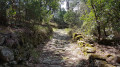
A short walk that climbs up to the heights above the charming little village of Banne and descends back down via a pretty paved slanting street.
The Granges Necropolis
 3.64 mi
+167 ft
-167 ft
1h 50
Easy
Departure from Berrias-et-Casteljau (Ardèche)
3.64 mi
+167 ft
-167 ft
1h 50
Easy
Departure from Berrias-et-Casteljau (Ardèche)
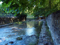
The Granges Necropolis is one of the most important dolmen sites in Ardèche. This short, easy circuit allows hikers to discover some of them while enjoying the landscape, vegetation and waterways of the limestone plateaus of lower Ardèche.
Short loop around the Granzon stream
 5.68 mi
+591 ft
-564 ft
3h 10
Moderate
Departure from Banne (Ardèche)
5.68 mi
+591 ft
-564 ft
3h 10
Moderate
Departure from Banne (Ardèche)
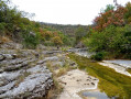
The Granzon stream canyon is a magical place that tour operators won't take you to. Go there, but don't tell anyone... The return route is via the plateau and a small road. Those allergic to tarmac may prefer to do a round trip.
The rocks and archaeological site of Carabasse at the start of Bessas
 5.42 mi
+712 ft
-705 ft
3h 05
Moderate
Departure from Bessas (Ardèche)
5.42 mi
+712 ft
-705 ft
3h 05
Moderate
Departure from Bessas (Ardèche)
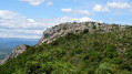
An easy hike to discover the landscapes of the Ardèche and Gard regions at the Carabasse rocks and, a little further on, the archaeological remains.
Château d’Allègre from Les Fumades
 9.07 mi
+879 ft
-883 ft
4h 55
Moderate
Departure from Allègre-les-Fumades (Gard)
9.07 mi
+879 ft
-883 ft
4h 55
Moderate
Departure from Allègre-les-Fumades (Gard)
This walk takes you along paths through unspoilt heath, a protected area within the Natura 2000 network. Its highlights: a village and a medieval castle overlooking olive groves, plus breathtaking panoramic views!
The steps of Sabuscles – Malbosc – Pont de Malbosquet
 2.88 mi
+866 ft
-856 ft
2h 05
Easy
Departure from Malbosc (Ardèche)
2.88 mi
+866 ft
-856 ft
2h 05
Easy
Departure from Malbosc (Ardèche)
A short walk along pleasant Cévennes paths. A route that begins with a magnificent staircase made of splendid schist slabs, and a series of small steps allowing you to cross the various accols (or faïsses: terms meaning terraced farmland) once maintained for cultivation.
Also worth noting is a distinctive feature of the Malbosquet Bridge, where one of the parapets has a pointed section in the middle, into which a slab has been set to form a seat.
Around Saint-Julien-les-Rosiers
 7.13 mi
+994 ft
-997 ft
4h 10
Moderate
Departure from Saint-Julien-les-Rosiers (Gard)
7.13 mi
+994 ft
-997 ft
4h 10
Moderate
Departure from Saint-Julien-les-Rosiers (Gard)
A hike in the foothills of the Cévennes, well signposted (yellow markings), with most of the route on good paths, fairly shaded and therefore suitable for summer walking despite the heat. No particular difficulties to report. Some splendid panoramic views, magnificent farmhouses including one dating from the 14th century, and an old abbey as the icing on the cake.
The upper Ganière valley and the Sentier du Facteur
 7.25 mi
+2,205 ft
-2,178 ft
5h 15
Difficult
Departure from Les Vans (Ardèche)
7.25 mi
+2,205 ft
-2,178 ft
5h 15
Difficult
Departure from Les Vans (Ardèche)
One of the most beautiful routes in the Vans region, both in terms of scenery and heritage. Balcony paths, chestnut groves and drying rooms, a gold-bearing river, low walls and beehives carved into chestnut tree trunks: everything invites you to discover this enclave of the Ardèche and its hamlets, which were once only accessible on foot.
Be careful, there are steep and very steep ascents and descents. Allow 5 hours for the route, plus extra time for wandering around.