Terres des Jeux 2024 Run in Bretteville-du-Grand-Caux

A running route in the heart of Bretteville-du-Grand-Caux to keep fit for the 2024 Olympic Games.

Details

26742525
Creation:
Last update:
Last review:
  • Walking
    Activity: Walking
  • ↔
    Distance: 4.55 mi
  • ◔
    Average duration: 2h 10 
  • ▲
    Difficulty: Easy

  • ⚐
    Back to start: Yes
  • ↗
    Ascent: + 98 ft
  • ↘
    Descent: - 102 ft

  • ▲
    Highest point: 367 ft
  • ▼
    Lowest point: 305 ft

Description of the walk

Park in the square: Place de l’Église, Bretteville-du-Grand-Caux.

(S/E) Walk past the butcher’s and take the Route d’Annouville. At the mini roundabout, turn left and continue straight on along the grassy track. Follow it until you are below the railway line and continue to the left until you reach the road. Turn right, go under the railway bridge and carry on until you reach the embankments planted in the typical Cauchois style. You will arrive at the crossroads in the hamlet of Le Brûlé.

(1) Turn right onto the path and carry on until you reach a road.

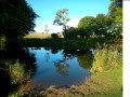
(2) Turn right to head back towards Bretteville. Pass under the railway line again. At the junction, turn left towards La Roseraie, then right at the speed bump and enter the housing estate. Walk to the pond, turn left, then left again to go round the last house. Continue straight on between the houses and the field.

::3: When you reach the farm building, turn right and walk alongside the farm until you reach the road. Cross the road and take the tarmac path on the right. Then turn left onto Route de Chaumont and continue to the last house.

(4) Turn right to cross the tree-lined plot. At the very end, turn left onto the shaded path that winds its way past the houses until it joins the county road. Follow the road under the tree-lined avenue until you reach the road. Cross the road and head up the road to the right, keeping to the left to quickly reach the pavement. Walk up the pavement until you reach the entrance on the left to the small wooded park. Walk past the pond, then turn right onto the path between the houses. You’ll reach the junction with the road.

(5) Turn right, then left into the grassy area just before the houses. At the road, turn left to reach the junction with Rue de la Mare du Moulin.

(6) Turn right onto it, then continue along the path until you rejoin the road. Turn right, then left onto the grassy path. You’ll reach the hamlet of Neufbourg.

(7) Turn right, then take the first left. At the end of the housing estate, turn right onto the grassy track and follow it until you reach the road. Then turn right to reach the church square (S/E).

Waypoints

  1. S/E : mi 0 - alt. 361 ft - Church Square car park
  2. 1 : mi 0.83 - alt. 335 ft - Le Brûlé
  3. 2 : mi 1.24 - alt. 318 ft - Road junction
  4. 3 : mi 1.92 - alt. 364 ft - Farm building
  5. 4 : mi 2.23 - alt. 361 ft - Crossroads by the last house
  6. 5 : mi 2.73 - alt. 351 ft - Road junction
  7. 6 : mi 2.99 - alt. 348 ft - Rue de la Mare du Moulin
  8. 7 : mi 3.93 - alt. 315 ft - Le Neufbourg
  9. S/E : mi 4.55 - alt. 361 ft - Church Square car park

Reviews and comments

4.4 / 5
Based on 3 reviews

Reliability of the description
5 / 5
Ease of following the route
4.7 / 5
Route interest
3.7 / 5
Alain DELARUE
Alain DELARUE

Overall rating : 4 / 5

Date of your route : Oct 30, 2024
Reliability of the description : ★★★★★ Very good
Ease of following the route : ★★★★☆ Good
Route interest : ★★★☆☆ Average
Very busy route : No

It’s handy if you never want to be far from your car.

There are a few signposts indicating walking routes, most of them in poor condition; on one occasion, I even found one on a fallen post, which I tried to put back up. It’s not clear whether this is the route in question or not.

The grassy paths can get very wet. You end up with soaked feet, but that’s just part and parcel of the season!

Thanks for the detailed description!

Machine-translated

VBER
VBER

Overall rating : 4.7 / 5

Date of your route : Aug 21, 2023
Reliability of the description : ★★★★★ Very good
Ease of following the route : ★★★★★ Very good
Route interest : ★★★★☆ Good
Very busy route : No

A really lovely walk that forms a circular route around the starting point, which means you can shorten the route if needed. Paths and roads with little traffic. Definitely worth doing again 👍

Machine-translated

Dijola
Dijola

Overall rating : 4.7 / 5

Date of your route : Jul 18, 2023
Reliability of the description : ★★★★★ Very good
Ease of following the route : ★★★★★ Very good
Route interest : ★★★★☆ Good
Very busy route : No

A lovely, almost entirely flat walk, half on footpaths and half on small roads,
I’d definitely recommend it!

Machine-translated

Other walks in the area

For more walks, use our search engine .

The GPS track and description are the property of this route's author. Please do not copy them without permission.