Country:
 City:
City:


Park in the Gerville car park opposite the church.
(S/E) Facing the church and the cemetery, set off along the main street and, at the corner by the cemetery, turn left onto Rue des Alizés until you reach the Maniquerville crossroads.
(1) Continue straight on along Rue Ventose to the La Couarde crossroads, passing under a power line and past a gas installation.
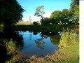
(2) Turn right onto Rue d’Enfer, pass by the treatment works’ ponds and join the D68 near the cemetery. Follow it to the right until you reach the centre of Sausseuzemare-en-Caux.
(3) At the crossroads, turn right onto the Route des Loges (D72), which passes in front of a pond and then under a power line. Leave the Chemin de la ferme du Parc on your right and arrive at a crossroads at the 122-metre mark.
(4) Turn right onto the small road which leads back to the Maniquerville crossroads, which you passed on the way out.
(1) Carry on straight ahead until you reach the junction by Maniquerville Town Hall.
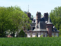
(5) Just before this, turn right, go round the castle and turn left to pass in front of the motte-and-bailey (oppidum) situated behind the cemetery.
(6) Cross the D11, carry on straight ahead, pass through the hamlet of La Hêtrée and arrive at a junction between the D279 and the D79.
(7) Take the hairpin bend to the left onto the D79 until you reach the first road.
(8) Turn right onto Petite Rue. Leave the two roads on your left and carry on straight ahead until you reach the D11.
(9) Turn left onto it and follow it for about 400 metres until you reach a roundabout.
(10) Carry on straight ahead along a small tarmac road, then take a track on the left which goes round the Ferme de la Vue Coquet. Join the tarmac road on the right which leads to Gerville.
(11) At the school and the town hall, turn left to return to the car park in front of the church (S/E).

 Visorando Member

 Tourism professional
 Easy
Easy 
 Difficult