


Refine your search for walks in Rodès
Rodès walks


 The Castle, the Guillera Gorges and Pic Pedrous via Casesnoves
 Visorando Member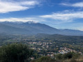
 9.77 mi
 +2,211 ft
 -2,205 ft
 6h 25
6h 25
 Moderate
 Departure from Rodès (Pyrénées-Orientales)
With Rodès Castle and the Guillera Gorges to start the hike, the diversity of the next section offers spectacular heath and rock landscapes in the midst of a unique mineral environment. It feels like wandering through a world of giants who have placed rounded blocks of rock, forming piles of monumental boulders scattered among the broom and rockroses that dot the area.
El Borboner, Cortal Grau, Sant Féliu and La Cogulera from Rodès
 9.41 mi
+1,749 ft
-1,739 ft
5h 50
9.41 mi
+1,749 ft
-1,739 ft
5h 50
 Difficult
Departure from Rodès (Pyrénées-Orientales)
Difficult
Departure from Rodès (Pyrénées-Orientales)
This hike in the north-western sector of Rodès mainly follows little-used paths. This circular route sometimes requires walking on poorly marked paths overgrown with vegetation (trousers recommended), and sometimes on well-marked paths or tracks (but as little as possible, as we prefer the paths). The "common thread" of the day is the almost constant view of Canigou. Some parts are not easy to walk, so they are reserved for walkers who are not afraid to "wear out their shoes".
Visorando app recommended.
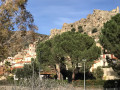
The Guillera Gorges, the castle and the village of Rodès
 2.51 mi
+381 ft
-351 ft
1h 30
2.51 mi
+381 ft
-351 ft
1h 30
 Easy
Departure from Rodès (Pyrénées-Orientales)
Easy
Departure from Rodès (Pyrénées-Orientales)
This is a short, easy loop that offers beautiful views.
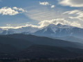
Pic Pédrous via a little-used path
 10.13 mi
+2,257 ft
-2,247 ft
6h 35
Moderate
Departure from Rodès (Pyrénées-Orientales)
10.13 mi
+2,257 ft
-2,247 ft
6h 35
Moderate
Departure from Rodès (Pyrénées-Orientales)
Puig Pedrós is a classic hike in Rodès. We wanted to climb it via a path that is no longer used. It runs around the Vallagra Ravine. As it was poorly marked, if at all, we reopened the middle section of the path, before and after crossing the Còrrec de Vallagra, on the right and left banks (lots of brambles and Mediterranean vegetation). We crossed the stream (elevation 319) using tree trunks deposited by the recent floods. This part of the route is a bit adventurous and is intended for adventurers. The rest of the circular route is uneventful.The GPX track is highly recommended.
The abandoned villages of Casesnoves and Las Cases
 10.19 mi
+2,136 ft
-2,146 ft
6h 35
Difficult
Departure from Rodès (Pyrénées-Orientales)
10.19 mi
+2,136 ft
-2,146 ft
6h 35
Difficult
Departure from Rodès (Pyrénées-Orientales)
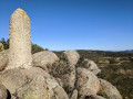
We are between the former kingdoms of Aragon and France, a superb circular hike of just over 17 km that will take you to two abandoned villages and up to Puig Pedros and its border marker. A region that is always sunny, with a splendid view of Mont Canigou through the fragrant maquis vegetation.
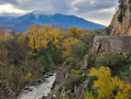
Ruins of the old village of Las Cases
 5.31 mi
+906 ft
-906 ft
3h 15
Moderate
Departure from Rodès (Pyrénées-Orientales)
5.31 mi
+906 ft
-906 ft
3h 15
Moderate
Departure from Rodès (Pyrénées-Orientales)
This is a hike that can be done even in winter and in the sunshine. We are in a region with a privileged climate. This easy circular hike of just over 8 km takes you through fragrant and colourful scrubland vegetation with the majestic Canigou massif as a backdrop.
Sant Feliu Church – Serrat Blanc – La Devesa from Rodès
 Association / Club / Walk leader7.37 mi
+1,234 ft
-1,234 ft
4h 30
Moderate
Departure from Rodès (Pyrénées-Orientales)
Association / Club / Walk leader7.37 mi
+1,234 ft
-1,234 ft
4h 30
Moderate
Departure from Rodès (Pyrénées-Orientales)
A pleasant route above Rodès, with stunning views of the Canigou massif and the Vinça Dam.
Places to see: the ruins of Sant Feliu de les Cases, the old Devesa de Rodès quarry, where a jazz festival is held in summer. Tracks, paths and dirt tracks. Some sections are a bit rough, but the route is not difficult.
Moderator’s note: on some sections, the paths have disappeared; see the reviews for this hike for alternative routes
Around Vinça
 6.61 mi
+440 ft
-436 ft
3h 25
Easy
Departure from Vinça (Pyrénées-Orientales)
6.61 mi
+440 ft
-436 ft
3h 25
Easy
Departure from Vinça (Pyrénées-Orientales)
A beautiful excursion in the Terres du Bas Conflent region, allowing you to discover four of its villages: Vinça, Finestret, Joch and Rigarda.
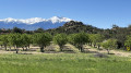
Around Montalba-le-Château
 3.37 mi
+164 ft
-151 ft
1h 40
Easy
Departure from Montalba-le-Château (Pyrénées-Orientales)
3.37 mi
+164 ft
-151 ft
1h 40
Easy
Departure from Montalba-le-Château (Pyrénées-Orientales)
A short walk around Montalba-le-Château to enjoy the diversity of the landscapes.
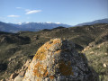
Puig Pedrous from Montalba-le-Château
 5.15 mi
+801 ft
-804 ft
3h 05
Moderate
Departure from Montalba-le-Château (Pyrénées-Orientales)
5.15 mi
+801 ft
-804 ft
3h 05
Moderate
Departure from Montalba-le-Château (Pyrénées-Orientales)
A lovely circular of two hours starting from Montalba-le-Château and passing through Puig Pedrous.
Ille-sur-Têt - Montalba-le-Château - Rodès via old paths and canals
 12.77 mi
+1,660 ft
-1,670 ft
7h 20
Difficult
Departure from Ille-sur-Têt (Pyrénées-Orientales)
12.77 mi
+1,660 ft
-1,670 ft
7h 20
Difficult
Departure from Ille-sur-Têt (Pyrénées-Orientales)
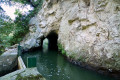
A hike to explore this low-lying mountain range, which was once farmed by humans. Numerous terraces bear witness to this past. Vines were once cultivated here. Mechanisation brought an end to farming in these wild and hard-to-reach areas.Yellow markings are virtually non-existent, and recent directional posts have been installed (as observed at the end of January 2024). These are not particularly relevant to the route. A GPX track is essential for this route, which features numerous paths.
Author’s note: The main sites of the fires in early July 2026 in the Pyrénées-Orientales were Ille-sur-Têt and Rodès. This walk has been affected by them. Much of the vegetation has been destroyed.
The Croix loop from the village of Joch
 5.47 mi
+1,722 ft
-1,752 ft
4h 00
Moderate
Departure from Joch (Pyrénées-Orientales)
5.47 mi
+1,722 ft
-1,752 ft
4h 00
Moderate
Departure from Joch (Pyrénées-Orientales)
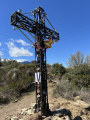
A beautiful half-day circular hike from this village.The climb is via the Way of the Cross to the large Croix de Joch.The return journey is via the very pretty balcony path that connects Joch (Jóc) to Baillestavy (Vallestàvia).A variant towards the canal is now accessible from wp (11).See practical information before setting out on this hike.
La Croix de Joch – Baillestavy – Marbet crossroads from Joch
 11.80 mi
+3,081 ft
-3,104 ft
8h 05
Difficult
Departure from Joch (Pyrénées-Orientales)
11.80 mi
+3,081 ft
-3,104 ft
8h 05
Difficult
Departure from Joch (Pyrénées-Orientales)
A long and beautiful walk starting from the village of Joch (Jòc).
The ascent follows an unmarked route via the Way of the Cross, then via La Volta de Santa Anna.
The return journey from the hamlet of Baillestavy (Vallestàvia) follows the very scenicGR®36.
This circular route overlooks the Llentillà, on the right bank on the way out and on the left bank on the way back.
This walk can be considered difficult.
You can start it at Finestret D25: there’s a small car park at (17) or a large car park 200 metres further on to the right.
See the practical information and route description for possible alternatives.
Pic des Maurous via Pic de Marbet and Roc de l'Agle
 8.85 mi
+3,425 ft
-3,399 ft
7h 05
Difficult
Departure from Finestret (Pyrénées-Orientales)
8.85 mi
+3,425 ft
-3,399 ft
7h 05
Difficult
Departure from Finestret (Pyrénées-Orientales)
In the first part of the hike from Finestret to Pic des Maurous, the climb from the point (1) is quite demanding. The steep slope throughout this section requires a good level of fitness. It offers beautiful views of the north and east of the area, from the Madres Massif to the sea, passing through the plain and its villages, the Fenouillèdes and the Corbières in the distance.
The GPX track can be very useful.
Pic Marbet via Espira-de-Conflent
 6.22 mi
+1,526 ft
-1,499 ft
4h 10
Moderate
Departure from Finestret (Pyrénées-Orientales)
6.22 mi
+1,526 ft
-1,499 ft
4h 10
Moderate
Departure from Finestret (Pyrénées-Orientales)
A pleasant walk that gets a little challenging towards the end. This section will allow you to discover three villages in Bas Conflent: Espira-de-Conflent, Estoher and Finistret.