Country:

 City:
City:


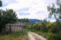
From Perpignan, take the N116 towards Vinça; at the Vinça reservoir, turn left onto the D13 towards Baillestavy and Joch. At the Colomina junction, turn left onto the D25 towards Joch.
At the entrance to the village, first turn right then left to head up towards the viewpoint. There is a first car park on the right, or further on at the town hall, or better still at the viewpoint itself, where the route description begins. Park carefully, ensuring you leave enough space for local residents to pass. There is an orientation board, benches and a fenced-off, secure children’s play area.
Yellow/white and yellow signposting.
(S/E) From the viewpoint car park, head up to the left, towards the track to the left of the underground water reservoir.
Continue along a track, looking out for old yellow markings.
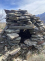
You’ll come to a junction of three small tracks near a wayside shrine.
(1) Leave the wayside shrine on your left and the track on your right, and continue down the middle track for 50 m, ignoring the old markings.
End of signposting. No signposting
(2) Turn immediately left onto a well-trodden path marked on the ground which climbs through the vegetation. The path climbs steadily, passing numerous numbered iron crosses.
At around 510 m, the left-hand fork is hidden by overgrown vegetation.
Carry on to the right along the correct path, which turns south-east, following a ridge. Continue climbing until you reach Cross number IV.
(3) At this fork, carry on straight ahead, now heading due south, climbing up the well-marked path to reach Cross No. VII further on.
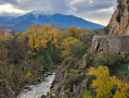
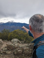
(4) Magnificent panoramic view over the Têt valley and the Vinça reservoir.
The path branches off to the right, heading south-west. Ignore the various junctions. At an altitude of 751 metres, the path heads due south again to reach Cross No. XII. Continue straight ahead due south, still following the ridge.
(5) You’ll reach a more open area where the ruins of the Cortal de les Feixes (enclosure, Ash Tree Hut) stand at an altitude of 853 metres. The path heads south-west. The summit cross is visible and serves as a landmark.
After 300 m, at the next fork, the clearly visible path heads due south again, towards the cross.
Leave the path on the right before the steep climb.
The path climbs steeply. Higher up, on a flat section, the Croix de Joche is accessible on the left-hand side. Continue now on more or less level ground along the ridge, heading due south towards the Puig de les Feixes (Pic des Frênes).
(6) From the summit, continue along the ridge, heading due south, for about 400 m, passing another peak, until you reach a first, not very obvious, fork at around 895 m. A cairn and two yellow markings are visible on the rocks at this point.
Leave the path that descends completely to the right.
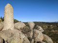
Continue straight ahead along the wooded ridge for 100 m until you reach another fork and a large cairn situated exactly at an altitude of 903 metres for the Creu de les Fous (Croix des Fous).
Recent yellow and white markings. Volta de Santa Anna (Tour de Sainte Anne).
(7) Descend steeply to the right, following the clearly visible markings from the start.
Follow this beautiful forest path, which is perfectly well-marked, clean and clear.
You’ll reach a large junction of tracks and paths. There’s a bench made from a railway sleeper at an altitude of 697 metres. Directional signs.
(8) Without joining the track, turn left, running parallel to it.
Follow the signs for Can Carbonell and Baillestavy. The path is marked with yellow and white markings. You’ll arrive at Mas de Saïllà, a grassy, derelict and very overgrown area (9 June 2020 and 18 August 2020).
Follow a grassy track, leaving a large solar panel array and the various buildings of the farmhouse on your left.
(9) Join a track and turn left onto it. The track curves to the right. Head straight ahead into the large pasture you come to, where there is a marker on top of a post on the left, and continue along the edge of the woodland on your left. Leave the track on your left.
After 100 m, look out for a yellow and white marker on the left and head up into the woodland to join a very good path heading south-west, then due south. This beautiful path overlooks the Lentillà valley and the D 13. Much further on, ignore all the right-hand turnings leading down towards the road.
Head back up to the left onto a track that overlooks the valley and, at a hairpin bend to the left, look for the signpost and the path which, this time, descends towards the D 13. Signpost for Can Carbonell de Biax (580 m).
(10) Turn left towards Baillestavy. Take care of traffic ! Walk on the side of the road where you are visible... Continue to the hamlet of La Farga (La Forge).
(11) Behind the town hall there is a local bistro where you can take shelter and find a tap with drinking water.
It’s a lovely spot for a well-deserved break.
Turn back from here and head left over the arched stone bridge spanning the Lentillà.
No signposting
(12) After the bridge, follow the Lentillà towards the cemetery. Ignore all signposted paths.
You can turn left and head up a steep, stony path to the very pretty village of Baillestavy.
Continue in this way, off the marked trail, along the river to reach the renovated Sant Andreu Church and the cemetery.
Red and white markings forthe GR® 36
(13) Join theGR® 36 markings again and follow them to the right, still alongside the Lentillà. Pass through a scrap metal gate (please close it behind you) and continue on theGR® 36.
Ignore the various adjacent paths. Pass under two old cables which bear witness to the area’s mining history. Further on, the pastureland opens out; leave the ford across the Lentillà on your right.
Follow the track to the left as it climbs for 200 m until it reaches its first hairpin bend to the left, at around 510 m.
Take care! The path to follow is barely visible. There are noGR® markings at this junction.
(14) Leave the track and find a very good path on the right at this hairpin bend. Continue along theGR® 36. The path climbs up to the Puig de Marbet crossroads (elevation 726). The scenery is magnificent. You’ll reach a four-way junction with a signpost.
(15) There are various signposts here. Turn right and head steeply downhill along theGR® 36 towards Finestret. You’ll reach the end of a track.
(16) Continue due north along this track. Pass through its numerous hairpin bends to reach the D 25.
(17) Keep right onto this road (Carrer Major) to enter Finestret. Cross the Lentillà via a large road bridge. Head up the wide stone steps opposite into Carrer dels Graons.
(18) At the top, turn left onto Carrer Major and follow it for 120 m.
Yellow and white markings. End of theGR® 36
(19) Leave theGR® 36 and head right, climbing steeply up Cami del Crist for 80 m, then turn right onto Cami de la Falgosa for about 300 m. 10 m before the right-hand bend and before a small road on the left, look for a path on the left (at around 340 m).
(20) Set off along this good path, which is stony at the start but somewhat overgrown (9 June 2020). Continue along it until you emerge into pastureland and rejoin a track. Cross a small water channel, which is vital to this region.
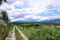
Cross the Baillestavy road (D 25) at an altitude of 363 metres. Continue straight on through this lovely area of orchards. Water flows freely here thanks to the numerous canals in the area.
Ignore the first road on the left (D 25) and turn right at the next junction, heading towards the viewpoint, to reach the car park and Joch Town Hall (S/E).

 Visorando Member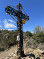
 Moderate
 Easy
Easy  Association / Club / Walk leader