


 Country:

 City:


Start from the Route du Col des Prés (alt. 1,090 m). There is a small car park on the right as you drive up from Aillon-le-Jeune.
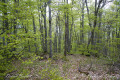
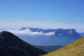
(S/E) Head towards the wooden sign at the start of the path indicating the Col de la Verne. A well-marked path through the forest with views over the Val d’Aillon, Mont Colombier and the Arclusaz. You’ll reach the Replat chalets, which are in ruins and particularly visible from the return path.
(1) Keep left at the fork, following the sign pointing towards the Col de la Verne: marked with a green sign with a yellow stripe. You’ll reach the pass after taking a 90° left-hand bend along the path.
(2) Walk back about sixty metres, take the ascending path on the right, then keep left at the three-way junction to descend into the Combe de la Verne until you reach the forest track.
(3) Follow this track to the start of the path leading down to Rocquerand.
(4) Turn right onto this path, pass the junction with the path coming down from the Combe de la Verne and continue to a fork in the path: there is a sign pointing to the Chalets du Replat.
(5) Turn right to follow the path which climbs, at times steeply, to the ruins of the chalets: once again, you can enjoy the view over the Val d’Aillon, Mont Colombier and L’Arclusaz. At the top of the hill, you’ll come across the ruins of the chalets. Join the ascending path.
(1) Head left and follow this path in the opposite direction to the Route du Col des Prés, then return to the car park (S/E).
 Visorando Member

 Tourism professional
 Very difficult

 Easy

