Country:

 City:
City:


Park near the motorhome site, which is on the left-hand side of the forest road 1.7 km after the Chartreuse d’Aillon. (Drive carefully; the road is winding and narrow).
(S/E) Start the walk by continuing along the forest road towards the Chalet de Praz Gelaz.
(1) Once past the last car park and then the Torrent de la Fullie, turn left onto the path which crosses a cow pasture (make sure you close the gates or fence handles properly behind you). Follow the track. (On the day I did this walk, there were cows without a guard dog).
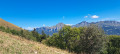
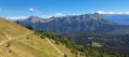
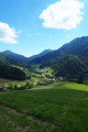
Head up towards the woodland, which you will cross. Continue along this path, using the steps built into the slope to reach the Col de la Fullie, from where you will catch sight of the first chalets below the summit of the Colombier d’Aillon. You may be lucky enough to spot a few chamois or ibex playing on the cliffs, or to see vultures or bearded vultures flying overhead.
(2) Head left up the track across the meadow towards the Chalets de la Fullie.
(3) Walk past the chalets, then take the path on your left for a few hundred metres.
(4) When you reach the small pass, leave the flat path and head up into the clearing opposite. You will then tackle a steep climb to the north-west until you reach the hairpin bend, which marks the end of the most strenuous part of the climb.
(5) Continue left, first uphill, then slightly downhill and slightly uphill again, until you reach the 4x4 track.
(6) Take the track on your right, pass the first hairpin bend and carry on to the Col de la Cochette.
(7) From the Col de la Cochette, the more adventurous can pop over to the Chalet de Rossane for a spot of roe deer spotting. (Watch out for the herding dogs.) Turn back to the previous junction.
(6) Head down to the right along the stony, steep track, with a few alternative routes available for those with the strongest knees. It’s a long descent. Return to the 4x4 track and follow it down to a fork.
(8) Take the forest road on the left, which climbs slightly, then head back down to a crossroads. The motorhome car park is on the right after the hairpin bend by the forest hut (S/E).
 Visorando Member
 Difficult
 Easy
Easy 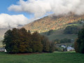
 Tourism professional
 Extremely difficult
 Very difficult