


Refine your search for walks in Butte de Montautour
Butte de Montautour walks


 Montautour Rock
 Local authority
 8.00 mi
 +390 ft
 -367 ft
 4h 00
 Moderate
 Departure from Montautour (Ille-et-Vilaine)
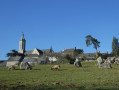
Here is a route for those who enjoy small, tarmac-surfaced country roads. Nevertheless, the verges are wide enough that, very often, you can walk on soft ground. It is also hilly enough to offer beautiful views of the surrounding countryside at certain points.
The Rocher route in the Vitré Communauté guidebook
Walks near Butte de Montautour
From Vitré to Argentré-du-Plessis via the Valière lake
 13.51 mi
+377 ft
-390 ft
6h 35
 Difficult
Departure from Vitré (Ille-et-Vilaine)
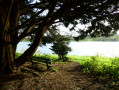
This route is the first stage of a 96 km circular through the Vitré countryside. Consisting mainly of sunken lanes, this route will take you, among other places, to the Château des Rochers-Sévigné and the Valière lake.