Roche Tabot

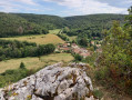
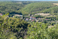
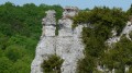
A short, shaded walk along paths that are sometimes little-used, offering a beautiful view of Val-Suzon from Roche Tabot.

Details

42551823
Creation:
Last update:
Last review:
  • Walking
    Activity: Walking
  • ↔
    Distance: 3.16 mi
  • ◔
    Average duration: 1h 55 
  • ▲
    Difficulty: Moderate

  • ⚐
    Back to start: Yes
  • ↗
    Ascent: + 502 ft
  • ↘
    Descent: - 509 ft

  • ▲
    Highest point: 1,575 ft
  • ▼
    Lowest point: 1,175 ft
  • ⚐ Country: France
  • ⚐ City: Val-Suzon (21121)
  • ⚑
    Start/End: N 47.412411° / E 4.90297°
  • ❏
    IGN map(s): Ref. 3022ET
  • Hour-by-hour weather

Photos

Description of the walk

Park in Val-Suzon Bas, on Rue de Sainte-Foy, below the church.

(S/E) Take Rue de l’Église northwards, up a steep incline. It turns into a track, then a path that veers slightly to the left, through a hedge of trees between fields (a section that is not well maintained). Continue along the field track, which eventually descends slightly to reach the top of Combe Peulnay.

(1) Turn left to descend Combe Peulnay along a good path, join the Grande Combe at the junction with a path on the right, and continue for a few more metres.

(2) Take an ascending path on the right (in late summer 2023, a fallen tree was blocking the way at the start of the path) and arrive at a barbed-wire fence.

(3) Cross it and walk along the field towards the south. When you reach a track, cross the fence again on the left, then continue slightly to the left until you reach a good, straight track through the woods.

(4) Take this path, heading south-east, until you reach a T-junction.

(5) Carry on straight ahead along this path; at the end, take the path on the left, and 50 metres further on, turn right, heading slightly downhill to La Roche Tabot.

(6) Turn back and return to the previous T-junction you passed on the way out.

(5) Turn right onto the path through the wasteland. Shortly afterwards, turn left and head steeply downhill to reach the Grande Combe.

(7) Follow it down to the right along a good path which becomes Rue des Combes. When you reach Rue de l’Église, walk up it for a few metres to rejoin Rue de Sainte-Foy and the car park (S/E).

Waypoints

  1. S/E : mi 0 - alt. 1,181 ft - Car park on Rue de Sainte-Foy
  2. 1 : mi 0.97 - alt. 1,549 ft - Top of the Combe Peulnay
  3. 2 : mi 1.4 - alt. 1,388 ft - Grande Combe
  4. 3 : mi 1.54 - alt. 1,493 ft - End
  5. 4 : mi 1.76 - alt. 1,532 ft - Start of the straight path
  6. 5 : mi 2 - alt. 1,539 ft - Junction. Return to the viewpoint
  7. 6 : mi 2.23 - alt. 1,483 ft - Roche Tabot viewpoint
  8. 7 : mi 2.8 - alt. 1,273 ft - Grande Combe
  9. S/E : mi 3.16 - alt. 1,184 ft - Car park on Rue de Sainte-Foy

Worth a visit

Roche Tabot viewpoint: lovely view over Val-Suzon.

Reviews and comments

3.7 / 5
Based on 5 reviews

Reliability of the description
4 / 5
Ease of following the route
4 / 5
Route interest
3.2 / 5
pascal21850
pascal21850
• Edited:

Overall rating : 4.3 / 5

Date of your route : Mar 10, 2025
Reliability of the description : ★★★★★ Very good
Ease of following the route : ★★★★★ Very good
Route interest : ★★★☆☆ Average
Very busy route : No

Enjoy your walk through the woods and fields. It’s a peaceful route, with a lovely view of Val Suzon from the Roche Tabourot. Watch out for brambles on part of the route. The perfect distance for an afternoon walk (2½ hours).

Machine-translated

kiara21000
kiara21000

Overall rating : 3.7 / 5

Date of your route : Feb 24, 2025
Reliability of the description : ★★★★☆ Good
Ease of following the route : ★★★★☆ Good
Route interest : ★★★☆☆ Average
Very busy route : No

Rough tracks rather than proper paths along the edges of fields. Make sure you wear trousers, as there are thorns and even barbed wire to watch out for!
There really is a lovely view from Roche Tabourot, but apart from that, nothing particularly interesting… We added a circular route to the route, along some more pleasant paths.
At least we were able to go for a walk this Sunday without coming across any hunters! That’s a plus!

Machine-translated

bernardcadiou
bernardcadiou

Overall rating : 4.3 / 5

Date of your route : Jan 11, 2024
Reliability of the description : ★★★★☆ Good
Ease of following the route : ★★★★☆ Good
Route interest : ★★★★★ Very good
Very busy route : No

A lovely walk.
A few improvements are needed regarding the upkeep of the path between the rows of trees, and some paintwork is required at the junctions – particularly to mark the route from the forest to the fence above the fields.

Machine-translated

mille1000
mille1000

Overall rating : 4 / 5

Date of your route : Dec 06, 2023
Reliability of the description : ★★★★☆ Good
Ease of following the route : ★★★★☆ Good
Route interest : ★★★★☆ Good
Very busy route : No

Enjoy a long walk covering around ten kilometres.
Thank you.

Machine-translated

Sago
Sago
• Edited:

Overall rating : 2.3 / 5

Date of your route : Nov 23, 2023
Reliability of the description : ★★★☆☆ Average
Ease of following the route : ★★★☆☆ Average
Route interest : ★☆☆☆☆ Very disappointing
Very busy route : No

There’s no point in crossing fields… Etc
The only highlight is the view of Tabot Rock

Machine-translated

Other walks in the area

For more walks, use our search engine .

The GPS track and description are the property of this route's author. Please do not copy them without permission.