The springs on the hillsides in Darois

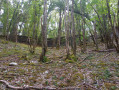
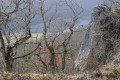
A not-too-long walk to explore the three springs on the hillsides to the east of Darois, alternating between the GR®2 and the GR®7.

Details

69351197
Creation:
Last update:
Last review:
  • Walking
    Activity: Walking
  • ↔
    Distance: 4.65 mi
  • ◔
    Average duration: 2h 40 
  • ▲
    Difficulty: Easy

  • ⚐
    Back to start: Yes
  • ↗
    Ascent: + 630 ft
  • ↘
    Descent: - 630 ft

  • ▲
    Highest point: 1,699 ft
  • ▼
    Lowest point: 1,125 ft
  • ⚐ Country: France
  • ⚐ City: Darois (21121)
  • ⚑
    Start/End: N 47.39165° / E 4.94181°
  • ❏
    IGN map(s): Ref. 3022ET
  • Hour-by-hour weather

Description of the walk

 Park in the small car park on Rue du Château.

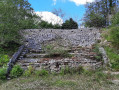
(S/E) Facing the castle, turn left, head down the cul-de-sac on the left, then take the path entrance on the left: a red sign indicates the GR®. Continue to the ruins of the old campsite.

(1) Leave the GR®, which heads down to the right, and take the path opposite, which climbs slightly through the woods. 

(2) At the junction of several paths, first turn left then right to follow a track. Stay on this path, ignoring all other junctions, and cross Champ Barthélémy to join the GR®2.

(3) Follow this path as it descends slightly to the right until you reach a junction where a sign marks the entrance to the Val Suzon Nature Reserve.

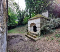
(4) Turn right here and head down into the woods, staying on the GR®2. Follow it as it veers to the left, taking care in wet weather on this stony, slippery descent. You’ll reach the Fontaine de la Trouvée, which has a stone basin built to collect the water. 

(5) Cross the fountain and continue along the GR®. Then let the path lead you down into the valley and back up the wide track on the left, to rejoin the main path you left at the edge of the nature reserve.

(6) Head down to the right along this wide, straight path through the forest. At the bottom, head down to the right and reach the Source des Chéneaux, which is signposted. This descent is steep and slippery in wet weather: a sign explains how these limestone springs are formed.

(7) From the spring’s basin, head down the main path that forms part of the GR® 7. Follow it back up to the right into the Combe des Chéneaux: this section climbs gently and is not difficult. You’ll reach a large junction in the valley with signposts.

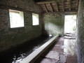
(8) Let the GR®2 head off to the right and stay on the GR®7 by taking the valley on the left. Continue uphill: be careful, as there are a few slightly steep sections and fallen trees, until you reach the Lavoir de Darois, situated slightly set back to the left of the path. A beautiful stone structure, perfectly restored, which collects water from the small cliff.

(9) Return to the GR®7 path and turn left to complete the climb and reach the ruins of the old campsite.

(1) Once back at this point, turn left to reach the end point at the small car park on Rue du Château (S/E). 

Waypoints

  1. S/E : mi 0 - alt. 1,637 ft - Car park on Rue du Château
  2. 1 : mi 0.35 - alt. 1,631 ft - Ruins of the campsite, junction of the circular loop
  3. 2 : mi 0.54 - alt. 1,657 ft - Forest junction
  4. 3 : mi 1.09 - alt. 1,699 ft - GR 2 junction
  5. 4 : mi 1.32 - alt. 1,650 ft - Boundary of the nature reserve
  6. 5 : mi 1.78 - alt. 1,473 ft - Fontaine de la Trouvée
  7. 6 : mi 2.15 - alt. 1,581 ft - Large forest clearing
  8. 7 : mi 2.82 - alt. 1,155 ft - Source des Chénaux
  9. 8 : mi 3.44 - alt. 1,234 ft - The two GR routes split here
  10. 9 : mi 4.1 - alt. 1,545 ft - Darois wash house
  11. S/E : mi 4.65 - alt. 1,637 ft - Car park on Rue du Château

Notes

I recommend following the route described on rainy or damp days, as the descent from the Lavoir de Darois is the most difficult.
There is a bread and cheese vending machine in Darois, as well as a restaurant.

Worth a visit

Darois Aerodrome.
Dijon is 15 km away.

Always be cautious and plan ahead when you're outdoors. Visorando and the author of this route cannot be held responsible for any accidents occurring on this route.

The GR® and PR® markings are the intellectual property of the Fédération Française de Randonnée Pédestre.

Reviews and comments

4.8 / 5
Based on 2 reviews

Reliability of the description
5 / 5
Ease of following the route
5 / 5
Route interest
4.5 / 5
MichelRando21
MichelRando21

Thank you, that's very kind of you! Yes, it's an easy hike to discover some beautiful spots on the outskirts of Dijon.
Best regards, MichelRando21

Machine-translated

NanaDidi
NanaDidi

Overall rating : 5 / 5

Date of your route : Oct 09, 2025
Reliability of the description : ★★★★★ Very good
Ease of following the route : ★★★★★ Very good
Route interest : ★★★★★ Very good
Very busy route : No

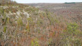
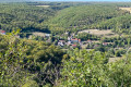
It is a pleasant walk through a beautiful forest, with occasional lovely views.
A few comments:
- the campsite is no longer really in ruins but is being renovated
- the springs have not yet recovered from the summer heatwave, but we had no problem accessing them
- the description is remarkably accurate.
In short, thank you!

Machine-translated

GAGNAUX
GAGNAUX
• Edited:

Overall rating : 4.7 / 5

Date of your route : Feb 24, 2025
Reliability of the description : ★★★★★ Very good
Ease of following the route : ★★★★★ Very good
Route interest : ★★★★☆ Good
Very busy route : No

A lovely, enjoyable walk, well described in the information sheet provided; avoid walking in the rain as it can be slippery. No trouble finding parking spaces at the start.

Machine-translated

Other walks in the area

For more walks, use our search engine .

The GPS track and description are the property of this route's author. Please do not copy them without permission.