Country:
 City:
City:


Park in the car park alongside the D971, heading downhill from Dijon.
(S/E) Take the path at the end and follow the GR®2 trail (red and white markings).
(1) From the GR®2, turn right, following the markings and signposts for Le Châtelet.
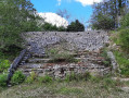
(2) At Le Châtelet, admire the magnificent rampart, which was reconstructed in the second half of the 20th century. Several information boards explain the site, and a scale model reconstruction is on display – for enthusiasts – at the Dijon Archaeological Museum. Then rejoin the GR® trail by turning right into the woods. Follow it to a clearly marked junction at the end of the Combe Renevey (signs).
(3) Stay on the GR®2 trail, which soon takes on the appearance of a field path, winding through copse and farmland.
(4) Leave the GR®2 and turn left towards the valleys. At the next junction, stay on the path on the left; the path shown on maps above the Combe du Diable no longer exists. Continue in this direction until you reach a wide path; the yellow-marked path you should follow is 5 m to the left and downhill, but first head right towards the viewpoint, about 300 m away along a narrow track.
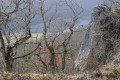
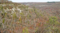
(5) A viewpoint overlooking the Combe du Diable, one of the least well-known in the whole range, overlooking the Suzon. Retrace your steps to find the path leading back to the start and, a little further on, turn left onto the yellow-marked path through the trees, without continuing the descent. Continue along this section, which follows limestone outcrops or stony sections above the valleys and offers numerous views.
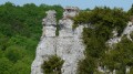
(6) From this point, there’s a stunning view of the Éperon Barré du Châtelet opposite and to the left, and of the Plain d’Ahuy and the plateaus further to the right. Follow this balcony-like path until you reach a section of the trail through the woods that you’ve already walked along.
(3) Turn right towards Le Châtelet but, at the end, carry on straight ahead to explore the site of the fortified spur on the GR®2. You get the best sense of this defensive site in autumn or winter, when the leaves have fallen. The views are magnificent in the first half of the route, on the north-facing slope.
(7) At the end of the fortified spur, continue the walk along the GR®2 path by turning left and head back towards Le Châtelet, which is 50 metres to the left at the end of the path.
(2) Join the GR®2 again andenjoy the many views of the village of Val Suzon Haut and the Suzon valley.
(1) Continue straight on to reach the car park (S/E).
 Visorando Member
 Moderate