Country:
 City:
City:


Park your car opposite Val Suzon Town Hall in Val-Suzon Haut.
(S/E) Walk straight up to the D971 (Route de Troyes), which winds down from the Étaules and Darois plateau.
(1) Cross it carefully and continue straight ahead along Rue de la Vieille Route, which climbs through the fields and turns into a track. Follow this track for a further 200 metres, until you reach a three-way junction.
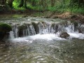
(2) Take the path on your left that leads down towards Val-Suzon Bas. Cross the bridge over the Suzon (which is often dry in summer), then join the D7 (Route de Messigny).
(3) Cross it carefully, take the small street opposite, then head right towards Saint-Nicolas Church.
(4) Before you reach it, turn left onto Rue des Combes and walk up the Grande Combe for about 1.5 km.
(5) Turn sharply left to follow a narrow path, somewhat overgrown with vegetation, and head up towards the plateau until the path ends at the edge of a field.
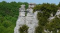
(6) Go under the fence and walk along the edge of the field until you rejoin the path that heads into the woods on your left, towards Val Suzon. Follow this straight path for about 700 m, turn left at a right angle, then take the path on the right leading to the Roche Tabot viewpoint: enjoy the magnificent view over Val Suzon.
(6) Retrace your steps and continue on the right, along a slightly steep path that winds its way down until it joins a small road called Rue de la Côte à la Vache, which overlooks the Route de Messigny.
(8) Take this street on your right, then continue right onto the D7 to join the D971 at the bridge over the Suzon. Carry on to the right until you reach the pedestrian crossing, cross over to take the footbridge over the Suzon, then turn right towards the town hall to return to your car (S/E)
 Visorando Member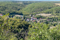

 Moderate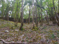
 Difficult