Refine your search for walks in Roche du Chardonnet
Roche du Chardonnet walks


 Mont Thabor from the Chalets de Laval
 Visorando Member
 11.79 mi
 +4,416 ft
 -4,403 ft
 10 hrs
 Very difficult
 Departure from Névache (Hautes-Alpes)
It's a round trip, but a magnificent one, where the trail winds its way among high-altitude lakes and takes you to the highest point, the area's iconic summit: Mont Thabor.
You will sometimes follow theGR® trail, sometimes unmarked paths, marked by almost too many cairns. Trust your map and your sense of direction, but still check your position before entering dangerous areas.
4 days in the Clarée Valley (Cerces and Thabor)
 30.15 mi
+12,549 ft
-12,520 ft
4 days
Very difficult
Departure from Névache (Hautes-Alpes)
30.15 mi
+12,549 ft
-12,520 ft
4 days
Very difficult
Departure from Névache (Hautes-Alpes)
This 4-day circular bivouac is for experienced hikers.
It does, of course, follow sections of marked trails (GR®,GRP®), but the nature of the terrain when off-trail requires extreme caution (rock falls) and a solid knowledge of navigation, especially in unpredictable weather. The daily summit climb is obviously dependent on your equipment (crampons?), weather conditions (snowfields?) and your physical fitness.
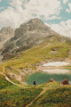
Mont Thabor and its twenty lakes
 14.99 mi
+5,036 ft
-5,013 ft
10 hrs
Very difficult
Departure from Névache (Hautes-Alpes)
14.99 mi
+5,036 ft
-5,013 ft
10 hrs
Very difficult
Departure from Névache (Hautes-Alpes)
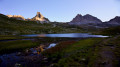
This splendid alternative to the usual linear route takes in more than 20 lakes around the Mont Thabor viewpoint.
Setting off early in the morning allows you to avoid the crowds and enjoy the many sunrises behind the peaks.
A short section of the walk is off-trail and requires navigating by sight, but it’s easy to find your way.
Lac Blanc - Refuge des Drayères
 7.21 mi
+2,339 ft
-3,763 ft
5h 20
7.21 mi
+2,339 ft
-3,763 ft
5h 20
 Difficult
Departure from Névache (Hautes-Alpes)
Difficult
Departure from Névache (Hautes-Alpes)
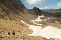
A day at high altitude in a rocky landscape, starting with the ascent of Mont Thabor (3,178 m), followed by a long descent to the Refuge des Drayères.
Lacs de la Madeleine - Lac Lavoir via Mont Thabor
 6.38 mi
+2,283 ft
-3,448 ft
7 hrs
Very difficult
Departure from Névache (Hautes-Alpes)
6.38 mi
+2,283 ft
-3,448 ft
7 hrs
Very difficult
Departure from Névache (Hautes-Alpes)
Third day of the circular with ascent of Mont Thabor (highest point of the route) via the oldGR® trail along the Roche du Chardonnet ridge and the Valmeinier Glacier, which presents certain difficulties compared to the newGR® route.
As with the other days of the circular, this route is intended for very experienced hikers who are accustomed to high mountains.
Walks near Roche du Chardonnet
Lac des Méandes - Mont Thabor - Valfréjus
11.02 mi
+2,379 ft
-5,850 ft
7h 10
Difficult
Departure from Névache (Hautes-Alpes)
The hike starts after the bivouac at Lac des Méandes (below Col des Méandes) to reach the summit of Mont Thabor and admire the 360° view of the mountains. Then return via the Refuge du Mont Thabor and descend to Valfréjus.
Lac Lavoir - Laval car park via the Pic du Lac Blanc
 8.57 mi
+2,746 ft
-3,556 ft
8 hrs
Very difficult
Departure from Névache (Hautes-Alpes)
8.57 mi
+2,746 ft
-3,556 ft
8 hrs
Very difficult
Departure from Névache (Hautes-Alpes)
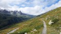
Last day of the circular, returning to the Laval car park via the Col du Vallon and the Pic du Lac Blanc, from where you can see the route of the previous three days.
Refuge des Drayeres – Valmeinier 1,800
 10.62 mi
+2,500 ft
-3,848 ft
7h 05
Difficult
Departure from Névache (Hautes-Alpes)
10.62 mi
+2,500 ft
-3,848 ft
7h 05
Difficult
Departure from Névache (Hautes-Alpes)
The final stage of this route runs from the Refuge des Drayeres in the Clarée Valley to the resort of Valmeinier. You will pass the Deuil des Rochilles before emerging onto three magnificent high-altitude lakes: Lac de la Clarée, Lac Rond and Lac du Grand Ban. Next comes the ascent of the Col des Plagnettes, followed by the descent with the rocky ridge of the Grande Paré to your left and the Aiguille Noire to your right, then the ascent of the Pas des Griffes, before descending back to Valmeinier, the end point of this 5-day route.
Refuge des Drayères – Pont de l’Alpe
 9.08 mi
+2,014 ft
-3,563 ft
5h 55
9.08 mi
+2,014 ft
-3,563 ft
5h 55
 Moderate
Departure from Névache (Hautes-Alpes)
Moderate
Departure from Névache (Hautes-Alpes)
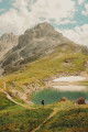
3rd and final stage. Starting from the Refuge des Drayères, head up to the source of the Clarée and return to Pont de l’Alpe via the Col de la Ponsonnière. A tour of the Massif des Cerces taking in numerous lakes, each more beautiful than the last: in turn, the Clarée, Rond, Grand Ban, Cerces, Ponsonnière and, finally, the Grand Lac.
Refuge de Terre Rouge - Le Prec
 8.76 mi
+2,165 ft
-3,848 ft
5h 55
Difficult
Departure from Valmeinier (Savoie)
8.76 mi
+2,165 ft
-3,848 ft
5h 55
Difficult
Departure from Valmeinier (Savoie)
This is the last stage of this three-day route, with one last beautiful climb. A final alpine pass, a few lakes, and the return via the Fenêtre du Prec to round off this lovely Tour du Thabor.
From the Terre Rouge Refuge to the Mont Thabor Refuge
 Association / Club / Walk leader8.39 mi
+3,740 ft
-2,651 ft
7h 05
Difficult
Departure from Valmeinier (Savoie)
Association / Club / Walk leader8.39 mi
+3,740 ft
-2,651 ft
7h 05
Difficult
Departure from Valmeinier (Savoie)
Second stage of the short Mont Thabor circuit hike
From the Mont Thabor Refuge to Grange Bernard
10.96 mi
+2,671 ft
-5,587 ft
7h 20
Difficult
Departure from Modane (Savoie)
Third and final stage of the short Mont Thabor circuit hike.
Thabor Refuge - Terzo Alpini Refuge
 10.06 mi
+2,690 ft
-5,069 ft
7h 00
Difficult
Departure from Modane (Savoie)
10.06 mi
+2,690 ft
-5,069 ft
7h 00
Difficult
Departure from Modane (Savoie)
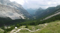
The second stage of this route is one of the most beautiful, thanks to the panoramic views and, above all, the ascent of Mont Thabor to an altitude of nearly 3,200 metres. Be mindful of the temperature and altitude. You’ll have your eyes fixed on the summit of Thabor, one of the day’s main objectives. The route takes you through the Peyron valley, with Thabor opposite, the Cheval Blanc to the right, Lake Peyron, the Grand Seru, the Col du Méandre, the ascent of Thabor, and then the descent towards the Granges de la Vallée Étroite.
Mont Thabor Refuge - Terre Rouge Refuge
 8.21 mi
+2,638 ft
-3,740 ft
6h 05
Difficult
Departure from Modane (Savoie)
8.21 mi
+2,638 ft
-3,740 ft
6h 05
Difficult
Departure from Modane (Savoie)
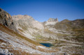
The central stage of the tour, with the ascent of Mount Thabor, the highest point of the tour and offering exceptional panoramic views. This stage requires good mountain walking skills, particularly for the descent into the Terre Rouge valley.