


Refine your search for walks in Roc de Trabinet
Roc de Trabinet walks


 The summit of Mentiès
 Visorando Member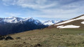
 6.04 mi
 +3,068 ft
 -3,068 ft
 5h 25
5h 25
 Difficult
 Departure from Saurat (Ariège)
This gentle peak is not notable for its modest altitude but nevertheless offers a superb vantage point over the Trois Seigneurs massif, the Montagne de Tabe and far beyond. After an initial section through a beautiful beech forest, the long climb up the broad grassy ridge allows you to fully enjoy the scenery. However, you’ll need patience and perseverance, as the slope is steep from start to finish with very little respite, except at the Col de Carlong.
Walks near Roc de Trabinet
Port de Lers–Bassiès Refuge via Pas du Roc, Étang de Labant, Col Fouzès
 7.46 mi
+2,927 ft
-2,493 ft
6h 00
Difficult
Departure from Suc-et-Sentenac (Ariège)
7.46 mi
+2,927 ft
-2,493 ft
6h 00
Difficult
Departure from Suc-et-Sentenac (Ariège)
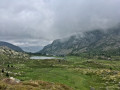
The first day takes you to the Refuge de Bassiès, passing huts, a valley, mountain passes, an old mine, a pond, and various cols and mountain passes. The stretch from the Col de las Fouzès to the Port de Bassiès is particularly beautiful.The route follows paths and tracks that are difficult due to their terrain (rock, scree, unmarked).See practical information * From (3) to (6) an unmarked path with gradients of 15% and 25%, with the presence of Patou dogs from (4). From (12) to (18) a marked path with gradients of 16% to 30%.The GPX track is necessary in places to avoid any confusion, as the route does not necessarily follow GR®, GRP® or PR® trails.Allow around 6 hours for the walk.
Bassiès-Port de Lers mountain hut via the Étang d’Alate and Mont Ceint
 3.97 mi
+1,883 ft
-2,313 ft
3h 30
Difficult
Departure from Auzat (Ariège)
3.97 mi
+1,883 ft
-2,313 ft
3h 30
Difficult
Departure from Auzat (Ariège)
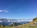
Before heading back, there is the option of a return trip to the Étang de Bassiès from the refuge, leaving some of your luggage at the refuge.A fairly short second stage, with two steep ascents (19% to 38%): one from the Refuge de Bassiès to the Port de Bassiès, and the even more challenging one from the Port de Saleix to the Pic de Girantès or Mont Ceint. In fact, it is a rather gruelling, up-and-down stage, classified as difficult. The ascents and descents are on challenging trails (pebbles, rocks, scree). The whole day is spent in open country with stunning panoramic views. The route passes the beautiful Étang d’Alate.The relative altitude, between 1,520 m and 2,100 m, means this day’s walk is feasible even in the height of summer.
Étang du Rouch via Étang de Gnioure
 8.63 mi
+6,322 ft
-1,004 ft
10 hrs
8.63 mi
+6,322 ft
-1,004 ft
10 hrs
 Very difficult
Departure from Siguer (Ariège)
Very difficult
Departure from Siguer (Ariège)
Climb the ridge marking the border with Andorra to the beautiful Étang du Rouch, which seems to sit at the foot of the Pic de Font Blanca, passing by the majestic Étang de Gnioure and its lovely, long valley:
- numerous waterfalls during the fairly steep and very stony climb up to the Peyre bridge;
- a short, slightly vertiginous ledge section to reach the immense Étang de Gnioure;
- a long path running alongside the lake, then the stream, and winding its way into the valley;
- a hillside climb that starts off fairly gentle but ends up quite steep, leading up to the Étang du Rouch.
Pradières d’en haut car park – Étang d’Izourt – Refuge du Fourcat
 4.80 mi
+4,298 ft
-75 ft
5h 55
Difficult
Departure from Auzat (Ariège)
4.80 mi
+4,298 ft
-75 ft
5h 55
Difficult
Departure from Auzat (Ariège)
First stage of the journey through the Haute-Ariège.
A beautiful, steady climb takes you to the Étang d’Izourt, steeped in human history.
This is followed by a gruelling climb up to the Orri de la Caudière.
Once you’ve crossed the rustic footbridge, there’s another very steep climb up to the small Étang du Fourcat.
The rest of the route to the Étang du Fourcat refuge is more gentle.
A very steep climb to the Fourcat refuge with an average gradient of 17 per cent.
Please note: from the Étang d’Izourt to the refuge, the gradient is 24 per cent.
Marc's Lodge - Refuge du Pinet
4.31 mi
+4,012 ft
-36 ft
5h 30
Difficult
Departure from Auzat (Ariège)
The first stage of the journey, the shortest and easiest, to warm up your legs, passing through the Bois de Fontanal and the Étang Sourd to the Refuge du Pinet. The elevation gain is still significant.
Guzet viewpoint from Guzet Neige
 8.03 mi
+1,490 ft
-2,641 ft
5h 00
8.03 mi
+1,490 ft
-2,641 ft
5h 00
 Moderate
Departure from Ustou (Ariège)
Moderate
Departure from Ustou (Ariège)
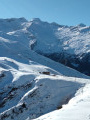
A hike best undertaken in July–August, when the chairlifts from Guzet Neige are operating, for a touch of originality. The first section (from the start (S) at the top of the chairlift to (1) and back) is optional and shortens the walk by an hour, but it’s a shame to miss it as the view over the Cirque de Cagateille is well worth it!
A varied walk without any major difficulties, offering magnificent views, with some sections in the open and others in the shade, and a steady alternation of descents and ascents.