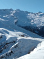
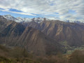
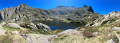
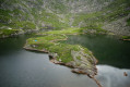
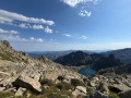
Guzet viewpoint from Guzet Neige

A hike best undertaken in July–August, when the chairlifts from Guzet Neige are operating, for a touch of originality. The first section (from the start (S) at the top of the chairlift to (1) and back) is optional and shortens the walk by an hour, but it’s a shame to miss it as the view over the Cirque de Cagateille is well worth it!
A varied walk without any major difficulties, offering magnificent views, with some sections in the open and others in the shade, and a steady alternation of descents and ascents.

Details

n°37516947
Creation:
Last update:
Last review:
  • Walking
    Activity: Walking
  • ↔
    Distance: 8.03 mi
  • ◔
    Average duration: 5h 00 
  • ▲
    Difficulty: Moderate

  • ⚐
    Back to start: No
  • ↗
    Ascent: + 1,490 ft
  • ↘
    Descent: - 2,641 ft

  • ▲
    Highest point: 5,719 ft
  • ▼
    Lowest point: 4,117 ft

Photos

Description of the walk

Access by car: park at the Guzet-Neige resort. The route starts at the top station of the Picou chairlift.

(S) Walk down to the Beauregard chalet via the Col d’Escots.

(1) Continue straight on along the track for 30 to 40 minutes. This first section is a return route, so it is optional. (The road is in the sun, so bring something to protect yourself from the sun). Reach the magnificent viewpoint over the Cirque de Cagateille. A blue shelter provides a place to take a break in the shade.

(2) Return via the same route to the Chalet de Beauregard.

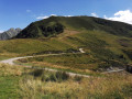
(1) Take the mountain pasture path which descends behind the chalet to the right of the track. From there, follow the yellow markings until the end of the walk. The path descends gently and offers some lovely views, then enters a forest providing a pleasant, shaded stretch.
On emerging from the forest, continue along the path to the ‘Combe de Fougarolle’ sign.

(3) Follow the path to the Combe de Crespies. The elevation changes steadily as the route alternates between open and shaded sections.

(4) From the Combe de Crespies, follow the path along the edge of the forest, which climbs occasionally. You’ll reach the go-kart descent track at the ‘Prat Mataou’ sign.

(5) Take care! Follow this track down to a chairlift area.

(6) Leave the kart track at the ‘Les Souleillous’ sign and continue following the yellow markings. This final section is the most challenging, with steep climbs through the fields (ski runs in winter). Take care not to miss, after a particularly steep climb, a path branching off to the right towards Bois de Toujech.

(7) Follow this path as it descends gently through the forest to the road. Walk a short distance along the road to the right until you reach signpost 36.

(8) Follow the path to the right. Continue down through the woods, with a few occasional climbs. Cross a field to reach a road. Cross the road and head uphill towards the chalets to reach the resort car park (E).

Waypoints

  1. S : mi 0 - alt. 5,719 ft - Top station of the Picou chairlift
  2. 1 : mi 0.45 - alt. 5,331 ft - Chalet de Beauregard - Col d'Escots (1623m)
  3. 2 : mi 1.58 - alt. 5,676 ft - Viewpoint over the Cagateille cirque
  4. 3 : mi 4.24 - alt. 4,636 ft - Exit from the forest
  5. 4 : mi 4.9 - alt. 4,537 ft - Combe de Crespies (sign)
  6. 5 : mi 5.38 - alt. 4,564 ft - Prat Mataou (signpost)
  7. 6 : mi 5.79 - alt. 4,213 ft - Les Souleillous (signpost)
  8. 7 : mi 7.07 - alt. 4,570 ft - Bois de Toujech (signpost)
  9. 8 : mi 7.74 - alt. 4,610 ft - Sign 36
  10. E : mi 8.03 - alt. 4,593 ft - Resort car park

Notes

Summer hike, July–August: make sure the Guzet chairlifts are operating before setting off.
Chairlift tickets: pedestrian access, up-only: €5 for adults, €3 for children – 2023 prices.

Reviews and comments

4 / 5
Based on 2 reviews

Reliability of the description
4 / 5
Ease of following the route
4 / 5
Route interest
4 / 5
Core In
Core In

Overall rating : 3.7 / 5

Date of your route : Dec 28, 2025
Reliability of the description : ★★★★☆ Good
Ease of following the route : ★★★★☆ Good
Route interest : ★★★☆☆ Average
Very busy route : Yes

Surely very nice in summer, I did this hike during the December snowfall, with the resort open... I didn't exactly follow the hike because some sections were closed due to too much snow and avalanche risk...So I climbed up to the Col d'Escot and on to the Picou de la Mire. It was very pretty once I got to the top, with a 360° view, but several sections were on ski slopes, which was a bit disappointing... There were obviously a lot of people, but I'd do it again in better weather... On the other hand, apart from a few sections, it wasn't too difficult a climb, so it was perfect for my first day of getting back into shape...

Machine-translated

Odeli
Odeli

Overall rating : 4.3 / 5

Date of your route : Aug 14, 2023
Reliability of the description : ★★★★☆ Good
Ease of following the route : ★★★★☆ Good
Route interest : ★★★★★ Very good
Very busy route : No

We didn’t go to see the Cagateille cirque, which is mentioned at the start of the route, to cut down on the time, but it’s a very pleasant hike in the low mountains, even in the heat. Varied terrain, clear paths with views of the neighbouring peaks, meadows (lots of flowers) and woodland. A few fairly steep climbs… The idea of starting with the chairlift is brilliant! However, the start of the path isn’t obvious (or perhaps I just couldn’t spot the yellow markings at the start?): with the restaurant behind you, head down to the left of the ski lift structure, below the track leading to the restaurant, into a very green strip of land, almost like a bog. Head right towards the gap between two fence posts (first yellow marker) and go under the ski lift (a path trampled by animals).

Machine-translated

Other walks in the area

For more walks, use our search engine .

The GPS track and description are the property of this route's author. Please do not copy them without permission.