Rigole de la Montagne Noire and Bassin du Lampy Neuf

A circular trail taking in the Rigole de la Montagne Noire. You’ll also walk alongside the Bassin du Lampy, then return upstream along the Rigole past historic buildings.

Details

61623401
Creation:
Last update:
Last review:
  • Walking
    Activity: Walking
  • ↔
    Distance: 6.74 mi
  • ◔
    Average duration: 3h 15 
  • ▲
    Difficulty: Moderate

  • ⚐
    Back to start: Yes
  • ↗
    Ascent: + 164 ft
  • ↘
    Descent: - 154 ft

  • ▲
    Highest point: 2,234 ft
  • ▼
    Lowest point: 2,060 ft

Description of the walk

To park, you can use the small car park along the Rigole de la Montagne Noire: three to four spaces. There are also a few spaces on the second track on the right: you’ll need to drive on for about 50 metres.

(S/E) The walk starts on the other side of the D4. The route follows the course of the Rigole de la Montagne Noire. Head towards Lampy Vieux, go round the back of the buildings and you’ll reach the D4.

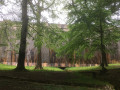
(1) Cross the road and take the path slightly to your right. There will be tall trees on your left and a sign pointing the way to the Bassin du Lampy Neuf.

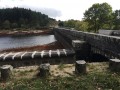
(2) Take the path on your right, which leads you directly to the dam.

(3) Continue along the path, keeping the dam on your left and walking alongside the reservoir: you do not have to follow the marked path all the way (choice of route).

(4) The path stops running alongside the reservoir and heads towards Le Lampiot.

(5) Cross through this hamlet via a path quite close to the houses: no access restrictions noted. Join the tarmac road, turn left and walk for about a hundred metres.

(6) Turn right, leaving the tarmac to follow a path through the forest.

(7) Head down to the right and cross a small bridge (small weir) to rejoin the Rigole de la Montagne Noire. There are a few old buildings to see, and it’s a lovely spot for a picnic if you fancy one, in the shade and coolness provided by the river and the little waterfall. Then continue to the right, following the Rigole. You’ll reach the beautiful little château at the Domaine de la Camigné.

(8) Enjoy the view: the château is private and entry to the grounds is prohibited. Resume the walk along the Rigole de la Montagne Noire.

(9) Cross the stream, then follow the route to the left to return to the car park (S/E).

Waypoints

  1. S/E : mi 0 - alt. 2,073 ft - Small car park - Rigole de la Montagne noire (cours d'eau) -
  2. 1 : mi 1.47 - alt. 2,064 ft - Le Lampy Vieux, D4 - Lampy (rivière) - Affluent du Fresquel
  3. 2 : mi 1.89 - alt. 2,064 ft - Junction towards the dam
  4. 3 : mi 2.03 - alt. 2,080 ft - Lampy Dam - Bassin du Lampy Neuf (Saissac)
  5. 4 : mi 2.83 - alt. 2,152 ft - Junction towards the Lampiot
  6. 5 : mi 3.11 - alt. 2,169 ft - Le Lampiot
  7. 6 : mi 3.44 - alt. 2,234 ft - Path on the right
  8. 7 : mi 4.03 - alt. 2,116 ft - Return to the Rigole de la Montagne Noire
  9. 8 : mi 5.95 - alt. 2,077 ft - Camigné Estate
  10. 9 : mi 6.59 - alt. 2,073 ft - Crossing the Rigole
  11. S/E : mi 6.74 - alt. 2,080 ft - Small car park

Notes

Please note: there is no mobile signal along most of the route (particularly at the Bassin du Lampy Neuf).

Estimated difficulty: moderate, due to the distance. However, there are no particular difficulties on the route, which is relatively flat. The descent via the forest path from (6) to return along the Rigole de la Montagne Noire is the only ‘difficulty’. Nevertheless, the route remains suitable for the whole family.

Reviews and comments

4 / 5
Based on 4 reviews

Reliability of the description
4.3 / 5
Ease of following the route
4 / 5
Route interest
3.8 / 5
Nono756
Nono756

Overall rating : 3.7 / 5

Date of your route : Jul 20, 2026
Reliability of the description : ★★★★☆ Good
Ease of following the route : ★★★★☆ Good
Route interest : ★★★☆☆ Average
Very busy route : No

Best done in summer, as the route is almost always in the shade

Machine-translated

lagardais
lagardais

Overall rating : 4.7 / 5

Date of your route : Aug 26, 2025
Reliability of the description : ★★★★★ Very good
Ease of following the route : ★★★★★ Very good
Route interest : ★★★★☆ Good
Very busy route : Yes

pleasant hike in general, but download the route beforehand as there is little internet connection.

Machine-translated

kevin72300
kevin72300

Overall rating : 5 / 5

Date of your route : Oct 02, 2024
Reliability of the description : ★★★★★ Very good
Ease of following the route : ★★★★★ Very good
Route interest : ★★★★★ Very good
Very busy route : No

A really lovely walk, between the river and the lake. The path is very well signposted – it’s hard to go wrong!
Good description!

Machine-translated

Giorgio0911
Giorgio0911

Hello,
When we arrived at the lake dam, there were no further signposts, so we couldn’t complete the circular route… We made up for it by walking round the lake (which was brilliant) and headed back the way we’d come.

Machine-translated

Larigolade
Larigolade

Your review isn’t very detailed – could you provide more information to help improve the description of the walk or the waypoints if necessary?

At what point is the route difficult to follow or the description unreliable?
(As for how interesting it is, everyone’s opinion is their own – it’s a fairly simple circular path but a pleasant one when it’s hot)

Machine-translated

Giorgio0911
Giorgio0911

Overall rating : 2.7 / 5

Date of your route : Sep 16, 2024
Reliability of the description : ★★★☆☆ Average
Ease of following the route : ★★☆☆☆ Disappointing
Route interest : ★★★☆☆ Average
Very busy route : No

Machine-translated

Other walks in the area

For more walks, use our search engine .

The GPS track and description are the property of this route's author. Please do not copy them without permission.