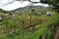
Queen of the Valleys in Courzieu

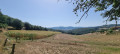
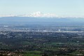
Starting from the hamlet of La Randonnière, this route will take you along the western slope of the commune of Courzieu, offering panoramic views stretching from the Brévenne valley to the Forez mountains. It’s also an opportunity to discover the Pomeyrieu Chapel along the way.

Details

10381516
Creation:
Last update:
Last review:
  • Walking
    Activity: Walking
  • ↔
    Distance: 4.82 mi
  • ◔
    Average duration: 3h 15 
  • ▲
    Difficulty: Moderate

  • ⚐
    Back to start: Yes
  • ↗
    Ascent: + 1,155 ft
  • ↘
    Descent: - 1,138 ft

  • ▲
    Highest point: 2,221 ft
  • ▼
    Lowest point: 1,207 ft

Description of the walk

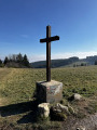
Coming from La Giraudière, park in the hamlet of La Randonnière, in the small square next to the wayside cross.

(S/E) With your back to the small square and the wayside cross on your left, start your walk by taking the Route de la Randonnière towards the hamlet of Le Maroge. Ignore two paths on the left.

(1) Take the path on your right, leaving the road to continue uphill. You’ll come out onto the Route de Pomeyrieux.

(2) Turn left. Admire the Chapel of Pomeyrieu, a building constructed at the end of theSecond World War. Feel free to push open the door and take a look inside. Then continue along the road towards Pomeyrieu. Leave the hamlet of George behind.

(3) Turn right towards the hamlet of Le Dalaire.

(4) In the centre of Delaire, take the small road on the left that leads uphill. This quickly turns into a footpath. Continue uphill along the path until you reach the area around Les Aguettants with its hillside ponds. You’ll cross the GR 7 at an elevation of 628.

(5) Follow theGR®7trail for about 70 metres. At the Y-junction, leave the trail by turning left. The path becomes a track, then a road as you reach Les Avergues. Leave the hamlet and you’ll come to a crossroads with a wayside cross on your left.

(6) Turn left, heading north. The path splits in two after about 300 metres.

(7) Head slightly to the left. Follow theGR®7without straying from the path to return to the hamlet of La Randonnière and your starting point (S/E).

Waypoints

  1. S/E : mi 0 - alt. 1,207 ft - The hamlet of La Randonnière. Near the - Brévenne(rivière) - Affluent de l'Azergues
  2. 1 : mi 0.39 - alt. 1,322 ft - Junction for Pomeyrieu
  3. 2 : mi 1.15 - alt. 1,470 ft - Junction
  4. 3 : mi 1.39 - alt. 1,549 ft - The hamlet of Le George
  5. 4 : mi 1.85 - alt. 1,512 ft - The hamlet of Dalaire
  6. 5 : mi 2.49 - alt. 2,044 ft - GR7
  7. 6 : mi 3.25 - alt. 2,221 ft - Les Avergues
  8. 7 : mi 3.43 - alt. 2,152 ft - Head slightly to the left
  9. S/E : mi 4.82 - alt. 1,207 ft - La Randonnière hamlet

Worth a visit

Always be cautious and plan ahead when you're outdoors. Visorando and the author of this route cannot be held responsible for any accidents occurring on this route.

The GR® and PR® markings are the intellectual property of the Fédération Française de Randonnée Pédestre.

Reviews and comments

4.6 / 5
Based on 3 reviews

Reliability of the description
4.7 / 5
Ease of following the route
4.7 / 5
Route interest
4.3 / 5
p26beins
p26beins

Overall rating : 4.7 / 5

Date of your route : Oct 13, 2024
Reliability of the description : ★★★★★ Very good
Ease of following the route : ★★★★★ Very good
Route interest : ★★★★☆ Good
Very busy route : No

A lovely circular route with a gentle, easy start, followed by a climb to warm up your legs and enjoy the view. The descent is steep, though there may be a gentler alternative by heading further north and taking a detour via Le Poulat.

Machine-translated

SandrineetVincent
SandrineetVincent

Overall rating : 4 / 5

Date of your route : Mar 06, 2023
Reliability of the description : ★★★★☆ Good
Ease of following the route : ★★★★☆ Good
Route interest : ★★★★☆ Good
Very busy route : No

A lovely walk with some lovely views

Machine-translated

dennis
dennis

Overall rating : 5 / 5

Date of your route : Jul 10, 2021
Reliability of the description : ★★★★★ Very good
Ease of following the route : ★★★★★ Very good
Route interest : ★★★★★ Very good
Very busy route : No

A walk offering quite varied scenery, with decent signposting, which also follows the route of the ‘Circuit de la Fraise’ in Courzieu.

Machine-translated

Other walks in the area

For more walks, use our search engine .

The GPS track and description are the property of this route's author. Please do not copy them without permission.