


 Country:

 City:


Les lieux d'hébergement sont prévus durant cette randonnée mais si le Refuge du Fornet peut être réservé, les places libres dans les cabanes sont plus aléatoires. Il est plus prudent de transporter une tente pour bivouaquer, d'autant plus que de nombreux lacs offrent des emplacements magnifiques.
Boucle de 4 jours au départ de Salau

Une boucle de quatre jours entre l'Ariège sauvage et la douceur de la Catalogne, où l'on traverse des paysages de haute montagne, avec une magnifique succession de lacs côté catalan durant la seconde étape.
Remarque : en adaptant, cette boucle est faisable en trois jours.
Details
Creation:
Last update:
Last review:
–
–
-
 Activity: Walking
-
 Distance: 24.77 mi
-
 Average duration: 4 days
-
 Difficulty: Difficult
-
-
 Back to start: Yes
-
 Ascent: + 11,309 ft
-
 Descent: - 11,270 ft
-
-
 Highest point: 8,507 ft
-
 Lowest point: 3,186 ft
Photos


Stages of the route
This route needs several days, find the details below:
Notes
Other walks in the area
Léziou and Bégé waterfalls
 Visorando Member
 4.39 mi
+958 ft
-958 ft
2h 50
 Easy
 Departure from Couflens (Ariège)
A pleasant walk with no difficult sections or steep slopes. It follows a track suitable for vehicles (GR® T57) and offers views of two magnificent waterfalls as it runs alongside a stream in the first section.
The Cirque d'Anglade and the Saubé Hut
6.48 mi
+3,238 ft
-3,225 ft
5h 50
Difficult
Departure from Couflens (Ariège)
This hike offers a variety of landscapes, with woods giving way to mountain pastures as you climb higher, and the beautiful Cirque d'Anglade site to discover.Visorando app recommended.
Ascent to Port de Salau
 7.79 mi
+3,307 ft
-3,284 ft
6h 30
Difficult
Departure from Couflens (Ariège)
This is a round trip organised as part of the festival celebrating friendship between Occitans and Catalans. This gathering takes place on the first Sunday of every August. A unique opportunity to share, in a spirit of camaraderie, Occitan cheeses and Catalan wines in a fabulous setting high above the French-Spanish border. Traditional songs and dances are celebrated at the summit of the Pyrenees.
Cirque d'Anglade
 2.06 mi
+1,089 ft
-1,089 ft
1h 55
 Moderate
Departure from Couflens (Ariège)
A short but steep climb leads to this cirque with the remains of the Anglade mines.
Refugi Mont Roig – Cabane de Marterat
5.60 mi
+1,844 ft
-2,300 ft
4h 10
Moderate
Departure from Lladorre (Lleida)
A short transitional stage, offering a chance to rest and enjoy the scenery. You can also extend the route with the fourth stage to complete the circular route in three days. Another route, which is slightly longer and arguably more interesting, is also possible. It is mentioned as an alternative in the route description and is of a higher difficulty level.
Tuc de Peyre Mensongère from Rouzé d’en Bas
 4.88 mi
+2,520 ft
-2,520 ft
4h 25
Moderate
Departure from Ustou (Ariège)
A relatively short walk that takes you to a summit from which the view stretches from the Pic des Trois Seigneurs to the Valier.
Étang d’Areau and Tuc de Fourmiguet
 4.63 mi
+1,844 ft
-1,827 ft
3h 45
Difficult
Departure from Seix (Ariège)
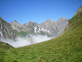
In the heart of a mountain pasture (sheep, horses), with magnificent views of Mont Vallier and the Estours valley. Part of the trail is unmarked.
The waterfalls on the Chemin d'Espagne
 Association / Club / Walk leader
 5.76 mi
+1,417 ft
-1,421 ft
3h 55
Moderate
Departure from Ustou (Ariège)
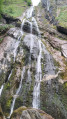
A beautiful hike in the Uustou Valley, which passes through the hamlets of L'Echart and Ossèse, with numerous waterfalls (especially in spring). As a bonus, you can see the superb Lastien waterfall. A very beautiful hike with no difficulty. Most of the route is covered by vegetation (pleasant in strong sunlight).
For more walks, use our search engine .
The GPS track and description are the property of this route's author. Please do not copy them without permission.

