


Refine your search for walks in Refuge delle Marmote (2142m)
Refuge delle Marmote (2142m) walks


 Grand Ru from Rhemes-Notre-Dame
 Visorando Member
 6.04 mi
 +1,670 ft
 -1,660 ft
 4h 15
 Moderate
 Departure from Rhêmes-Notre-Dame (Aosta Valley)
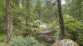
An easy walk at the bottom of the Rhêmes Valley, through larch and spruce forests and along the Grand Ru irrigation canal.
A short, slightly steeper detour takes you to the beautiful Vallon d’Entrelor and the Refuge Delle Marmotte.
On the way back, don’t miss the chance to admire the stunning Entrelor Waterfall and the lovely little Lake Pellaud.
From Rhêmes-Notre-Dame to Refigio de la Marmotte
5.41 mi
+1,929 ft
-1,926 ft
4h 10
Moderate
Departure from Rhêmes-Notre-Dame (Aosta Valley)
A beautiful and fairly easy walk to a very nice Refigio. A large part is through the forest, so there is plenty of shade. After the Refigio, you can walk a little further to sit and relax at a small current (2). If you fancy a very short walk (due to bad weather, for example), turn left at (3) instead of going up. You walk along a very old irrigation canal (Rû).
Refuge de la Marmotte - Eaux Rousses
 Association / Club / Walk leader8.35 mi
+2,831 ft
-4,406 ft
6h 20
 Difficult
Departure from Rhêmes-Notre-Dame (Aosta Valley)
A short day as the next day takes you into the Gran Paradiso National Park, where camping is prohibited; I had to cut the stage short, otherwise it would have had to be extended unreasonably. The Hostellerie du Gran Paradis is the only place to stay overnight. The food is great, but be warned: at weekends there are often Italians, French people, etc. out mountain biking.
Tor des Géants
147.02 mi
+59,301 ft
-60,259 ft
11 days
 Very difficult
Departure from La Thuile (Aosta Valley)
A magnificent hike following the trail of the ultra-trail of the same name. A hike designed for experienced hikers. The sections in the southernmost part can be tricky due to late snowfields on the north-east face. The route is very well marked, so there aren’t really any problems along the way. The hike can be done in either direction. This route allows you to tackle the wildest section at the start. It is also the most technically challenging part.
Walks near Refuge delle Marmote (2142m)
Bruil - Eaux Rousses
8.16 mi
+4,177 ft
-4,347 ft
7h 25
Difficult
Departure from Rhêmes-Notre-Dame (Aosta Valley)
Another valley trek, the aim of today is Valsavarenche.
Rhêmes-Notre-Dame – Rifugio Benevolo
 5.32 mi
+1,916 ft
-98 ft
4h 05
Moderate
Departure from Rhêmes-Notre-Dame (Aosta Valley)
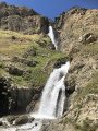
The Waterfalls Trail: thesecond stage of a circular route in the Gran Paradiso National Park.
Starting from Rhêmes-Notre-Dame, you reach Rifugio Benevolo, passing numerous impressive waterfalls along the way.
Bénévolo – Chivasso
 6.47 mi
+3,005 ft
-1,975 ft
5h 35
Difficult
Departure from Rhêmes-Notre-Dame (Aosta Valley)
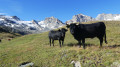
The ascent takes you through very wild, virtually off-trail terrain up to the Nivoletta Alpine Pass (3,152 m), followed by a descent via the gullies overlooking the magnificent Leitz and Rosset Lakes in the Valsavarenche. You then make your way towards the Chivasso Refuge through splendid flower-filled mountain pastures, renowned for their delicious fontina cheese.
Eaux Rousses - Refuge Vittorio Sella
 8.70 mi
+5,495 ft
-2,523 ft
10 hrs
Very difficult
Departure from Valsavarenche (Aosta Valley)
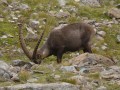
From Valsavaranche to Val de Cogne in the middle of a herd of chamois.
Eaux Rousse - Cognes
15.65 mi
+5,804 ft
-6,168 ft
12h 15
Very difficult
Departure from Valsavarenche (Aosta Valley)
A long day lies ahead with the climb to the Col de Lauzon (3,299m). This is the highest point of the TDG. The descent from the pass is pure delight. It is possible to run downhill for 3–4 km to the Vittorio Sella Refuge. It is a large refuge with plenty of people. The descent to Valnontey is also long, but there are plenty of cafés to rest in.
Refuge de l'Epée - Bruil
 3.83 mi
+1,621 ft
-3,763 ft
3h 10
Moderate
Departure from Valgrisenche (Aosta Valley)
Fourth stage between Valgisenche and Val de Rheme.
From the Chalet de l’Épée mountain hut to the Mario Bezzi mountain hut
 6.01 mi
+2,044 ft
-2,313 ft
4h 35
Moderate
Departure from Valgrisenche (Aosta Valley)
The third stage of the Tour de l’Archeboc, between France and Italy. A day offering panoramic views of several French and Italian glaciers. Shorter in distance and elevation gain than the other days of the tour, but with a few slightly more technical sections (scree slopes).
Eaux-Rousses – Rhêmes-Notre-Dame
 9.09 mi
+4,383 ft
-4,199 ft
7 hrs
Very difficult
Departure from Valsavarenche (Aosta Valley)
First stage of a circular route in the Gran Paradiso National Park, based on the5th stage of the Gran Paradiso Crossing proposed by bernardino.
A long stage: 4 hours 20 minutes’ ascent and 3 hours 10 minutes’ descent. Splendid views of Gran Paradiso and along small mountain lakes.
Rifugio Savoia - Eaux-Rousses
 11.66 mi
+1,437 ft
-4,272 ft
6h 35
Difficult
Departure from Valsavarenche (Aosta Valley)
A balcony trail. Stage4 of the circular route in the Gran Paradiso National Park. Return to the Valsavarenche valley.
Chivasso – Carro
 6.52 mi
+3,130 ft
-2,582 ft
5h 45
Difficult
Departure from Valsavarenche (Aosta Valley)
Cross the mountain pastures along a descending path, from where there is a magnificent view of Lake Agniel and Lake Serru (2,240 m). A path leads to Lago Delle Rocc Grandi and the high-altitude path over the Col du Carro (3,122 m). The pass marks the French-Italian border and the entrance to the Vanoise National Park. A steep descent leads to the Refuge du Carro (2,759 m) for a well-deserved rest.
Please note: Just before Lac du Caro, the glacier tongue has swept away the landmarks (markings, cairns), makingnavigation and progress very difficult(see notice dated 7 September 2026).