Eaux-Rousses – Rhêmes-Notre-Dame

First stage of a circular route in the Gran Paradiso National Park, based on the5th stage of the Gran Paradiso Crossing proposed by bernardino.
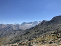
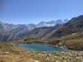
A long stage: 4 hours 20 minutes’ ascent and 3 hours 10 minutes’ descent. Splendid views of Gran Paradiso and along small mountain lakes.

This walk is part of a multi-day hike: Gran Paradiso Park Circular Route

Details

n°25194246
Creation:
Last update:
Last review:
  • Walking
    Activity: Walking
  • ↔
    Distance: 9.09 mi
  • ◔
    Duration according to the author: 7 hrs 
  • ▲
    Difficulty: Very difficult

  • ⚐
    Back to start: No
  • ↗
    Ascent: + 4,383 ft
  • ↘
    Descent: - 4,199 ft

  • ▲
    Highest point: 9,839 ft
  • ▼
    Lowest point: 5,482 ft

Photos

Description of the walk

The route starts at Eaux-Rousses in the Valsavarenche valley; see the ‘Miscellaneous information’ section for access details.
It is also possible to park in one of the twenty or so free, unlimited-time parking spaces along the road as it passes through the hamlet.

(S) Start of trail no. 2, marked in yellow, just before the entrance to the Hostellerie du Paradis, above the hamlet of Eaux-Rousses.
A gentle, winding climb through the forest and then across pastures. You’ll reach the edge of the forest.

(1) Take the path on the left and follow it to reach the area above Lac Djouan.

(2) Walk past the lake and on to Lac Nero.

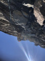
(3) Walk alongside it, then tackle the hairpin bends to emerge at the Col d’Entrelor

(4) Start the descent opposite to reach a tricky section.

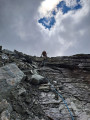
(5) Use the fixed ropes to get across; watch out for loose rocks. Continue along the path to reach Plan des Feyes, where you’ll find the Ruisseau de l’Entrelor.

(6) Follow it, then turn off to the right. After a few hairpin bends, followed by a straighter stretch, you’ll reach the Gran Ru canal.

(7) Follow this pretty traditional irrigation canal for a few metres along its right bank. Leave it on the left to reach Rhêmes-Notre-Dame (E).

Waypoints

  1. S : mi 0 - alt. 5,486 ft - Eaux-Rousses
  2. 1 : mi 2.07 - alt. 7,113 ft - Edge of the forest
  3. 2 : mi 4.05 - alt. 8,264 ft - Lac Djouan
  4. 3 : mi 4.9 - alt. 8,806 ft - Lac Nero
  5. 4 : mi 5.88 - alt. 9,836 ft - Col d'Entrelor
  6. 5 : mi 6.09 - alt. 9,400 ft - Tricky section
  7. 6 : mi 7.18 - alt. 7,559 ft - Map of Les Feyes
  8. 7 : mi 8.46 - alt. 6,175 ft - Grand Ru Canal. Towards the - Dora Di Rhêmes (cours d'eau) - Italie - Affluent du Savara
  9. E : mi 9.09 - alt. 5,659 ft - Rhêmes-Notre-Dame

Notes

Access to Eaux-Rousses: Arriva bus route 611 from Villeneuve
Accommodation near the Eaux-Rousses start point:
Hostellerie du Paradis (often fully booked) Tel: 39 0165 905972
Camping Grivola, also rents out rooms Tel: 39 0165905743
Camping Gran Paradiso, also rents out caravans Tel: 39 0165905801
Albergo Gran Paradiso, surrounded by a campsite, very popular Tel: 39 016595454
On arrival at Rhêmes-Notre-Dame, there are numerous hotels and guest rooms, particularly 1.5 km further north in the hamlet of Chanavey (follow the river along a path on the right bank). List of accommodation
(5) The only difficulty apart from the length of the route is the very steep descent shortly after the Col d’Entrelor, which involves a fixed rope with metal steps, followed by about ten steps over large, very unstable rocks after the rope.

Worth a visit

(2) Pleasant swimming

Reviews and comments

5 / 5
Based on 1 review

Reliability of the description
5 / 5
Ease of following the route
5 / 5
Route interest
5 / 5
SIOLAT
SIOLAT

Overall rating : 5 / 5

Date of your route : Jun 19, 2026
Reliability of the description : ★★★★★ Very good
Ease of following the route : ★★★★★ Very good
Route interest : ★★★★★ Very good
Very busy route : No

A very pleasant route with magnificent scenery – high-mountain scenery – but featuring one tricky section where you need to use a rope. The first section climbs steadily up to the Col Entrelor at an altitude of 3,002 metres. Then comes the descent, which is quite steep at first with that tricky section requiring the use of a rope, followed by a steady descent.

Machine-translated

Other walks in the area

For more walks, use our search engine .

The GPS track and description are the property of this route's author. Please do not copy them without permission.