Country:

 City:
City:


From the Aosta West motorway exit, head up the SS26 then turn left towards Valsavarenche; after the village of Introd, take the SR24 through the Val de Rhêmes to the village of Bruil. There is a large car park on the right at the entrance to the village.
(S/E) Head south-west and, shortly afterwards, turn left down the small road, passing through the hamlet of Les Oreiller. Then turn right towards Le Peysset.
(1) Join Trail No. 9A, which climbs up through a mountain pasture before levelling out. Turn right, following the Grand Ru stream, cross two junctions and reach a crossroads at an altitude of around 1,880 metres.
(2) Turn left onto Trail No. 2, which climbs steeply to reach the plateau of the Vallon d’Entrelor (1,937 m).
(3) Head left until you reach a fork at an altitude of around 2,120 m.
(4) Turn right and, a few hundred metres further on, you’ll reach the Refuge delle Marmotte (2,142 m).
(5) Continue past the refuge.
(6) Cross the Entrelor stream at an altitude of around 2,160 metres, join a signposted path and follow it to the left until you reach the fork you passed on the way out.
(4) Follow the route in the opposite direction to the outward journey until you reach the Vallon d’Entrelor plateau (1,937 m).
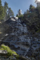
(3) Continue to the left, towards the waterfall. Cross the Grand Ru and you’ll immediately come to a fork in the path.
(7) Turn left for a return trip to the waterfall.
(8) From the waterfall, retrace your steps to the fork near the Grand Ru.
(7) On your return, turn left onto Trail No. 9B, which passes through Broillat and leads to La Chaudanaz.
(10) To do another circular route, cross the hamlet, turn left and, on leaving the hamlet, take the path on the left which leads up to Lac de Pellaud.
(9) At the track, turn right, then walk alongside Lac de Pellaud and return directly to La Chaudanaz and the junction you have already passed.
(10) Turn left onto Path No. 11B, which runs alongside the stream. Cross the stream and head towards Rhêmes and the Bruil car park (S/E).



 Visorando Member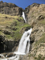

 Easy
Easy  Difficult
  Association / Club / Walk leader