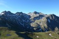
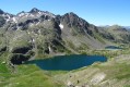
From the Vens mountain hut to the hamlet of Le Pra via the Morgon Lakes

Second part of the circular route to explore the magnificent Lacs de Vens.
Starting from the Vens Lakes and Vens Refuge, the route leads to the hamlet of Le Pra via the small pass of Tortisse, the Col du Fer, the Pas de Morgon and the Morgon Lakes.

This walk is part of a multi-day hike: Boucle de deux jours autour des Lacs de Vens et de Morgon

Details

61220666
Creation:
Last update:
Last review:
  • Walking
    Activity: Walking
  • ↔
    Distance: 6.18 mi
  • ◔
    Average duration: 3h 50 
  • ▲
    Difficulty: Moderate

  • ⚐
    Back to start: No
  • ↗
    Ascent: + 1,178 ft
  • ↘
    Descent: - 3,455 ft

  • ▲
    Highest point: 8,917 ft
  • ▼
    Lowest point: 5,495 ft

Photos

Description of the walk

Starting from the Refuge de Vens.

(S) From the rear of the refuge, head towards the Collet de Tortisse, climbing to the right of the waterfall. Cross a stream and then follow the red and white markings. Climb the wide hairpin bends at a leisurely pace.

(1) You’ll reach the Collet de Tortisse (altitude 2,591), marked by signpost 35a; continue straight along the path, keeping to the flat section towards the Col du Fer.

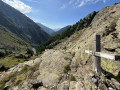
(2) You’ll reach the Col du Fer (2,584 metres) at marker 35. This is where theGR® (red and white) markings end. Take the path on the left, beginning the ascent to the summit towards the Pas de Morgon (the peak marking the border between France and Italy). Follow the path and the cairns, taking care on the steep slopes on either side where there are significant drops. The path remains wide and easy to walk on for most of the route.

(3) Cross the area of large boulders and rocks, keeping to the left and following the cairns closely. Continue towards the Pas de Morgon until you reach it.

(4) Pas de Morgon (2,714 metres), the highest point of the hike and the end of the ascent. Begin the descent by continuing along the path towards the Lacs de Morgon.

(5) Turn off onto the path on the left towards the Morgon Lakes and follow the cairns down the slope.

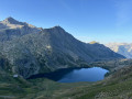
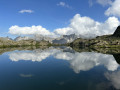
(6) Walk along the left-hand side of the Morgon Lakes, following the cairns, and continue to the Lac Majeur de Morgon (elevation 2338).

(7) Reach the shore of Lac Majeur de Morgon and turn right to begin the descent towards the Vallon de la Cabane, which lies below. Follow the path from there.

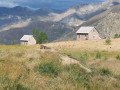
(8) Walk past the sheep pens and continue along the path.

(9) Turn right to cross the dry riverbed before continuing along the path.

(10) When you reach marker 37 (elevation 2094), turn left, heading south, whilst following the fairly faint path. Do not continue straight on towards the hut.

(11) Pass the White Cross and continue the descent along the path.

(12) Cross the Ravin de Salse Morene and continue along the path that runs alongside it until you finally reach the car park at the hamlet of Le Pra (E).

Waypoints

  1. S : mi 0 - alt. 7,772 ft - Refuge de Vens
  2. 1 : mi 0.82 - alt. 8,494 ft - Marker 35a - Collet de Tortisse (2591m)
  3. 2 : mi 1.09 - alt. 8,465 ft - Marker 35 - Col du Fer (2584m)
  4. 3 : mi 1.69 - alt. 8,858 ft - Imposing rocks and boulders
  5. 4 : mi 1.89 - alt. 8,917 ft - Pas de Morgon
  6. 5 : mi 2.16 - alt. 8,586 ft - Path descending to the left
  7. 6 : mi 2.37 - alt. 8,442 ft - Start - Lacs de Morgon
  8. 7 : mi 2.94 - alt. 7,969 ft - Lake Maggiore - Lacs de Morgon
  9. 8 : mi 4.11 - alt. 7,070 ft - Sheep pen
  10. 9 : mi 4.23 - alt. 6,985 ft - Dry riverbed
  11. 10 : mi 4.54 - alt. 6,873 ft - Marker 37
  12. 11 : mi 4.95 - alt. 6,755 ft - Pas of the White Cross
  13. 12 : mi 5.4 - alt. 6,102 ft - Ravin de Salse Morene
  14. E : mi 6.18 - alt. 5,515 ft - Le Pra

This route passes through a protected area, which may be subject to special regulations:

Always be cautious and plan ahead when you're outdoors. Visorando and the author of this route cannot be held responsible for any accidents occurring on this route.

The GR® and PR® markings are the intellectual property of the Fédération Française de Randonnée Pédestre.

Reviews and comments

4.3 / 5
Based on 3 reviews

Reliability of the description
4 / 5
Ease of following the route
4.3 / 5
Route interest
4.7 / 5
gutnecht
gutnecht

Overall rating : 3.7 / 5

Date of your route : Jul 14, 2025
Reliability of the description : ★★☆☆☆ Disappointing
Ease of following the route : ★★★★☆ Good
Route interest : ★★★★★ Very good
Very busy route : Yes

A very lovely walking route in the Mercantour, but the information on the duration and technical difficulty of the walk is incorrect.
The author of the walk states a total duration of 3 hours 50 minutes. My group of friends and I took more than twice that time, including a lunch break during the walk and a few stops to admire the surrounding scenery, without dawdling.
As for the technical difficulty of the walk, we found it quite challenging, particularly at the White Cross as we began the descent into the Salse Morene ravine. This descent is particularly long, steep and physically demanding, with numerous scree slopes and sections covered in brambles to cross – something not mentioned in the description.
Furthermore, erosion has caused sections of the path overlooking the ravine to collapse in places, which is dangerous if you’re not careful. My friend slipped and broke his walking poles on this stretch.
All in all, I would recommend considering an alternative route to return to the hamlet of Pra.

Machine-translated

rinaldopanozzo
rinaldopanozzo

Overall rating : 4.3 / 5

Date of your route : Jul 21, 2025
Reliability of the description : ★★★★★ Very good
Ease of following the route : ★★★★☆ Good
Route interest : ★★★★☆ Good
Very busy route : No

A magnificent route overlooking the lakes as you approach from the Pas de Morgon. Take care at marker 37, as the path is barely visible. The GPS track is essential for finding your way back on course. Once you reach the bottom, you’ll need to adapt, as the stream has washed away parts of the path, but it’s still passable.

Machine-translated

Yaniro
Yaniro

Overall rating : 5 / 5

Date of your route : Jun 11, 2025
Reliability of the description : ★★★★★ Very good
Ease of following the route : ★★★★★ Very good
Route interest : ★★★★★ Very good
Very busy route : No

Absolutely brilliant! With mouflons, chamois and marmots to keep you company, this hike is superb and the welcome at the mountain hut is perfect!
Just a word of warning, though: depending on the time of year you do it, you might find yourself cut off by snow.
We crossed a great many snowfields between the Pas de Morgon and the Lac Majeur de Morgon.
We lost about an hour on the descent and had lunch with our feet thoroughly soaked.
Despite everything, we made it through, but do take care all the same.

Machine-translated

Other walks in the area

For more walks, use our search engine .

The GPS track and description are the property of this route's author. Please do not copy them without permission.