


Refine your search for walks in Lac de la Fous
Lac de la Fous walks


 Tour of the Tête du Lac Autier
 Visorando Member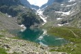
 7.16 mi
 +2,989 ft
 -2,989 ft
 5h 55
5h 55
 Difficult
 Departure from Belvédère (Alpes-Maritimes)
A beautiful loop in the Gordolasque valley that takes you close to five lakes, including the superb Lac Autier and Lac Niré. There are also some beautiful waterfalls, including the vast Cascade de l'Estrech. Numerous chamois can be seen throughout the hike. A few ibex and marmots can be spotted below the Lac de la Fous dam.
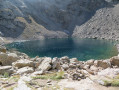
Lac de la Fous - Refuge de Nice - Lac Niré
 7.46 mi
+2,280 ft
-2,277 ft
5h 25
Difficult
Departure from Belvédère (Alpes-Maritimes)
7.46 mi
+2,280 ft
-2,277 ft
5h 25
Difficult
Departure from Belvédère (Alpes-Maritimes)
Discover the Gordolasque Valley and the Mercantour.
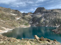
Lac Long de la Gordolasque
 6.71 mi
+2,959 ft
-2,933 ft
5h 40
Difficult
Departure from Belvédère (Alpes-Maritimes)
6.71 mi
+2,959 ft
-2,933 ft
5h 40
Difficult
Departure from Belvédère (Alpes-Maritimes)
The destination of a hike starting from Pont du Countet, the traditional entry point to the Vallée des Merveilles, Lac Long is relatively uncrowded and exudes an atmosphere of serenity in its rocky setting dominated by the elegant Cime de la Malédie.
Reaching this lake allows you to enter a wild and mineral valley located near the very popular Refuge de Nice. Ibex and chamois will probably be your only companions.
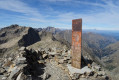
Mont Clapier
 8.94 mi
+4,390 ft
-4,390 ft
8 hrs
8.94 mi
+4,390 ft
-4,390 ft
8 hrs
 Very difficult
Departure from Belvédère (Alpes-Maritimes)
Very difficult
Departure from Belvédère (Alpes-Maritimes)
Mont Clapier (3,045 m) is one of the five 3,000-metre peaks in the Alpes-Maritimes, and probably the most accessible.
The ascent does not present any particular technical difficulties, but you do need a good sense of direction to navigate the scree slopes from the Lacs du Mont Clapier.
At the summit, there is a superb panorama of the peaks from the Italian-Swiss border to Corsica, passing through the Po plain, the ever-isolated Mont Viso, and closer by, Mont Bégo, Grand Capelet, Gélas and Argentera.
The Balcon du Gélas via Lac Long
 8.70 mi
+4,567 ft
-4,537 ft
8 hrs
Very difficult
Departure from Belvédère (Alpes-Maritimes)
8.70 mi
+4,567 ft
-4,537 ft
8 hrs
Very difficult
Departure from Belvédère (Alpes-Maritimes)
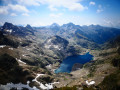
The Balcon du Gélas, which rises to over 3,000 metres, is a minor peak in the Haute Vésubie, situated close to its larger counterparts, the iconic Gélas peaks.
The ascent, however, offers superb views of the highest peaks of the Gordolasque, Lac Long, as well as the Argentera and even the Viso on the Italian side.
This hike, starting from Pont du Countet, takes you up the Gordolasque valley to Lac de la Fous, then leads you to the peaceful Lac Long before a climb to the Terrasse du Gélas—the only tricky section—and an easy final ascent to reward you with this beautiful summit, at the foot of the highest peak in the Mercantour massif.
Mercantour route via the GR®52
 65.54 mi
+21,585 ft
-24,639 ft
7 days
Very difficult
Departure from Saint-Martin-Vésubie (Alpes-Maritimes)
65.54 mi
+21,585 ft
-24,639 ft
7 days
Very difficult
Departure from Saint-Martin-Vésubie (Alpes-Maritimes)
TheGR® 52 is a route that crosses the Mercantour National Park, through the Alpes-Maritimes from Saint-Dalmas-de-Valdeblore to Menton.
ThisGR® route is very challenging due to the varied terrain and significant elevation changes.
You’ll reach altitudes of up to 2,700m, where you can admire the high-mountain landscapes, flora and fauna. Then, in the second half of the route, you’ll encounter panoramas that are more southern in character but just as extraordinary.
Le Boreon - Refuge de Nice
 10.85 mi
+5,971 ft
-3,678 ft
12 hrs
Very difficult
Departure from Saint-Martin-Vésubie (Alpes-Maritimes)
10.85 mi
+5,971 ft
-3,678 ft
12 hrs
Very difficult
Departure from Saint-Martin-Vésubie (Alpes-Maritimes)
The most difficult stage of thisGR®, but the most beautiful for its landscapes, flora and fauna: chamois, marmots, ibex.
After the Pas des Ladres, we chose to take theGR®52via the alternative route that passes close to the Col de Fenestre, then descends to Lac de Fenestre before reaching La Madone de Fenestre.
Three sections are particularly difficult: between Lac de Trecolpas and the Pas des Ladres, the ascent of the Pas du Colomb, and the descent from the Pas du Colomb.