Country:
 City:
City:


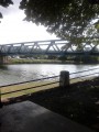
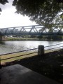
The route starts on the banks of the Marne in Damery, where you can park (Rue du Coche).
(S/E) Set off in the opposite direction to the bridge and follow Rue Alfred Révolte, then turn left onto Rue Paul Douce. At the roundabout, go straight ahead towards Fleury-la-Rivière. Just before the cemetery, turn left. At the corner by the electricity substation, turn right, following theGR® signposts. Follow the red and white markings in the same direction until you reach the T-junction, then turn right.
(1) At the crossroads by the wayside cross, turn left. Pass the hairpin bend and continue to the crossroads where you enter the woods.
(2) Head towards Reuil, taking the single-track path to the left.
Heading west, you’ll go through the woods, then through a cleared area beneath the high-voltage power line, and then back into the woods.
(3) When you reach a crossroads, with the Ferme d’Harnotay in view, leave theGR® and take the small tarmac road opposite which leads down towards Venteuil. At the football pitch, turn right onto the path that leads through the vineyards and follow it to the cemetery. Walk along the top of the cemetery, then turn left onto Rue de Grands Jardins, where you turn right. After 20 metres, turn right again and follow Boulevard Saint-Michel, which then becomes Rue de la Potière. You’ll reach the Grande Rue, which you take to the right (D1). Pass through the hamlet of Tincourt, staying on the Grande Rue and turning slightly to the left.
(4) At the last houses, turn right onto the small road that leads through the vineyards towards Villers-sous-Châtillon. Stay on this road until you reach the crossroads.
(5) Turn left towards Reuil. Walk through the village of Reuil along Rue des Vignes, then turn right onto the Grande Rue and left onto Rue du Pont until you reach the picnic area on the banks of the Marne.
(6). Take the path (GR®14) which runs alongside the Marne to the right and follow it to Port à Binson. Once in Port à Binson, cross the bridge over the Marne.
(7) Carry on straight ahead. Before the chemist’s, turn right, walk past the post office and turn left onto Rue de la Fontaine. Cross the main road (N3) and head straight ahead onto Rue du Docteur Rémy, which runs through the vineyards to the crossroads.
(8) Take the small tarmac road on the left. At the end of this road, turn slightly left onto the dirt track that runs above the vineyards.
(9) Cross the D36 and head straight on along the small road. Walk alongside the vineyards, then across open fields, and you’ll arrive back at the corner of a vineyard.
(10) Take the path on the left. Then turn right onto the path that runs between the vineyards and the pastures, then carry on straight ahead through the vineyards. Follow the more or less tarmac-surfaced path to the entrance to the village of Oeuilly.
Turn right towards the village, then carry on straight on towards the care home (signposted). Walk up through the village along Rue Jean Jaurès, passing the Croix d’Or fountain and then the war memorial.
(11). Continue along Rue du Huit Mai. On leaving the village, do not head towards the care home, but turn right towards La Cense Carrée. Continue along the small tarmac road that climbs through the woods to the crossroads, where you will see the farm ‘La Cense Carrée’.
(12) At the crossroads, take the dirt track at a 60° angle to the left, which forms the boundary between the woods and the farm’s pastures.
Please note: in this area, the route ofthe GR® has been altered; the route shown on the 1:25,000 map is no longer up to date. Do not follow it.
Follow the dirt track until you reach a crossroads in the woods (elevation 228).
(13) Turn left onto the narrow path which descends steeply through the woods. Turn right onto a wider track (GR®14) and continue in the same direction (east).
When you can see the houses, turn right. You’ll pass the Lune viewpoint
(14) Carry on towards the village of Boursault. Enter via Rue Dom Pérignon, turn left onto Rue des Écoles, then right onto Rue de la Duchesse d’Uzes. Walk past the church, then past a restaurant. Turn right onto Rue du Château Neuf, then immediately left onto Rue de Vauciennes. Cross the Pont de Roches.
(15) Carry on straight ahead along the path that runs alongside the vineyards. You’ll come to a small tarmac road, which you follow.
The small road runs along the top of the vineyards, passes the Boursois farm, then reaches the edge of a woodland.
(16) On the right-hand side, a small path branches off beneath the trees of the hedge, markedGR®. Follow it uphill, first along the field, then through the woods. Do not walk under the power line; instead, head slightly to the right.
(17) At the crossroads in the woods, head straight ahead. You’ll emerge from the woods after 200 metres and walk alongside a field. At the next crossroads, turn left towards the Limons farm.
(18) In front of the farm, take the path on the right which descends gently through the fields towards the Étang d’Orléans. Walk alongside the pond and continue along the path that follows the power line.
(19) The path leaves the wooded area and crosses fields. You’ll reach a small road; walk 50 metres to the left, then take the road on the right (D22) towards the hamlet of Mont Bayen (watch out for cars).
At the first houses, turn left onto the path that descends into the vineyards.
(20) Follow this path through the vineyards, skirting the woodland, until you reach a small road where you turn left.
(21) The path climbs back up through the vineyards and follows the boundary between the woodland and the vineyards almost exactly.
Stay on this path above the vineyards of Vinay, Moussy and Pierry, ignoring all the turnings to the right.
(22) You’ll reach a small woodland, which you cross to reach La Bécasserie. You’ll pass La Loge Pinard and continue along the path that skirts the woodland beneath the highest vineyard plots.
(23) You’ll join theGR®14and follow its signposts along the Épernay ring road.
(24) When you reach the crossroads with signposts for Mardeuil, Moussy and Vauciennes, turn left towards Vauciennes. You’ll pass the Saint-Antoine equestrian centre and the Chapotteen farm, still following theGR®14markings.
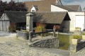
(25) You’ll arrive in Vauciennes, where you’ll pass the church and the wash house, and head down Rue de Boursault.
(26) At the crossroads, turn right towards La Chaussée de Damery. You’ll soon come within sight of the “XXL” restaurant.
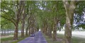
(27) Cross at the traffic lights and head towards Damery after crossing the level crossing. Follow the avenue of plane trees on the right-hand side, along the narrow path that runs parallel to the road.
As you approach Damery, cross the bridge and return to the starting point (S/E).





 Visorando Member
 Moderate
 Difficult