The Brunet circular starting from Damery

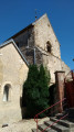
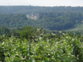
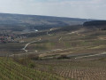
This is a short but very varied walk: along the banks of the Marne, through vineyards and woods. It offers beautiful views over the valley. It is not difficult as it is signposted throughout.

It takes its name from the Brunet, the stream that flows through the valley.

Details

n°2203495
Creation:
Last update:
Last review:
  • Walking
    Activity: Walking
  • ↔
    Distance: 10.89 mi
  • ◔
    Average duration: 5h 55 
  • ▲
    Difficulty: Moderate

  • ⚐
    Back to start: Yes
  • ↗
    Ascent: + 1,066 ft
  • ↘
    Descent: - 1,040 ft

  • ▲
    Highest point: 860 ft
  • ▼
    Lowest point: 233 ft
  • ⚐ Country: France
  • ⚐ City: Damery (51480)
  • ⚑
    Start/End: N 49.070044° / E 3.877575°
  • ❏
    IGN map(s): Ref. 2713E
  • Hour-by-hour weather

Photos

Description of the walk

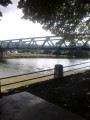
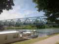
The route starts at the Port de Damery, where you can park in the shade of the trees.

(S/E) Take Rue F. Révolte, heading away from the bridge. Continue left onto Rue Paul Douce and walk past the post office. At the roundabout, carry on straight ahead, walk past the town hall and continue to the park entrance.

(1) Turn right and enter the park. Walk through the park, keeping in the same direction until you reach a side street. Turn left onto Rue de Romery, walk past the wayside cross and continue straight on until the next junction.

(2) Turn right. Cross the bridge and head up through the vineyards, keeping to an easterly direction. Walk alongside the copse until you reach a T-junction.

(3) Turn left onto the vineyard path that runs alongside the copse. Walk in this direction for 500 m until you reach the crossroads where you can enter the woods.

(4) Turn right and follow the path through the woodland. Ignore the paths branching off to the right and left: these are private woods, so you must stay on the signposted path. After 2 km, you’ll come back to the vineyards and continue in the same direction.

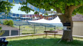
(5) In front of the picnic area, continue to the right onto the D322. At the junction, turn right onto the Route d’Hautvillers, then immediately left onto Rue des Gais Hordons, followed by Rue de l’Oluze on the right as it continues. Just before the last buildings, turn left along the tall trees.

The path leads to the vineyards. Follow it, and take the sixth path on the left (signposted). Then take the first path on the right and walk to the woods. Turn left along the edge of the woods.

(6) When you can see the houses, cross the stream and turn left at a right angle. Walk to the road.

(7) Cross the road and turn left, then right about fifty metres further on. Walk past the reservoir. Continue in the same direction until you reach the woods.

(8) At the T-junction, turn right into the woods. When you reach the small road, turn left and walk along it carefully. After 300 metres, look out for the entrance to the Fleury-la-Rivière Communal Forest on the right (gate).

(9) Take the forest track and continue straight on. Cross a path and take the one opposite.

(10) When you reach a T-junction, turn left and walk to the vineyards, which are about 800 metres away.

(11) Continue straight ahead along the path that crosses the vineyards and leads down towards the village of Fleury-la-Rivière. Carry on along Rue du Ponceau, then the D22. Walk past the media centre, continue for a further 50 m and take the hairpin bend to the right onto Rue du Chauffour (D324) towards Cuchery. Walk past the cave entrances and continue to a path entrance on the left.

(12) Take this path and carry on straight ahead until you reach the junction with Rue des Hautes Treilles.

(13) Turn right onto the tree-lined sunken track and walk to the edge of the woodland. Turn left and walk alongside the woodland. After 400 m, the path enters the woodland and winds its way to the edge of the fields.

(14) At the crossroads, turn left onto the path that forms the boundary between the woodland and the fields. Pass under the high-voltage power line and arrive at the T-junction.

(15) Turn left and continue straight on until you reach the small car park at the start of the Pâtis de Damery route.

(16) Cross the esplanade and continue straight ahead into the vineyards. Take the hairpin bend and walk to the wayside cross.

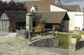
(17) Turn right. At the fountain, turn left and walk straight on until you reach the junction by the electricity substation.

(18) Turn left, walk past the cemetery, then turn right.

(1) Continue straight on, go past the roundabout and veer to the right to reach the Marne at Port de Damery (S/E).


Waypoints

  1. S/E : mi 0 - alt. 233 ft - Port de Damery
  2. 1 : mi 0.29 - alt. 292 ft - Park entrance
  3. 2 : mi 0.93 - alt. 272 ft - Crossroads
  4. 3 : mi 1.47 - alt. 554 ft - T-junction
  5. 4 : mi 1.86 - alt. 528 ft - Entrance to the woods
  6. 5 : mi 3.32 - alt. 518 ft - Picnic area
  7. 6 : mi 4.67 - alt. 725 ft - Crossing the stream
  8. 7 : mi 4.8 - alt. 705 ft - Route
  9. 8 : mi 5.29 - alt. 804 ft - Entrance to the woods
  10. 9 : mi 5.63 - alt. 827 ft - Barrier
  11. 10 : mi 6.27 - alt. 860 ft - T-junction
  12. 11 : mi 6.83 - alt. 778 ft - Start of the vineyards
  13. 12 : mi 7.51 - alt. 682 ft - Vineyard trail
  14. 13 : mi 7.84 - alt. 682 ft - Crossroads – Sunken lane
  15. 14 : mi 8.33 - alt. 840 ft - Fields
  16. 15 : mi 8.62 - alt. 843 ft - T-junction
  17. 16 : mi 9.05 - alt. 761 ft - Sign for the Pâtis de Damery
  18. 17 : mi 9.54 - alt. 577 ft - Calvary
  19. 18 : mi 10.28 - alt. 295 ft - Transformer
  20. S/E : mi 10.89 - alt. 233 ft - Damery Harbour - Marne (la)

Notes

No water along the route.

There are winegrowers in all the villages along the route. All shops are in Damery.

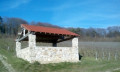
Picnic areas at the start, in Romery, at the church in Fleury-la-Rivière and in Cormoyeux.

Worth a visit

Champagne by the glass in the cafés.

You can reach the start from Epernay railway station by walking along the River Marne.

In Damery, beyond the bridge, there is a magnificent avenue of plane trees, listed as part of the department’s heritage since 1933.

Reviews and comments

4.2 / 5
Based on 2 reviews

Reliability of the description
4.5 / 5
Ease of following the route
4 / 5
Route interest
4 / 5
virgule
virgule
• Edited:

We did the route again today, a shorter version, starting from Fleury-la-Rivière and passing through Raday. 13.6 km.

The grape harvest will finish early next week.

Machine-translated

scorto
scorto

@virgule Thanks, yes, that’s why I’m grateful to the people who mark out the trails – it’s a lot of work
Long, signposted walks are rare (or little-known?) in this area; we’re always on the lookout for them

Machine-translated

virgule
virgule

Thank you for this review. In our region, the signposting is sometimes rather inconspicuous. However, in the Marne Valley, it is managed by a very professional team.

The Cormoyeux picnic area has been moved a little further up the hill, to a spot with a lovely view over the valley. Once the trees have grown, there will be some shade.

Machine-translated

scorto
scorto

Overall rating : 3.7 / 5

Date of your route : Jul 30, 2023
Reliability of the description : ★★★★☆ Good
Ease of following the route : ★★★☆☆ Average
Route interest : ★★★★☆ Good
Very busy route : No

A lovely route, though there are issues with signposting in places, particularly on the way out of Damery through the vineyards. The first section through the forest was very difficult to navigate due to timber extraction work, which made the path rather impassable, and in the next wood it was hard to find our way as many trees had been felled and the path was no longer very visible. There were plenty of yellow arrows everywhere trying to guide us despite everything, but it was a rather dreary and disheartening stretch. The rest of the route is better. It’s a circular route we’d recommend, but it’s best to download the GPX file onto a smartwatch to help you find your way in certain places – that’s what really helped us. Thanks to the people who go to the trouble of creating these routes.

Machine-translated

virgule
virgule
• Edited:

The picnic table at Cormoyeux has gone (7), which is a shame for our lunch break. I hope they’ll put another one there.

The path through the woods is a bit rough due to forestry work. Be careful to stay on course. We got lost where there were tree trunks on the path.

Machine-translated

virgule
virgule

Along the route, there is a pretty church with 13th-century frescoes in Cormoyeux, and a Vign’art sculpture in Fleury-la-Rivière (summer 2022 only)

For those who find this route too long, you can set off from Romery and take a shortcut via Fleury-la-Rivière, which brings the distance down to just 9 km.

Machine-translated

virgule
virgule

Hello,

thank you for this review. That was the last walk I went on, exactly a year ago, the day before lockdown. It’s beautiful in every season

Machine-translated

didoudep
didoudep

Overall rating : 4.7 / 5

Date of your route : Mar 10, 2021
Reliability of the description : ★★★★★ Very good
Ease of following the route : ★★★★★ Very good
Route interest : ★★★★☆ Good
Very busy route : No

A circular walk through varied countryside, very well signposted.

Machine-translated

virgule
virgule

Hello,

I finished the reconnaissance on Sunday, never imagining that I wouldn’t be going back there for a long time.

Thanks to the moderators.

Machine-translated

Other walks in the area

For more walks, use our search engine .

The GPS track and description are the property of this route's author. Please do not copy them without permission.