Le Quaireux via the green trail

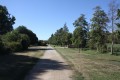
This route follows part of the Sentier de la Découverte and then the Ruban Vert (Melle–Celles-sur-Belle), which follows the route of the old single-track railway line. A lovely, easy walk along wide paths, shaded for most of the way. Suitable for all weathers.

Details

233409
Creation:
Last update:
Last review:
  • Walking
    Activity: Walking
  • ↔
    Distance: 5.93 mi
  • ◔
    Average duration: 2h 50 
  • ▲
    Difficulty: Easy

  • ⚐
    Back to start: Yes
  • ↗
    Ascent: + 135 ft
  • ↘
    Descent: - 135 ft

  • ▲
    Highest point: 525 ft
  • ▼
    Lowest point: 390 ft

Description of the walk

Park in the car park at the old Melle railway station (opposite the nursery).

(S/E) Walk to the far end of the car park, keeping the old station building on your left. Take the wide path called the ‘Sentier de la Découverte’, which starts on the left after you’ve passed the wooden gate.

(1) Walk past the entrance to the Melle Forest Arboretum, which is situated to the right of the path. On the other side, you can see the buildings of the agricultural college. Cross the first road via a bridge, then continue until you reach a second road.

(2) The Discovery Trail gives way to the Ruban Vert, which you follow in the shade of the trees lining it.

(3) At the junction with a road, carry on straight ahead along the Ruban Vert path. About 600 metres further on, cross the road leading from La Roche to Pied-Pouzin and carry on straight ahead until you reach the next crossroads.

(4) Leave the Ruban Vert and take the farm track on the right, which climbs slightly. This track leads onto a road at a place called Les Loges, where there is a farm shed. Take the road to the left and continue to the crossroads about 250 m further on.

(5) Turn left towards the hamlet of Le Quaireux.

(6) Immediately after passing the pretty house at Pré Nouveau, turn left onto the farm track which leads onto the Ruban Vert path near a small pond crossed by the Ruisseau de Vireblanc.

(7) Turn left and continue to the junction with the second road

(4) Carry on to the fork in the road from the outward journey.

(3) Then leave the Chemin du Ruban Vert and take the road to the right towards Saint-Thibault. Pass through the hamlet of Les Renaudries or Pet de Chien to reach a junction.

(8) Turn left onto the road leading downhill towards Melle. Just before the road passes under the Chemin du Ruban Vert, look out for the Fontaine de Saint-Thibault on your right and immediately take the small path just to the right of the bridge, which leads back up to the Chemin du Ruban Vert.

(2) Turn right and return to the car park where you started, following the same route in the opposite direction (S/E).


Waypoints

  1. S/E : mi 0 - alt. 390 ft - Former Melle railway station. Near the - Béronne (rivière)
  2. 1 : mi 0.38 - alt. 390 ft - Forest arboretum
  3. 2 : mi 0.95 - alt. 407 ft - Bridge
  4. 3 : mi 1.57 - alt. 443 ft - Bridge
  5. 4 : mi 1.98 - alt. 453 ft - On the right, at the crossroads
  6. 5 : mi 2.54 - alt. 512 ft - On the left, at the crossroads
  7. 6 : mi 2.86 - alt. 522 ft - Pré Nouveau
  8. 7 : mi 3.47 - alt. 453 ft - Green Ribbon: turn left
  9. 8 : mi 4.83 - alt. 440 ft - At Saint-Thibault, at the crossroads, turn left
  10. S/E : mi 5.93 - alt. 390 ft - Former Melle railway station

Notes

A varied trail, largely created on the site of the former Melle–Celles-sur-Belle railway line. The walk is largely shaded.
At points (3) and (7), there are picnic tables.

Worth a visit

Forest Arboretum: established in 1993, the forest arboretum aims to showcase, over a few hundred metres of walking along its paths, the diversity of tree species found in the department, classified by canton. It also serves to illustrate how forestry is practised.

The Chemin de la Découverte takes you round the town of Melle (6.7 km long). It passes close to the Mines d’Argent and several wash houses. It is lined with a variety of tree species (arboretum). The Chemin de la Découverte is an arboretum comprising over 1,000 different taxa (trees and shrubs) planted along a footpath of approximately 7 km. This unique example of the conversion of a former railway line (two-thirds of the route) is a benchmark in France in terms of botany. It is home to nine collections accredited by the Conservatoire des Collections Végétales Spécialisées (CCVS). The nine genera in question are: birches, hornbeams, ash trees, currant bushes, chestnut trees, hackberry trees, willows, rowans and lime trees. Along the route, you can also admire an interesting collection of maples, oaks (with unusual leaves), beech trees, alders and nearly 200 rose bushes. A small copse has been created to showcase various types of remarkable bark, a feature as magnificent as it is fragile. Along the way, you’ll also find vantage points overlooking Melle, a ‘Petite Cité de Caractère’ (Small Town of Character), from which you can admire the three Romanesque churches, the Fontaine aux Lépreux (…) and two very beautiful wash houses. Stone, water and vegetation will accompany you on your walks along this Discovery Trail.

Reviews and comments

4.3 / 5
Based on 3 reviews

Reliability of the description
4.3 / 5
Ease of following the route
4.7 / 5
Route interest
4 / 5
Kaj
Kaj

Overall rating : 4.3 / 5

Date of your route : Jan 22, 2024
Reliability of the description : ★★★★☆ Good
Ease of following the route : ★★★★★ Very good
Route interest : ★★★★☆ Good
Very busy route : No

A very easy, pleasant walk. I imagine it’s fairly busy, with a few regulars. It was just the ticket for this Saturday, 20 January, which fell during a rather rainy spell. When the weather’s warm, it must be lovely too.

Machine-translated

Azimut71
Azimut71

Overall rating : 4.7 / 5

Date of your route : May 13, 2022
Reliability of the description : ★★★★★ Very good
Ease of following the route : ★★★★★ Very good
Route interest : ★★★★☆ Good
Very busy route : No

The Deux-Sèvres department had the good sense not to asphalt the greenway, unlike in other places, where it has, sadly, become a greyway.

Machine-translated

pgetrochon
pgetrochon

The Visorando tool is programmed on the basis of a minimum 15-minute break per hour. Furthermore, the duration of a walk depends on the walker’s pace, and there can be significant variations from one person to another. The times given are therefore approximate.
Kind regards

Machine-translated

Chrismelle
Chrismelle
• Edited:

Overall rating : 4 / 5

Date of your route : Sep 18, 2017
Reliability of the description : ★★★★☆ Good
Ease of following the route : ★★★★☆ Good
Route interest : ★★★★☆ Good

A pleasant route as it involves little road cycling. Easy.
Took 2 hours to complete and is rated at 2 hours 50 minutes.
Plenty of rest stops with benches. Nice

Machine-translated

Other walks in the area

For more walks, use our search engine .

The GPS track and description are the property of this route's author. Please do not copy them without permission.