Country:

 City:
City:


To get to Anies from Ayerbe, head towards Loarre via the A-1206. At Loarre, head towards Bolea, staying on the A-1206, and, 2 km before Bolea, turn left towards Anies via the HU-3130.
There are few parking spaces in this small village with its narrow streets; we chose to drive right through it and park by the information sign at the hermitage, so as not to inconvenience the villagers.
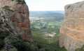
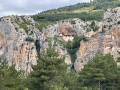
(S/E) Right from the start, look north-east to spot your first destination in the distance, clinging halfway up the cliff face, which seems inaccessible. Take the wide track and walk for about 1 km. Look for the start of a path on the right, by a signpost.
(1) Follow this path, which cuts across the hairpin bends of the track; it climbs steeply through Mediterranean vegetation, crossing the track twice before rejoining it.
You can make the climb easier by staying on the track, although this will lengthen the route slightly.
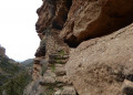
Continue along the track to reach a spring (the Fuente de los Monjes – 1,051 m) which flows to the left, with three picnic tables overlooking the track; this marks the start of the path to the hermitage. Climb steeply towards the rock face, then steps carved into the rock lead up to the monastery of the Virgen de la Peña – 1,150 m. The climb is perfectly safe. Don’t hesitate to climb above the hermitage to a plateau offering a bird’s-eye view of the small chapel (off the GPS track).
For details on visiting, see the practical information section.
(2) After enjoying the view, watching the vultures in flight and wondering whether any Coptic monks from Meteora might have ventured as far as Aragon, it’s time to head back down to the track and continue eastwards.
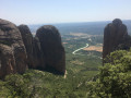
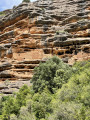
You’ll come within sight of a vast plateau (El Sostal) and follow the track that runs along its edge, hugging the contour line. In the distance, you can make out rocks eroded over time into shapes resembling stacks of plates; the second destination is hidden there.
Carry on along this wide track until you find the start of a path leading down to the right, clearly marked by a wooden sign
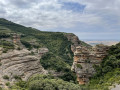
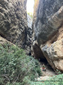
(3). Leave the track and take this path. Cross a heath area, passing a beekeeper’s hut, then the path descends through a rocky cirque, at times over smooth slabs that must turn into a waterfall in wet weather. You will then enter a boxwood copse, descending very steeply; the utmost caution is required, as it is treacherous and the emergency services would have great difficulty reaching you.
You’ll arrive near a rock shaped like a stack of plates; the hermitage is very close by.
(4) At an altitude of around 930 m, look for a small path on the right, which leads to steps carved into the cliff face. Follow these to reach the hermitage (which you can visit).
If you reach the Rio Soton, which you’ll see flowing between beautiful flat rock slabs, put your rucksacks down and look up towards the right bank; you’ll see the cave hermitage in the cliff face. Climb up about ten metres to try and find this little path and visit the site...
From this lovely spot at the foot of the hermitage, where it’s a great place to rest after the descent or have a picnic, take the path that follows the left bank of the Rio Soton as far as the Hermitage of Santa Quiteria. The very wild path descends gently, with the Rio Soton becoming increasingly enclosed on the right.
You’re in the Corsican maquis; the air is fragrant with thyme and rosemary, and you’ll find yourself getting scratched by thorny broom and holly.
In the distance, you can make out Bolea and its church. The path widens slightly before reaching a small field of almond trees (693 m). Take the track that descends towards the Hermitage of Santa Quiteria, whose tiled roof, nestled in the shade of pine trees, is visible.
(5) A short, relaxing break in the shade before setting off on the return journey to Anies. Continue along the track southwards, towards Bolea, until you reach the Way of St James.
(6) Turn right onto this arduous path, which is a wide farm track. Cross the Rio Soton and continue straight on for about 4 km.
(7) A sign at the side of the track directs you to leave the track and take a path that leads into the holm oaks and joins another track. Take this track to the left and, at the four-way junction, turn left towards Anies and continue to the next track junction (after about 900 m).
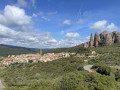
(8) Take the track on the right uphill, ignore a track joining from the right and head towards the village of Anies, which you can just make out; the track descends and then climbs again to reach a T-junction with a beautiful contemporary building on the right. Turn left to reach the village, then turn right onto a grassy lane until you reach another lane where a sign points to the Hermitage of Santa Barbara, now in ruins, on the right.
Retrace your steps after the visit and, at the sign, go straight on to rejoin the main street of Anies.
Turn right to return to the start of the route (S/E).

 Visorando Member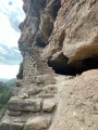
 Moderate
 Easy
Easy  Association / Club / Walk leader